 |
|
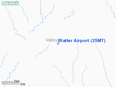
Location & QuickFacts
| FAA Information Effective: | 2008-09-25 |
| Airport Identifier: | 25MT |
| Airport Status: | Operational |
| Longitude/Latitude: | 106-15-12.0000W/48-25-20.0000N
-106.253333/48.422222 (Estimated) |
| Elevation: | 2800 ft / 853.44 m (Estimated) |
| Land: | 15 acres |
| From nearest city: | 23 nautical miles E of Glasgow, MT |
| Location: | Valley County, MT |
| Magnetic Variation: | () |
Owner & Manager
| Ownership: | Privately owned |
| Owner: | Leland Blatter |
| Address: | 100 Airport Rd.
Glasgow, MT 59230 |
| Phone number: | 406-228-4023 |
| Manager: | Leland Blatter |
| Address: | 100 Airport Rd.
Glasgow, MT 59230 |
| Phone number: | 706-228-4023 |
Airport Operations and Facilities
| Airport Use: | Private |
| Wind indicator: | Yes |
| Control Tower: | No |
| Sectional chart: | Billings |
| Region: | ANM - Northwest Mountain |
| Boundary ARTCC: | ZLC - Salt Lake City |
| Tie-in FSS: | GTF - Great Falls |
| FSS Toll Free: | 1-800-WX-BRIEF |
Runway Information
Runway 09/27
| Dimension: | 500 x 30 ft / 152.4 x 9.1 m |
| Surface: | TURF, |
| |
Runway 09 |
Runway 27 |
| Traffic Pattern: | Left | Left |
|
Runway 12/30
| Dimension: | 800 x 30 ft / 243.8 x 9.1 m |
| Surface: | TURF, |
| |
Runway 12 |
Runway 30 |
| Traffic Pattern: | Left | Left |
|
Runway 18/36
| Dimension: | 750 x 30 ft / 228.6 x 9.1 m |
| Surface: | TURF, |
| |
Runway 18 |
Runway 36 |
| Traffic Pattern: | Left | Left |
|
Radio Navigation Aids
| ID |
Type |
Name |
Ch |
Freq |
Var |
Dist |
| MKR | NDB | Milk River | | 339.00 | 14E | 19.7 nm |
| OLF | NDB | Wolf Point | | 404.00 | 11E | 32.3 nm |
| SCO | NDB | Scobey | | 283.00 | 16E | 39.9 nm |
| GGW | VOR/DME | Glasgow | 086X | 113.90 | 14E | 19.4 nm |
Images and information placed above are from
http://www.airport-data.com/airport/25MT/
We thank them for the data!
We don't guarantee the information is fresh and accurate. The data may
be wrong or outdated.
For more up-to-date information please refer to other sources.
|
|


