 |
|
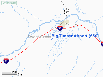
Location & QuickFacts
| FAA Information Effective: | 2008-09-25 |
| Airport Identifier: | 6S0 |
| Airport Status: | Operational |
| Longitude/Latitude: | 109-58-52.0000W/45-48-23.0000N
-109.981111/45.806389 (Estimated) |
| Elevation: | 4492 ft / 1369.16 m (Estimated) |
| Land: | 325 acres |
| From nearest city: | 3 nautical miles SW of Big Timber, MT |
| Location: | Sweet Grass County, MT |
| Magnetic Variation: | 15E (1985) |
Owner & Manager
| Ownership: | Publicly owned |
| Owner: | City Of Big Timber/sweetgrass Co |
| Address: | Po Box 460
Big Timber, MT 59011 |
| Phone number: | 406-932-5152 |
| Manager: | Douglas Ferguson |
| Address: | Box 666
Big Timber, MT 59011 |
| Phone number: | 406-932-4389 |
Airport Operations and Facilities
| Airport Use: | Open to public |
| Wind indicator: | Yes |
| Segmented Circle: | No |
| Control Tower: | No |
| Lighting Schedule: | DUSK-DAWN
MIRL RY 06/24 OPERATE DUSK-DAWN, OTR TIMES ACTVT - CTAF. |
| Beacon Color: | Clear-Green (lighted land airport) |
| Landing fee charge: | No |
| Sectional chart: | Great Falls |
| Region: | ANM - Northwest Mountain |
| Boundary ARTCC: | ZLC - Salt Lake City |
| Tie-in FSS: | GTF - Great Falls |
| FSS on Airport: | No |
| FSS Toll Free: | 1-800-WX-BRIEF |
| NOTAMs Facility: | GTF (NOTAM-d service avaliable) |
| Federal Agreements: | NGY |
Airport Communications
| CTAF: | 122.800 |
| Unicom: | 122.800 |
Airport Services
| Fuel available: | 100LLA |
| Airframe Repair: | MAJOR |
| Power Plant Repair: | MAJOR |
| Bottled Oxygen: | NONE |
| Bulk Oxygen: | NONE |
Runway Information
Runway 06/24
| Dimension: | 5285 x 75 ft / 1610.9 x 22.9 m |
| Surface: | ASPH, Good Condition |
| Weight Limit: | Single wheel: 12000 lbs. |
| Edge Lights: | Medium |
| |
Runway 06 |
Runway 24 |
| Traffic Pattern: | Left | Left |
| Markings: | Basic, Good Condition | Basic, Good Condition |
| Crossing Height: | 0.00 ft | 45.00 ft |
| VASI: | | 2-light PAPI on left side |
| Visual Glide Angle: | 0.00° | 3.00° |
|
Runway 18/36
| Dimension: | 4000 x 100 ft / 1219.2 x 30.5 m |
| Surface: | TURF, Good Condition |
| |
Runway 18 |
Runway 36 |
| Traffic Pattern: | Left | Left |
| Obstruction: | 4 ft fence, 99.0 ft from runway, 24:1 slope to clear | 4 ft fence, 105.0 ft from runway, 26:1 slope to clear |
|
Radio Navigation Aids
| ID |
Type |
Name |
Ch |
Freq |
Var |
Dist |
| HWQ | NDB | Harlowton | | 242.00 | 17E | 38.3 nm |
| RED | NDB | Red Lodge | | 203.00 | 17E | 45.5 nm |
| BZN | VOR/DME | Bozeman | 071X | 112.40 | 18E | 49.2 nm |
| LVM | VORTAC | Livingston | 108X | 116.10 | 15E | 20.3 nm |
Remarks
- SPRAY OPNS INCR EST TOT PEAK MO.
Images and information placed above are from
http://www.airport-data.com/airport/6S0/
We thank them for the data!
| General Info
|
| Country |
United States
|
| State |
MONTANA
|
| FAA ID |
6S0
|
| Latitude |
45-48-23.000N
|
| Longitude |
109-58-52.000W
|
| Elevation |
4492 feet
|
| Near City |
BIG TIMBER
|
We don't guarantee the information is fresh and accurate. The data may
be wrong or outdated.
For more up-to-date information please refer to other sources.
|
|


