 |
|
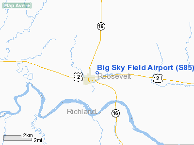
Location & QuickFacts
| FAA Information Effective: | 2008-09-25 |
| Airport Identifier: | S85 |
| Airport Status: | Operational |
| Longitude/Latitude: | 104-30-14.0000W/48-09-12.0000N
-104.503889/48.153333 (Estimated) |
| Elevation: | 1954 ft / 595.58 m (Estimated) |
| Land: | 103 acres |
| From nearest city: | 1 nautical miles NE of Culbertson, MT |
| Location: | Roosevelt County, MT |
| Magnetic Variation: | 13E (1985) |
Owner & Manager
| Ownership: | Publicly owned |
| Owner: | Roosevelt County & City |
| Address: | County Courthouse
Wolf Point, MT 59201 |
| Phone number: | 406-653-1852 |
| Manager: | Steve Hampton |
| Address: | Box 537
Culbertson, MT 59218 |
| Phone number: | 406-787-6620 |
Airport Operations and Facilities
| Airport Use: | Open to public |
| Wind indicator: | Yes |
| Segmented Circle: | Yes |
| Control Tower: | No |
| Lighting Schedule: | DUSK-DAWN
ACTVT MIRL RY 08/26 & PAPI RY 26 - CTAF. |
| Beacon Color: | Clear-Green (lighted land airport) |
| Landing fee charge: | No |
| Sectional chart: | Billings |
| Region: | ANM - Northwest Mountain |
| Boundary ARTCC: | ZLC - Salt Lake City |
| Tie-in FSS: | GTF - Great Falls |
| FSS on Airport: | No |
| FSS Toll Free: | 1-800-WX-BRIEF |
| NOTAMs Facility: | GTF (NOTAM-d service avaliable) |
| Federal Agreements: | NGY |
Airport Communications
| CTAF: | 122.800 |
| Unicom: | 122.800 |
Airport Services
| Fuel available: | 100LL |
| Airframe Repair: | MAJOR |
| Power Plant Repair: | MAJOR |
| Bottled Oxygen: | NONE |
| Bulk Oxygen: | NONE |
Runway Information
Runway 08/26
| Dimension: | 3800 x 60 ft / 1158.2 x 18.3 m |
| Surface: | ASPH, Fair Condition |
| Weight Limit: | Single wheel: 4000 lbs. |
| Edge Lights: | Medium |
| |
Runway 08 |
Runway 26 |
| Traffic Pattern: | Left | Left |
| Markings: | Basic, Good Condition | Basic, Good Condition |
| Crossing Height: | 0.00 ft | 27.00 ft |
| VASI: | | 2-light PAPI on left side |
| Visual Glide Angle: | 0.00° | 3.00° |
| Obstruction: | 13 ft road, 249.0 ft from runway, 4:1 slope to clear | , 50:1 slope to clear |
|
Radio Navigation Aids
| ID |
Type |
Name |
Ch |
Freq |
Var |
Dist |
| SDY | NDB | Sidney | | 359.00 | 12E | 29.6 nm |
| ISN | NDB | Williston | | 275.00 | 15E | 36.9 nm |
| PWD | NDB | Plentywood | | 251.00 | 16E | 38.3 nm |
| OLF | NDB | Wolf Point | | 404.00 | 11E | 44.1 nm |
| ISN | VORTAC | Williston | 110X | 116.30 | 12E | 30.8 nm |
Images and information placed above are from
http://www.airport-data.com/airport/S85/
We thank them for the data!
| General Info
|
| Country |
United States
|
| State |
MONTANA
|
| FAA ID |
S85
|
| Latitude |
48-09-12.000N
|
| Longitude |
104-30-14.000W
|
| Elevation |
1954 feet
|
| Near City |
CULBERTSON
|
We don't guarantee the information is fresh and accurate. The data may
be wrong or outdated.
For more up-to-date information please refer to other sources.
|
|


