 |
|
| Bert Mooney Airport |
| IATA: BTM – ICAO: KBTM – FAA LID: BTM |
| Summary |
| Airport type |
Public |
| Serves |
Butte, Montana |
| Elevation AMSL |
5,550 ft / 1,692 m |
| Coordinates |
45°57′17″N 112°29′51″W / 45.95472°N 112.4975°W / 45.95472; -112.4975 |
| Website |
www.ButteAirport.com |
| Runways |
| Direction |
Length |
Surface |
| ft |
m |
| 15/33 |
9,000 |
2,744 |
Asphalt |
| 11/29 |
5,100 |
1,554 |
Asphalt |
| Statistics (2007) |
| Aircraft operations |
34,682 |
| Based aircraft |
38 |
| Source: Federal Aviation Administration |
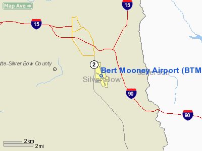
Bert Mooney Airport (IATA: BTM, ICAO: KBTM, FAA LID: BTM), is a public airport located three miles (5 km) southeast of the central business district of Butte, a city in Silver Bow County, Montana, United States. It is owned by the Bert Mooney Airport Authority.
The airport name was changed in 1972 to honor Bert Mooney, an aviator from Butte who was the first to fly mail into Yellowstone National Park in 1935. Prior to this the airport was named Butte Municipal Airport (from its opening in 1926) and Silver Bow County Airport from 1960-1972. Facilities and aircraft
Bert Mooney Airport covers an area of 890 acres (360 ha) which contains two asphalt paved runways: 15/33 measuring 9,000 x 150 ft (2,744 x 46 m) and 11/29 measuring 5,100 x 75 ft (1,554 x 23 m).
For the 12-month period ending April 30, 2007, the airport had 34,682 aircraft operations, an average of 95 per day: 74% general aviation, 16% air taxi, 9% scheduled commercial and 1% military. There are 38 aircraft based at this airport: 63% single-engine, 24% multi-engine and 13% helicopter.
IncidentsOn March 22, 2009, a Pilatus PC-12 flying in from Oroville, California crashed in Holy Cross Cemetery 500 feet from the airport, killing all 14 people on board.
Airlines and destinations
| Airlines |
Destinations |
| Delta Connection operated by SkyWest Airlines |
Salt Lake City |
The above content comes from Wikipedia and is published under free licenses – click here to read more.
Location & QuickFacts
| FAA Information Effective: | 2008-09-25 |
| Airport Identifier: | BTM |
| Airport Status: | Operational |
| Longitude/Latitude: | 112-29-50.9000W/45-57-17.3000N
-112.497472/45.954806 (Estimated) |
| Elevation: | 5550 ft / 1691.64 m (Surveyed) |
| Land: | 890 acres |
| From nearest city: | 3 nautical miles SE of Butte, MT |
| Location: | Silver Bow County, MT |
| Magnetic Variation: | 16E (1990) |
Owner & Manager
| Ownership: | Publicly owned |
| Owner: | Bert Mooney, Arpt Auth |
| Address: | 101 Airport Road
Butte, MT 59701 |
| Phone number: | 406-494-3771 |
| Manager: | Rick Griffith |
| Address: | 101 Airport Rd
Butte, MT 59701 |
| Phone number: | 406-494-3771 |
Airport Operations and Facilities
| Airport Use: | Open to public |
| Wind indicator: | Yes |
| Segmented Circle: | Yes |
| Control Tower: | No |
| Lighting Schedule: | DUSK-DAWN
ACTVT MIRL RYS 15/33 & 11/29, PAPI RYS 11 & 29, & REIL RYS 11, 29, & 15 - CTAF. |
| Beacon Color: | Clear-Green (lighted land airport) |
| Landing fee charge: | Yes
FEE FOR ALL COMMERCIAL ACFT & ACFT OVER 10000 LBS. |
| Sectional chart: | Great Falls |
| Region: | ANM - Northwest Mountain |
| Boundary ARTCC: | ZLC - Salt Lake City |
| Tie-in FSS: | GTF - Great Falls |
| FSS Toll Free: | 1-800-WX-BRIEF |
| NOTAMs Facility: | BTM (NOTAM-d service avaliable) |
| Certification type/date: | I A S 05/1973
PPR FOR UNSKED ACR OPNS WITH MORE THAN 30 PSGR SEATS CALL AMGR 406-494-3771. |
| Federal Agreements: | NGY3 |
Airport Communications
| CTAF: | 123.000 |
| Unicom: | 123.000 |
Airport Services
| Fuel available: | 100LLA |
| Airframe Repair: | MAJOR |
| Power Plant Repair: | MAJOR |
| Bottled Oxygen: | HIGH/LOW |
| Bulk Oxygen: | HIGH/LOW |
Runway Information
Runway 11/29
| Dimension: | 5100 x 75 ft / 1554.5 x 22.9 m |
| Surface: | ASPH, Good Condition |
| Surface Treatment: | Saw-cut or plastic Grooved |
| Weight Limit: | Single wheel: 12500 lbs. |
| Edge Lights: | Medium |
| |
Runway 11 |
Runway 29 |
| Longitude: | 112-30-20.6621W | 112-29-24.6683W |
| Latitude: | 45-57-32.3691N | 45-57-00.6139N |
| Elevation: | 5520.00 ft | 5530.00 ft |
| Alignment: | 127 | 127 |
| Traffic Pattern: | Left | Left |
| Markings: | Basic, Good Condition | Basic, Good Condition |
| Crossing Height: | 38.00 ft | 45.00 ft |
| VASI: | 2-light PAPI on left side
PAPI STAIGHT-IN ONLY. | 2-light PAPI on left side
PAPI RSTRD TO 2.1 NM FM RY 29 THLD DUE TO HIGH TERRAIN. |
| Visual Glide Angle: | 4.00° | 4.00° |
| Runway End Identifier: | Yes | Yes |
| Obstruction: | 16 ft road, 560.0 ft from runway, 275 ft right of centerline, 22:1 slope to clear | 36 ft bldg, 1251.0 ft from runway, 100 ft right of centerline, 29:1 slope to clear |
|
Runway 15/33
| Dimension: | 9001 x 150 ft / 2743.5 x 45.7 m |
| Surface: | ASPH, Good Condition |
| Surface Treatment: | Saw-cut or plastic Grooved |
| Weight Limit: | Single wheel: 75000 lbs.
Dual wheel: 160000 lbs.
Dual tandem wheel: 250000 lbs. |
| Edge Lights: | Medium |
| |
Runway 15 |
Runway 33 |
| Longitude: | 112-30-04.3327W | 112-29-35.3958W |
| Latitude: | 45-58-00.9425N | 45-56-34.4314N |
| Elevation: | 5506.00 ft | 5550.00 ft |
| Alignment: | 127 | 127 |
| ILS Type: | ILS/DME
| |
| Traffic Pattern: | Right | Left |
| Markings: | Precision instrument, Good Condition | Basic, Good Condition |
| Crossing Height: | 55.00 ft | 78.00 ft |
| VASI: | 4-light PAPI on left side | 4-box on left side
DO NOT USE VASI BYD 1.5 MI DUE TO HIGH TERRAIN. |
| Visual Glide Angle: | 3.50° | 3.00° |
| Runway End Identifier: | Yes | No |
| Obstruction: | , 50:1 slope to clear | 65 ft tower, 2986.0 ft from runway, 248 ft right of centerline, 42:1 slope to clear |
|
Radio Navigation Aids
| ID |
Type |
Name |
Ch |
Freq |
Var |
Dist |
| CVP | NDB | Capitol | | 335.00 | 16E | 45.6 nm |
| HAU | NDB | Hauser | | 386.00 | 16E | 48.0 nm |
| DRU | VOR | Drummond | | 117.10 | 17E | 50.0 nm |
| CPN | VOR/DME | Coppertown | 053X | 111.60 | 16E | 11.4 nm |
| DLN | VOR/DME | Dillon | 077X | 113.00 | 18E | 42.5 nm |
| HIA | VORTAC | Whitehall | 084X | 113.70 | 18E | 14.8 nm |
| HLN | VORTAC | Helena | 124X | 117.70 | 16E | 45.2 nm |
Remarks
- DEER IN VICINITY OF AIRPORT.
- TWY D RSTD TO ACFT 12,500 LBS OR LESS BTN RY 29 APCH END & RY 15-33, & TWY D BTN RY-11 APCH END AND TWY F.
- SNOW REMOVAL OPS IN PROGRES DURING PERIODS OF SNOW.
- RY 11/29 FM RY END 29 TO RY 15/33 & FM TWY F TO RY END 11 NOT AVBL FOR ACR ACFT OVER 12, 500 LBS.
Images and information placed above are from
http://www.airport-data.com/airport/BTM/
We thank them for the data!
| General Info
|
| Country |
United States
|
| State |
MONTANA
|
| FAA ID |
BTM
|
| Latitude |
45-57-17.300N
|
| Longitude |
112-29-50.900W
|
| Elevation |
5550 feet
|
| Near City |
BUTTE
|
We don't guarantee the information is fresh and accurate. The data may
be wrong or outdated.
For more up-to-date information please refer to other sources.
|
|


