 |
|
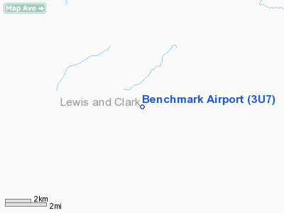
Location & QuickFacts
| FAA Information Effective: | 2008-09-25 |
| Airport Identifier: | 3U7 |
| Airport Status: | Operational |
| Longitude/Latitude: | 112-52-11.1640W/47-28-52.7950N
-112.869768/47.481332 (Estimated) |
| Elevation: | 5434 ft / 1656.28 m (Estimated) |
| Land: | 145 acres |
| From nearest city: | 19 nautical miles W of Benchmark, MT |
| Location: | Lewis And Clark County, MT |
| Magnetic Variation: | 18E (1985) |
Owner & Manager
| Ownership: | Publicly owned |
| Owner: | U S Forest Service |
| Address: | Lewis & Clark Natnl Forest
Choteau, MT 59422 |
| Phone number: | 406-791-7700 |
| Manager: | Linda Brandvold |
| Address: | Rocky Mt Ranger Dist
Great Falls, MT |
| Phone number: | 406-731-5329 |
Airport Operations and Facilities
| Airport Use: | Open to public |
| Wind indicator: | Yes
WIND INDICATOR BOTH ENDS AND MIDDLE OF RY; THREE WINDSOCKS ON FIELD. |
| Segmented Circle: | Yes |
| Control Tower: | No |
| Landing fee charge: | No |
| Sectional chart: | Great Falls |
| Region: | ANM - Northwest Mountain |
| Boundary ARTCC: | ZLC - Salt Lake City |
| Tie-in FSS: | GTF - Great Falls |
| FSS on Airport: | No |
| FSS Toll Free: | 1-800-WX-BRIEF |
| NOTAMs Facility: | GTF (NOTAM-d service avaliable) |
| Federal Agreements: | 1 |
Airport Communications
Airport Services
| Airframe Repair: | NONE |
| Power Plant Repair: | NONE |
| Bottled Oxygen: | NONE |
| Bulk Oxygen: | NONE |
Runway Information
Runway 12/30
| Dimension: | 6000 x 100 ft / 1828.8 x 30.5 m |
| Surface: | ASPH, Fair Condition |
| Weight Limit: | Single wheel: 45000 lbs.
Dual wheel: 80000 lbs.
Dual tandem wheel: 140000 lbs. |
| |
Runway 12 |
Runway 30 |
| Traffic Pattern: | Left | Left |
| Markings: | Basic, Fair Condition | Basic, Fair Condition |
| Obstruction: | 80 ft trees, 320.0 ft from runway, 225 ft left of centerline, 1:1 slope to clear
+58' TREES ON CENTERLINE.
+10' GND 129' R & +14' FENCE 151' R, BOTH 0' TO 200' FM EOR. +5' BRUSH 147' L 200' FM EOR. +3' FENCE 202' L, 0' TO 200' FM EOR. +15' RD 222' L 0 TO 200' FM EOR. | 272 ft hill, 3000.0 ft from runway, 550 ft left of centerline, 10:1 slope to clear
+250' TREES ON CENTERLINE.
+8' GND 151' R 0 TO 200' FM EOR. +12' FENCE & +42' TREES 205' R 0' TO 200' FM EOR. |
|
Radio Navigation Aids
| ID |
Type |
Name |
Ch |
Freq |
Var |
Dist |
| CII | NDB | Choteau | | 269.00 | 17E | 34.9 nm |
Remarks
- NO SNOW REMOVAL WINTERS.
- MTNS PARALLEL E & W OF ARPT IN TRANS SURFACE.
- RWY SUBJ TO MODERATE TO SEVERE CROSSWINDS AND TURBULENCE
- NO SVCS AVBL.
- NO TELEPHONE ON FIELD. BENCHMARK CABIN LCTD 1 MILE NW OF ARPT.
Images and information placed above are from
http://www.airport-data.com/airport/3U7/
We thank them for the data!
| General Info
|
| Country |
United States
|
| State |
MONTANA
|
| FAA ID |
3U7
|
| Latitude |
47-28-52.795N
|
| Longitude |
112-52-11.164W
|
| Elevation |
5434 feet
|
| Near City |
BENCHMARK
|
We don't guarantee the information is fresh and accurate. The data may
be wrong or outdated.
For more up-to-date information please refer to other sources.
|
|


