 |
|
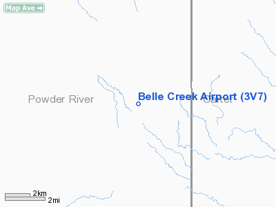
Location & QuickFacts
| FAA Information Effective: | 2008-09-25 |
| Airport Identifier: | 3V7 |
| Airport Status: | Operational |
| Longitude/Latitude: | 105-05-31.9380W/45-07-29.9480N
-105.092205/45.124986 (Estimated) |
| Elevation: | 3678 ft / 1121.05 m (Estimated) |
| Land: | 30 acres |
| From nearest city: | 1 nautical miles NE of Belle Creek, MT |
| Location: | Powder River County, MT |
| Magnetic Variation: | 12E (1985) |
Owner & Manager
| Ownership: | Publicly owned |
| Owner: | Powder River County |
| Address: | County Courthouse
Broadus, MT 59317 |
| Phone number: | 406-436-2657 |
| Manager: | Cody Morris |
| Address: | Po Box 270
Broadus, MT 59317 |
| Phone number: | 406-427-5188 |
Airport Operations and Facilities
| Airport Use: | Open to public |
| Wind indicator: | Yes |
| Segmented Circle: | No |
| Control Tower: | No |
| Lighting Schedule: | DUSK-DAWN
ACTVT LIRL RY 08/26 - CTAF. |
| Beacon Color: | Clear-Green (lighted land airport) |
| Landing fee charge: | No |
| Sectional chart: | Billings |
| Region: | ANM - Northwest Mountain |
| Boundary ARTCC: | ZDV - Denver |
| Tie-in FSS: | GTF - Great Falls |
| FSS on Airport: | No |
| FSS Toll Free: | 1-800-WX-BRIEF |
| NOTAMs Facility: | GTF (NOTAM-d service avaliable) |
Airport Communications
Airport Services
| Airframe Repair: | NONE |
| Power Plant Repair: | NONE |
| Bottled Oxygen: | NONE |
| Bulk Oxygen: | NONE |
Runway Information
Runway 08/26
| Dimension: | 3770 x 50 ft / 1149.1 x 15.2 m |
| Surface: | ASPH, Poor Condition
RWY 08/26 ASPHALT CRACKING WITH SUBSTANTIAL WEED GROWTH ON EDGES & IN CRACKS.
ASPHALT CRACKING WITH SUBSTANTIAL WEED GROWTH ON EDGES & IN CRACKS. |
| Weight Limit: | Single wheel: 4000 lbs. |
| Edge Lights: | Non-standard lighting system
NSTD LIRL SPACED 35 FT TO 45 FT FM PAVEMENT EDGES; NUMEROUS LIGHTS BROKEN OR OTS. THR RELOCATED 307 FT FOR NGT OPS ONLY. RY 26 THR RELOCATED 400 FT FOR NGT OPS ONLY. 3063 FT RY LENGTH AVBL FOR NGT OPS. |
| |
Runway 08 |
Runway 26 |
| Traffic Pattern: | Right | Left |
| Obstruction: | 13 ft road, 228.0 ft from runway, 2:1 slope to clear
+3' FENCE 100' FM EOR & +3' FENCE PARALLEL TO RY CNTRLN BEGINNINNG 100' FM EOR & 106' LEFT. ALSO +4' FENCE 88' RT & PARALLEL TO RY CNTRLN. RY 26 +4' FENCE 68' LEFT & PARALLEL TO RY CNTRLN & +4' FENCE 70' TO RIGHT AND PARALLEL TO RY CNTRLN. | 233 ft hill, 3000.0 ft from runway, 12:1 slope to clear |
|
Radio Navigation Aids
| ID |
Type |
Name |
Ch |
Freq |
Var |
Dist |
| BDX | NDB | Broadus | | 335.00 | 15E | 23.0 nm |
Remarks
Images and information placed above are from
http://www.airport-data.com/airport/3V7/
We thank them for the data!
| General Info
|
| Country |
United States
|
| State |
MONTANA
|
| FAA ID |
3V7
|
| Latitude |
45-07-29.948N
|
| Longitude |
105-05-31.938W
|
| Elevation |
3678 feet
|
| Near City |
BELLE CREEK
|
We don't guarantee the information is fresh and accurate. The data may
be wrong or outdated.
For more up-to-date information please refer to other sources.
|
|


