 |
|
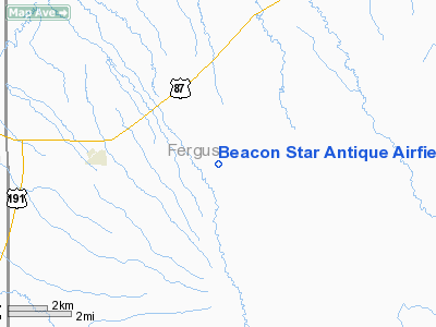
Beacon Star Antique Airfield Airport |
Location & QuickFacts
| FAA Information Effective: | 2008-09-25 |
| Airport Identifier: | MT24 |
| Airport Status: | Operational |
| Longitude/Latitude: | 109-36-48.6700W/46-58-19.8870N
-109.613519/46.972191 (Estimated) |
| Elevation: | 4320 ft / 1316.74 m (Estimated) |
| Land: | 0 acres |
| From nearest city: | 4 nautical miles E of Moore, MT |
| Location: | Fergus County, MT |
| Magnetic Variation: | 16E (1985) |
Owner & Manager
| Ownership: | Privately owned |
| Owner: | Frank Bass |
| Address: | Star Route
Moore, MT 59464 |
| Phone number: | 406-538-7616 |
| Manager: | Frank Bass |
| Address: | Star Route
Moore, MT 59464 |
| Phone number: | 406-538-7616 |
Airport Operations and Facilities
| Airport Use: | Private |
| Wind indicator: | Yes |
| Segmented Circle: | No |
| Control Tower: | No |
| Lighting Schedule: | PHONE REQ
FOR ROTG BCN CALL 406-538-7616. |
| Beacon Color: | Clear (unlighted land airport) |
| Landing fee charge: | No |
| Sectional chart: | Billings |
| Region: | ANM - Northwest Mountain |
| Boundary ARTCC: | ZLC - Salt Lake City |
| Tie-in FSS: | GTF - Great Falls |
| FSS on Airport: | No |
| FSS Toll Free: | 1-800-WX-BRIEF |
Airport Communications
Runway Information
Runway 03/21
| Dimension: | 3700 x 100 ft / 1127.8 x 30.5 m |
| Surface: | TURF, |
| |
Runway 03 |
Runway 21 |
| Traffic Pattern: | Left | Left |
|
Runway 07/25
| Dimension: | 2640 x 100 ft / 804.7 x 30.5 m |
| Surface: | TURF, |
| |
Runway 07 |
Runway 25 |
| Traffic Pattern: | Left | Left |
|
Runway 16/34
| Dimension: | 2640 x 100 ft / 804.7 x 30.5 m |
| Surface: | TURF, |
| |
Runway 16 |
Runway 34 |
| Traffic Pattern: | Left | Left |
|
Radio Navigation Aids
| ID |
Type |
Name |
Ch |
Freq |
Var |
Dist |
| LWT | NDB | Lewistown | | 353.00 | 17E | 6.6 nm |
| HWQ | NDB | Harlowton | | 242.00 | 17E | 33.5 nm |
| LWT | VORTAC | Lewistown | 057X | 112.00 | 15E | 4.9 nm |
Images and information placed above are from
http://www.airport-data.com/airport/MT24/
We thank them for the data!
| General Info
|
| Country |
United States
|
| State |
MONTANA
|
| FAA ID |
MT24
|
| Latitude |
46-58-19.887N
|
| Longitude |
109-36-48.670W
|
| Elevation |
4320 feet
|
| Near City |
MOORE
|
We don't guarantee the information is fresh and accurate. The data may
be wrong or outdated.
For more up-to-date information please refer to other sources.
|
|


