 |
|
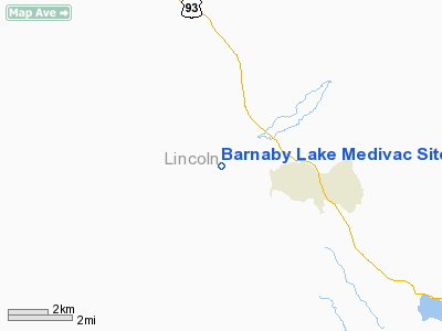
Barnaby Lake Medivac Site Heliport |
Location & QuickFacts
| FAA Information Effective: | 2008-09-25 |
| Airport Identifier: | 2MT7 |
| Airport Status: | Operational |
| Longitude/Latitude: | 114-58-06.4000W/48-46-41.5000N
-114.968444/48.778194 (Estimated) |
| Elevation: | 3034 ft / 924.76 m (Estimated) |
| Land: | 0 acres |
| From nearest city: | 2 nautical miles W of Fortine, MT |
| Location: | Lincoln County, MT |
| Magnetic Variation: | () |
Owner & Manager
| Ownership: | Privately owned |
| Owner: | Ronald W. Sperandeo |
| Address: | 1550 Barnaby Lake Rd
Eureka, MT 59917 |
| Phone number: | 406-882-4834 |
| Manager: | Ronald W. Sperandeo |
| Address: | 1550 Barnaby Lake Rd
Eureka, MT 59917 |
| Phone number: | 406-882-4834 |
Airport Operations and Facilities
| Airport Use: | Private
MEDICAL USE. |
| Control Tower: | No |
| Sectional chart: | Great Falls |
| Region: | ANM - Northwest Mountain |
| Boundary ARTCC: | ZSE - Seattle |
| Tie-in FSS: | GTF - Great Falls |
| FSS Toll Free: | 1-800-WX-BRIEF |
Runway Information
Helipad H1
| Dimension: | 52 x 52 ft / 15.8 x 15.8 m |
| Surface: | TURF, |
| |
Runway H1 |
Runway |
| Traffic Pattern: | Left | Left |
|
Radio Navigation Aids
| ID |
Type |
Name |
Ch |
Freq |
Var |
Dist |
| EUR | NDB | Eureka | | 392.00 | 20E | 12.2 nm |
| LYI | NDB | Libby | | 414.00 | 17E | 35.4 nm |
| SAK | NDB | Smith Lake | | 515.00 | 18E | 45.1 nm |
| FCA | VOR/DME | Kalispell | 079X | 113.20 | 18E | 46.3 nm |
Images and information placed above are from
http://www.airport-data.com/airport/2MT7/
We thank them for the data!
We don't guarantee the information is fresh and accurate. The data may
be wrong or outdated.
For more up-to-date information please refer to other sources.
|
|


