 |
|
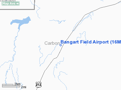
Location & QuickFacts
| FAA Information Effective: | 2008-09-25 |
| Airport Identifier: | 16MT |
| Airport Status: | Operational |
| Longitude/Latitude: | 109-07-47.5540W/45-24-18.8030N
-109.129876/45.405223 (Estimated) |
| Elevation: | 4320 ft / 1316.74 m (Estimated) |
| Land: | 179 acres |
| From nearest city: | 3 nautical miles NE of Roberts, MT |
| Location: | Carbon County, MT |
| Magnetic Variation: | 15E (1985) |
Owner & Manager
| Ownership: | Privately owned |
| Owner: | Beartooth Inc |
| Address: | 4536 Hill Rd
Billings, MT 59101-9345 |
| Phone number: | 406-254-6578 |
| Manager: | Thomas L Bangart |
| Address: | Po Box 206
Boyd, MT 59013 |
Airport Operations and Facilities
| Airport Use: | Private |
| Wind indicator: | Yes |
| Segmented Circle: | No |
| Control Tower: | No |
| Landing fee charge: | No |
| Sectional chart: | Great Falls |
| Region: | ANM - Northwest Mountain |
| Boundary ARTCC: | ZLC - Salt Lake City |
| Tie-in FSS: | GTF - Great Falls |
| FSS on Airport: | No |
| FSS Toll Free: | 1-800-WX-BRIEF |
Runway Information
Runway 17/35
| Dimension: | 3300 x 40 ft / 1005.8 x 12.2 m |
| Surface: | GRAVEL, |
| |
Runway 17 |
Runway 35 |
| Traffic Pattern: | Left | Left |
|
Radio Navigation Aids
| ID |
Type |
Name |
Ch |
Freq |
Var |
Dist |
| RED | NDB | Red Lodge | | 203.00 | 17E | 11.4 nm |
| POY | NDB | Powell | | 344.00 | 15E | 35.5 nm |
| HCY | NDB | Cowley | | 257.00 | 14E | 41.5 nm |
| COD | VOR/DME | Cody | 055X | 111.80 | 14E | 47.7 nm |
| BIL | VORTAC | Billings | 092X | 114.50 | 14E | 32.2 nm |
Images and information placed above are from
http://www.airport-data.com/airport/16MT/
We thank them for the data!
| General Info
|
| Country |
United States
|
| State |
MONTANA
|
| FAA ID |
16MT
|
| Latitude |
45-24-18.803N
|
| Longitude |
109-07-47.554W
|
| Elevation |
4320 feet
|
| Near City |
ROBERTS
|
We don't guarantee the information is fresh and accurate. The data may
be wrong or outdated.
For more up-to-date information please refer to other sources.
|
|


