 |
|
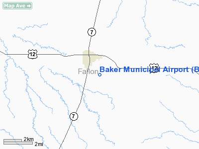
Location & QuickFacts
| FAA Information Effective: | 2008-09-25 |
| Airport Identifier: | BHK |
| Airport Status: | Operational |
| Longitude/Latitude: | 104-15-34.0000W/46-20-51.5000N
-104.259444/46.347639 (Estimated) |
| Elevation: | 2975 ft / 906.78 m (Surveyed) |
| Land: | 193 acres |
| From nearest city: | 1 nautical miles SE of Baker, MT |
| Location: | Fallon County, MT |
| Magnetic Variation: | 12E (1990) |
Owner & Manager
| Ownership: | Publicly owned |
| Owner: | Baker City And Fallon Co |
| Address: | Box 846
Baker, MT 59313 |
| Phone number: | 406-778-2883 |
| Manager: | Roger Meggers |
| Address: | P O Box 979
Baker, MT 59313 |
| Phone number: | 406-778-3508 |
Airport Operations and Facilities
| Airport Use: | Open to public |
| Wind indicator: | Yes |
| Segmented Circle: | Yes |
| Control Tower: | No |
| Lighting Schedule: | DUSK-DAWN
MIRL RY 13/31 AND PAPI RYS 13 & 31 OPERATE DUSK-2200; AFTER 2200 ACTVT - CTAF. |
| Beacon Color: | Clear-Green (lighted land airport) |
| Landing fee charge: | No |
| Sectional chart: | Billings |
| Region: | ANM - Northwest Mountain |
| Boundary ARTCC: | ZLC - Salt Lake City |
| Tie-in FSS: | GTF - Great Falls |
| FSS on Airport: | No |
| FSS Toll Free: | 1-800-WX-BRIEF |
| NOTAMs Facility: | BHK (NOTAM-d service avaliable) |
| Federal Agreements: | N |
Airport Communications
Airport Services
| Fuel available: | 100LLA |
| Airframe Repair: | MAJOR |
| Power Plant Repair: | MAJOR |
| Bottled Oxygen: | NONE |
| Bulk Oxygen: | NONE |
Runway Information
Runway 13/31
| Dimension: | 4898 x 75 ft / 1492.9 x 22.9 m |
| Surface: | ASPH, Good Condition |
| Weight Limit: | Single wheel: 17500 lbs.
Dual wheel: 22500 lbs. |
| Edge Lights: | Medium |
| |
Runway 13 |
Runway 31 |
| Longitude: | 104-15-57.4863W | 104-15-10.5242W |
| Latitude: | 46-21-09.3715N | 46-20-33.5998N |
| Elevation: | 2962.00 ft | 2975.00 ft |
| Alignment: | 127 | 127 |
| Traffic Pattern: | Left | Left |
| Markings: | Non-precision instrument, Good Condition | Non-precision instrument, Good Condition |
| Crossing Height: | 33.00 ft | 13.00 ft |
| VASI: | 2-light PAPI on left side | 2-light PAPI on left side |
| Visual Glide Angle: | 3.00° | 3.25° |
| Obstruction: | 110 ft ant, 4500.0 ft from runway, 200 ft right of centerline, 39:1 slope to clear | 6 ft fence, 515.0 ft from runway, 50:1 slope to clear |
|
Radio Navigation Aids
| ID |
Type |
Name |
Ch |
Freq |
Var |
Dist |
| BKU | NDB | Timber | | 344.00 | 12E | 0.1 nm |
| BOD | NDB | Bowman | | 374.00 | 10E | 35.9 nm |
Remarks
- HIGH TWR APRXLY 1 MILE NW OF ARPT.
Images and information placed above are from
http://www.airport-data.com/airport/BHK/
We thank them for the data!
| General Info
|
| Country |
United States
|
| State |
MONTANA
|
| FAA ID |
BHK
|
| Latitude |
46-20-51.491N
|
| Longitude |
104-15-34.011W
|
| Elevation |
2973 feet
|
| Near City |
BAKER
|
We don't guarantee the information is fresh and accurate. The data may
be wrong or outdated.
For more up-to-date information please refer to other sources.
|
|


