 |
|
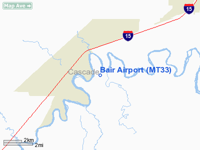
Location & QuickFacts
| FAA Information Effective: | 2008-09-25 |
| Airport Identifier: | MT33 |
| Airport Status: | Operational |
| Longitude/Latitude: | 111-29-14.8940W/47-24-33.8400N
-111.487471/47.409400 (Estimated) |
| Elevation: | 3340 ft / 1018.03 m (Estimated) |
| Land: | 0 acres |
| From nearest city: | 2 nautical miles SE of Ulm, MT |
| Location: | Cascade County, MT |
| Magnetic Variation: | 17E (1985) |
Owner & Manager
| Ownership: | Privately owned |
| Owner: | James & Margaret Bair |
| Address: | Box 6
Ulm, MT 59485 |
| Phone number: | 406-866-3309 |
| Address: |
|
Airport Operations and Facilities
| Airport Use: | Private
PERSONAL USE. |
| Wind indicator: | Yes |
| Segmented Circle: | No |
| Control Tower: | No |
| Sectional chart: | Great Falls |
| Region: | ANM - Northwest Mountain |
| Boundary ARTCC: | ZLC - Salt Lake City |
| Tie-in FSS: | GTF - Great Falls |
| FSS Toll Free: | 1-800-WX-BRIEF |
Runway Information
Runway 04/22
| Dimension: | 2000 x 40 ft / 609.6 x 12.2 m |
| Surface: | TURF, |
| |
Runway 04 |
Runway 22 |
| Traffic Pattern: | Left | Left |
|
Radio Navigation Aids
| ID |
Type |
Name |
Ch |
Freq |
Var |
Dist |
| ITU | NDB | Truly | | 371.00 | 16E | 5.3 nm |
| CII | NDB | Choteau | | 269.00 | 17E | 37.2 nm |
| CRD | NDB | Conrad | | 293.00 | 17E | 49.7 nm |
| GFA | TACAN | Malmstrom | 105X | | 17E | 13.7 nm |
| GTF | VORTAC | Great Falls | 098X | 115.10 | 16E | 3.9 nm |
Remarks
- PROVIDED PERSONAL USE, VFR USE ONLY,INGRESS/EGRESS HEADING OF 115/295 DEGREES.
Images and information placed above are from
http://www.airport-data.com/airport/MT33/
We thank them for the data!
| General Info
|
| Country |
United States
|
| State |
MONTANA
|
| FAA ID |
MT33
|
| Latitude |
47-24-33.840N
|
| Longitude |
111-29-14.894W
|
| Elevation |
3340 feet
|
| Near City |
ULM
|
We don't guarantee the information is fresh and accurate. The data may
be wrong or outdated.
For more up-to-date information please refer to other sources.
|
|


