 |
|
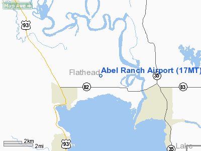
Location & QuickFacts
| FAA Information Effective: | 2008-09-25 |
| Airport Identifier: | 17MT |
| Airport Status: | Operational |
| Longitude/Latitude: | 114-10-38.1000W/48-06-25.4000N
-114.177250/48.107056 (Estimated) |
| Elevation: | 2900 ft / 883.92 m (Estimated) |
| Land: | 140 acres |
| From nearest city: | 8 nautical miles SE of Kalispell, MT |
| Location: | Flathead County, MT |
| Magnetic Variation: | () |
Owner & Manager
| Ownership: | Privately owned |
| Owner: | Paul Abel |
| Address: | 465 Farm Rd., Po Box 2481
Kalispell, MT 59903 |
| Phone number: | 406-857-2528 |
| Manager: | Paul Abel |
| Address: | 465 Farm Rd., Po Box 2481
Kalispell, MT 59903 |
| Phone number: | 406-857-2528 |
Airport Operations and Facilities
| Airport Use: | Private |
| Wind indicator: | Yes |
| Segmented Circle: | No |
| Control Tower: | No |
| Sectional chart: | Great Falls |
| Region: | ANM - Northwest Mountain |
| Boundary ARTCC: | ZLC - Salt Lake City |
| Tie-in FSS: | GTF - Great Falls |
| FSS Toll Free: | 1-800-WX-BRIEF |
Runway Information
Runway 12/30
| Dimension: | 3000 x 60 ft / 914.4 x 18.3 m |
| Surface: | TURF, |
| |
Runway 12 |
Runway 30 |
| Traffic Pattern: | Left | Left |
|
Runway 16/34
| Dimension: | 2600 x 60 ft / 792.5 x 18.3 m |
| Surface: | TURF, |
| |
Runway 16 |
Runway 34 |
| Traffic Pattern: | Left | Left |
|
Radio Navigation Aids
| ID |
Type |
Name |
Ch |
Freq |
Var |
Dist |
| SAK | NDB | Smith Lake | | 515.00 | 18E | 11.4 nm |
| PLS | NDB | Polson | | 275.00 | 20E | 24.7 nm |
| FCA | VOR/DME | Kalispell | 079X | 113.20 | 18E | 6.4 nm |
Remarks
- PRVDD VFR, FLIGHT PROCEDURES OFFICE ALSO RECOMMENDS NEED TO USE CAUTION.
Images and information placed above are from
http://www.airport-data.com/airport/17MT/
We thank them for the data!
We don't guarantee the information is fresh and accurate. The data may
be wrong or outdated.
For more up-to-date information please refer to other sources.
|
|


