 |
|
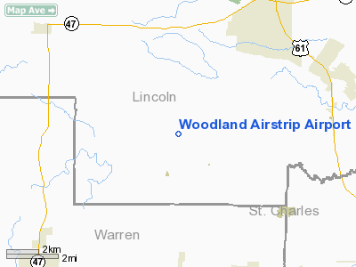
Woodland Airstrip Airport |
Location & QuickFacts
| FAA Information Effective: | 2008-09-25 |
| Airport Identifier: | MU89 |
| Airport Status: | Operational |
| Longitude/Latitude: | 091-02-08.5140W/38-54-43.1710N
-91.035698/38.911992 (Estimated) |
| Elevation: | 625 ft / 190.50 m (Estimated) |
| Land: | 9 acres |
| From nearest city: | 7 nautical miles S of Troy, MO |
| Location: | Lincoln County, MO |
| Magnetic Variation: | 03E (1985) |
Owner & Manager
| Ownership: | Privately owned |
| Owner: | Mike Fleming |
| Address: | 2712 Crevecoeur Mill Rd.
Maryland Hts., MO 63043 |
| Phone number: | 573-739-4341 |
| Manager: | Mike Fleming |
| Address: | 2712 Crevecoeur Mill Rd
Maryland Hts., MO 63043 |
| Phone number: | 573-739-4341 |
Airport Operations and Facilities
| Airport Use: | Private
PERSONAL USE. |
| Segmented Circle: | No |
| Control Tower: | No |
| Sectional chart: | Kansas City |
| Region: | ACE - Central |
| Boundary ARTCC: | ZKC - Kansas City |
| Tie-in FSS: | STL - Saint Louis |
| FSS Toll Free: | 1-800-WX-BRIEF |
Runway Information
Runway 09/27
| Dimension: | 1400 x 80 ft / 426.7 x 24.4 m |
| Surface: | TURF, |
| |
Runway 09 |
Runway 27 |
| Traffic Pattern: | Left | Left |
|
Radio Navigation Aids
| ID |
Type |
Name |
Ch |
Freq |
Var |
Dist |
| LM | NDB | Oblio | | 338.00 | 00E | 27.1 nm |
| UUV | NDB | Sullivan | | 356.00 | 02E | 41.1 nm |
| PPQ | NDB | Pittsfield | | 344.00 | 02E | 45.3 nm |
| FTT | NDB | Guthrie | | 317.00 | 03E | 45.5 nm |
| CVM | NDB | Civic Memorial | | 263.00 | 02E | 45.8 nm |
| CSX | VOR/DME | Cardinal | 111Y | 116.45 | 00E | 33.0 nm |
| FTZ | VORTAC | Foristell | 045X | 110.80 | 05E | 13.4 nm |
| STL | VORTAC | St Louis | 121X | 117.40 | 01E | 26.1 nm |
| SUS | VOT | Spirit Of St Louis | | 112.20 | | 23.4 nm |
| STL | VOT | St Louis Lambert | | 111.00 | | 33.0 nm |
Remarks
- OWNER DOES NOT WANT ARPT CHARTED.
- PROVIDED APCH TO EACH RUNWAY MAINTAINED FOR A MINIMUM 20:1 GLIDE SLOPE AND THE TRANSITIONAL SURFACE MAINTAINED FOR A 7:1 SLOPE.
Images and information placed above are from
http://www.airport-data.com/airport/MU89/
We thank them for the data!
| General Info
|
| Country |
United States
|
| State |
MISSOURI
|
| FAA ID |
MU89
|
| Latitude |
38-54-43.171N
|
| Longitude |
091-02-08.514W
|
| Elevation |
625 feet
|
| Near City |
TROY
|
We don't guarantee the information is fresh and accurate. The data may
be wrong or outdated.
For more up-to-date information please refer to other sources.
|
|


