 |
|
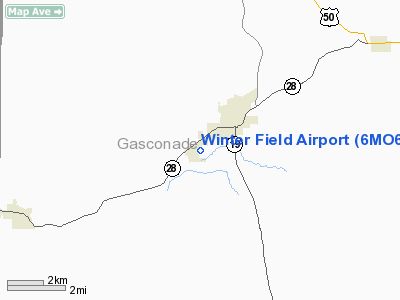
Location & QuickFacts
| FAA Information Effective: | 2008-09-25 |
| Airport Identifier: | 6MO6 |
| Airport Status: | Operational |
| Longitude/Latitude: | 091-31-00.5760W/38-20-00.1670N
-91.516827/38.333380 (Estimated) |
| Elevation: | 960 ft / 292.61 m (Estimated) |
| Land: | 10 acres |
| From nearest city: | 1 nautical miles W of Owensville, MO |
| Location: | Gasconade County, MO |
| Magnetic Variation: | 03E (1985) |
Owner & Manager
| Ownership: | Privately owned |
| Owner: | Milford H. H. Winter |
| Address: | 220 Circle Drive
Owensville, MO 65066 |
| Phone number: | 314-437-2156 |
| Manager: | Milford H. H. Winter |
| Address: | 220 Circle Drive
Owensville, MO 65066 |
| Phone number: | 573-437-2156 |
Airport Operations and Facilities
| Airport Use: | Private |
| Wind indicator: | Yes |
| Segmented Circle: | No |
| Control Tower: | No |
| Landing fee charge: | No |
| Sectional chart: | Kansas City |
| Region: | ACE - Central |
| Boundary ARTCC: | ZKC - Kansas City |
| Tie-in FSS: | COU - Columbia |
| FSS on Airport: | No |
| FSS Toll Free: | 1-800-WX-BRIEF |
Airport Services
| Airframe Repair: | NONE |
| Power Plant Repair: | NONE |
Runway Information
Runway E/W
| Dimension: | 1800 x 100 ft / 548.6 x 30.5 m |
| Surface: | TURF, |
| |
Runway E |
Runway W |
| Traffic Pattern: | Left | Left |
|
Radio Navigation Aids
| ID |
Type |
Name |
Ch |
Freq |
Var |
Dist |
| UBX | NDB | Cuba | | 380.00 | 01E | 16.7 nm |
| UUV | NDB | Sullivan | | 356.00 | 02E | 17.7 nm |
| JE | NDB | Algoa | | 397.00 | 03E | 29.1 nm |
| FTT | NDB | Guthrie | | 317.00 | 03E | 38.2 nm |
| ONH | NDB | Noah | | 515.00 | 03E | 38.8 nm |
| BHN | NDB | Buckhorn | | 391.00 | 03E | 47.3 nm |
| TBN | VOR | Forney | | 110.00 | 03E | 46.1 nm |
| VIH | VOR/DME | Vichy | 124X | 117.70 | 06E | 14.0 nm |
| COU | VOR/DME | Columbia | 039X | 110.20 | 03E | 43.7 nm |
| FTZ | VORTAC | Foristell | 045X | 110.80 | 05E | 33.6 nm |
| MAP | VORTAC | Maples | 081X | 113.40 | 06E | 46.5 nm |
| JEF | VOT | Jefferson City | | 112.00 | | 33.5 nm |
| SUS | VOT | Spirit Of St Louis | | 112.20 | | 45.2 nm |
Remarks
- STACK1000' & LGTD WATER TWR .25 MI NE RR & HWY 28' S, HWY NORTHSIDE
- RR TRACK & HIGHWAY 500' SOUTH. COUNTY ROAD NORTH. STACK 1000' NORTHEAST.
- RWY SOFT IN EARLY SPRING
Images and information placed above are from
http://www.airport-data.com/airport/6MO6/
We thank them for the data!
| General Info
|
| Country |
United States
|
| State |
MISSOURI
|
| FAA ID |
6MO6
|
| Latitude |
38-20-00.167N
|
| Longitude |
091-31-00.576W
|
| Elevation |
960 feet
|
| Near City |
OWENSVILLE
|
We don't guarantee the information is fresh and accurate. The data may
be wrong or outdated.
For more up-to-date information please refer to other sources.
|
|


