 |
|
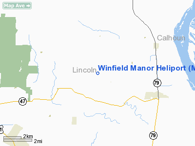
Location & QuickFacts
| FAA Information Effective: | 2008-09-25 |
| Airport Identifier: | MU66 |
| Airport Status: | Operational |
| Longitude/Latitude: | 090-49-04.4650W/39-01-04.1770N
-90.817907/39.017827 (Estimated) |
| Elevation: | 732 ft / 223.11 m (Estimated) |
| Land: | 0 acres |
| From nearest city: | 3 nautical miles SE of Winfield, MO |
| Location: | Lincoln County, MO |
| Magnetic Variation: | 02E (1980) |
Owner & Manager
| Ownership: | Privately owned |
| Owner: | Emerson Electric Co. |
| Address: | 8000 W. Florissant
St Louis, MO 63136 |
| Phone number: | 573-731-4517 |
| Manager: | D. Garland |
| Address: | Rr 1, Box 128
Winfield, MO 63389 |
| Phone number: | 573-553-3900 |
Airport Operations and Facilities
| Airport Use: | Private |
| Wind indicator: | Yes |
| Segmented Circle: | No |
| Control Tower: | No |
| Beacon Color: | Clear-Green-Yellow (heliport) |
| Landing fee charge: | No |
| Sectional chart: | Kansas City |
| Region: | ACE - Central |
| Boundary ARTCC: | ZKC - Kansas City |
| Tie-in FSS: | STL - Saint Louis |
| FSS on Airport: | No |
| FSS Toll Free: | 1-800-WX-BRIEF |
Runway Information
Helipad H1
| Dimension: | 50 x 50 ft / 15.2 x 15.2 m |
| Surface: | CONC, |
| |
Runway H1 |
Runway |
| Traffic Pattern: | Left | Left |
|
Radio Navigation Aids
| ID |
Type |
Name |
Ch |
Freq |
Var |
Dist |
| LM | NDB | Oblio | | 338.00 | 00E | 20.7 nm |
| CVM | NDB | Civic Memorial | | 263.00 | 02E | 36.4 nm |
| PPQ | NDB | Pittsfield | | 344.00 | 02E | 37.5 nm |
| UUV | NDB | Sullivan | | 356.00 | 02E | 49.8 nm |
| CSX | VOR/DME | Cardinal | 111Y | 116.45 | 00E | 26.7 nm |
| STL | VORTAC | St Louis | 121X | 117.40 | 01E | 18.3 nm |
| FTZ | VORTAC | Foristell | 045X | 110.80 | 05E | 20.7 nm |
| TOY | VORTAC | Troy | 107X | 116.00 | 04E | 45.3 nm |
| SUS | VOT | Spirit Of St Louis | | 112.20 | | 22.7 nm |
| STL | VOT | St Louis Lambert | | 111.00 | | 26.8 nm |
Remarks
- PROVIDED APP/DEP PATHS ARE CLEAR FOR A MINIMUM 8:1 GLIDE SLOPE & TRANSITIONAL SURFACE A 2:1 SLOPE.
Images and information placed above are from
http://www.airport-data.com/airport/MU66/
We thank them for the data!
| General Info
|
| Country |
United States
|
| State |
MISSOURI
|
| FAA ID |
MU66
|
| Latitude |
39-01-04.177N
|
| Longitude |
090-49-04.465W
|
| Elevation |
732 feet
|
| Near City |
WINFIELD
|
We don't guarantee the information is fresh and accurate. The data may
be wrong or outdated.
For more up-to-date information please refer to other sources.
|
|


