 |
|
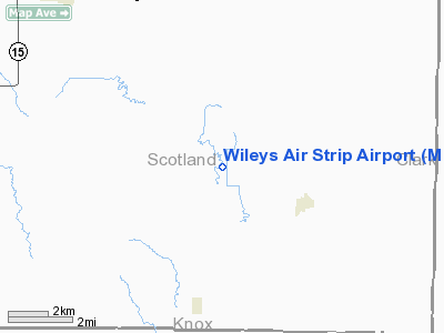
Location & QuickFacts
| FAA Information Effective: | 2008-09-25 |
| Airport Identifier: | MO42 |
| Airport Status: | Closed Indefinitely |
| Longitude/Latitude: | 092-04-20.6400W/40-22-35.1310N
-92.072400/40.376425 (Estimated) |
| Elevation: | 662 ft / 201.78 m (Surveyed) |
| Land: | 6 acres |
| From nearest city: | 3 nautical miles NW of Gorin, MO |
| Location: | Scotland County, MO |
| Magnetic Variation: | 03E (1985) |
Owner & Manager
| Ownership: | Privately owned |
| Owner: | Bette Wiley |
| Address: | Rte 1
Gorin, MO 63543 |
| Phone number: | 816-282-3465 |
| Manager: | Bette Wiley |
| Address: | Rt 1
Gorin, MO 63543 |
| Phone number: | 816-282-3465 |
Airport Operations and Facilities
| Airport Use: | Private |
| Wind indicator: | Yes |
| Segmented Circle: | No |
| Control Tower: | No |
| Landing fee charge: | No |
| Sectional chart: | Chicago |
| Region: | ACE - Central |
| Boundary ARTCC: | ZKC - Kansas City |
| Tie-in FSS: | COU - Columbia |
| FSS on Airport: | No |
| FSS Toll Free: | 1-800-WX-BRIEF |
Airport Services
| Airframe Repair: | MINOR |
| Power Plant Repair: | MINOR |
| Bottled Oxygen: | NONE |
| Bulk Oxygen: | NONE |
Runway Information
Runway 18/36
| Dimension: | 1825 x 90 ft / 556.3 x 27.4 m |
| Surface: | TURF, Good Condition |
| |
Runway 18 |
Runway 36 |
| Traffic Pattern: | Left | Left |
| Markings: | None,
18/36 MARKED WITH 2' WHITE BOARDS, WHITE TIRES AND REFLECTORS. | None, |
| Runway End Identifier: | No | No |
| Centerline Lights: | No | No |
| Touchdown Lights: | No | No |
| Obstruction: | 10 ft road | 90 ft trees, 2000.0 ft from runway, 22:1 slope to clear |
|
Radio Navigation Aids
| ID |
Type |
Name |
Ch |
Freq |
Var |
Dist |
| BEX | NDB | Bloomfield | | 269.00 | 02E | 27.5 nm |
| EOK | NDB | Keokuk | | 366.00 | 02E | 29.7 nm |
| FFL | NDB | Fairfield | | 332.00 | 03E | 38.3 nm |
| TVK | NDB | Centerville | | 290.00 | 04E | 42.2 nm |
| MPZ | NDB | Mount Pleasant | | 212.00 | 02E | 42.6 nm |
| UI | NDB | Quincy | | 293.00 | 02E | 47.8 nm |
| HAE | NDB | Hannibal | | 411.00 | 03E | 48.4 nm |
| OTM | VOR/DME | Ottumwa | 053X | 111.60 | 06E | 40.9 nm |
| MCM | VOR/DME | Macon | 076X | 112.90 | 06E | 47.3 nm |
| IRK | VORTAC | Kirksville | 093X | 114.60 | 06E | 27.9 nm |
| UIN | VORTAC | Quincy | 083X | 113.60 | 05E | 48.4 nm |
Remarks
- HGR'S, PARKING AREA, TREES, TIE DOWN AREA, PPOLES & RD IN PRIM SFC; VIOLATIONS OF 7:1 TREES, RD & HGR WEST SIDE; TREES & RD NORTH END.
- (ARPT STATUS) ARPT CLSD INDEFLY.
- EXISTED PRIOR TO 1959.
Images and information placed above are from
http://www.airport-data.com/airport/MO42/
We thank them for the data!
| General Info
|
| Country |
United States
|
| State |
MISSOURI
|
| FAA ID |
MO42
|
| Latitude |
40-22-35.131N
|
| Longitude |
092-04-20.640W
|
| Elevation |
662 feet
|
| Near City |
GORIN
|
We don't guarantee the information is fresh and accurate. The data may
be wrong or outdated.
For more up-to-date information please refer to other sources.
|
|


