 |
|
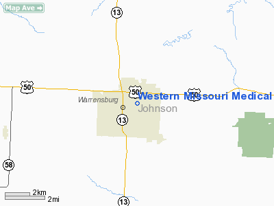
Western Missouri Medical Center Heliport |
Location & QuickFacts
| FAA Information Effective: | 2008-09-25 |
| Airport Identifier: | MU60 |
| Airport Status: | Operational |
| Longitude/Latitude: | 093-43-19.7780W/38-46-00.0410N
-93.722161/38.766678 (Estimated) |
| Elevation: | 850 ft / 259.08 m (Estimated) |
| Land: | 0 acres |
| From nearest city: | 0 nautical miles of Warrensburg, MO |
| Location: | Johnson County, MO |
| Magnetic Variation: | 04E (1985) |
Owner & Manager
| Ownership: | Privately owned |
| Owner: | Western Missouri Medical Ctr |
| Address: | 403 Burkarth Road
Warrensburg, MO 64093 |
| Phone number: | 816-747-2500 |
| Manager: | Gregory B. Vinardi, Pres. |
| Address: | Western Missouri Medical Ctr
Warrensburg, MO 64093 |
| Phone number: | 816-747-2500 |
Airport Operations and Facilities
| Airport Use: | Private
MEDICAL. |
| Wind indicator: | Yes |
| Segmented Circle: | No |
| Control Tower: | No |
| Landing fee charge: | No |
| Sectional chart: | Kansas City |
| Region: | ACE - Central |
| Boundary ARTCC: | ZKC - Kansas City |
| Tie-in FSS: | COU - Columbia |
| FSS on Airport: | No |
| FSS Toll Free: | 1-800-WX-BRIEF |
Runway Information
Helipad H1
| Dimension: | 40 x 40 ft / 12.2 x 12.2 m |
| Surface: | CONC, |
| |
Runway H1 |
Runway |
| Traffic Pattern: | Left | Left |
|
Radio Navigation Aids
| ID |
Type |
Name |
Ch |
Freq |
Var |
Dist |
| HCK | NDB | Hawks | | 296.00 | 04E | 10.9 nm |
| GLY | NDB | Golden Valley | | 388.00 | 04E | 24.6 nm |
| DMO | NDB | Sedalia | | 281.00 | 03E | 25.9 nm |
| PUR | NDB | Marshall | | 371.00 | 03E | 29.7 nm |
| LXT | NDB | Lesumit | | 263.00 | 04E | 32.6 nm |
| GPH | NDB | Mosby | | 284.00 | 03E | 44.3 nm |
| GQ | NDB | Norge | | 517.00 | 05E | 47.1 nm |
| GKB | NDB | Norge | | 517.00 | 05E | 47.1 nm |
| VER | NDB | Viertel | | 347.00 | 02E | 49.8 nm |
| SZL | TACAN | Whiteman | 035X | | 04E | 8.3 nm |
| RIS | VOR/DME | Riverside | 051X | 111.40 | 05E | 46.1 nm |
| OJC | VOR/DME | Johnson County | 077X | 113.00 | 06E | 47.7 nm |
| ANX | VORTAC | Napoleon | 087X | 114.00 | 07E | 27.4 nm |
| BUM | VORTAC | Butler | 106X | 115.90 | 07E | 46.7 nm |
| MKC | VOT | Kansas City Downtown | | 108.60 | | 46.2 nm |
Remarks
- OWNER DESIRES ARPT NOT BE CHARTED.
- APP/DEP PATHS ARE 8:1 GLIDE SLOPE AND TRANSITIONAL SURFACE OF A 2:1 SLOPE.
Images and information placed above are from
http://www.airport-data.com/airport/MU60/
We thank them for the data!
| General Info
|
| Country |
United States
|
| State |
MISSOURI
|
| FAA ID |
MU60
|
| Latitude |
38-46-00.041N
|
| Longitude |
093-43-19.778W
|
| Elevation |
850 feet
|
| Near City |
WARRENSBURG
|
We don't guarantee the information is fresh and accurate. The data may
be wrong or outdated.
For more up-to-date information please refer to other sources.
|
|


