 |
|
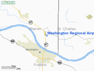
Washington Regional Airport |
Location & QuickFacts
| FAA Information Effective: | 2008-09-25 |
| Airport Identifier: | MO6 |
| Airport Status: | Operational |
| Longitude/Latitude: | 090-59-37.7000W/38-35-15.3000N
-90.993806/38.587583 (Estimated) |
| Elevation: | 488 ft / 148.74 m (Surveyed) |
| Land: | 507 acres |
| From nearest city: | 3 nautical miles N of Washington, MO |
| Location: | Warren County, MO |
| Magnetic Variation: | 01E (2000) |
Owner & Manager
| Ownership: | Publicly owned |
| Owner: | City Of Washington |
| Address: | 405 Jefferson
Washington, MO 63090 |
| Phone number: | 636-390-1000 |
| Manager: | Kevin Hellmann |
| Address: | 405 Jefferson
Washington, MO 63090
ARPT ADDRESS 12958 HWY 47, MARTHESVILLE, MO, 63357 |
| Phone number: | 636-221-1959 |
Airport Operations and Facilities
| Airport Use: | Open to public |
| Wind indicator: | Yes |
| Segmented Circle: | Yes |
| Control Tower: | No |
| Lighting Schedule: | DUSK-DAWN
MIRL RY 15/33 PRESET ON MED INTST DUSK TO 0000; TO INCR INTST & ACTVT MIRL RY 15/33 & REIL RYS 15 & 33 - CTAF. PAPI RYS 15 & 33 ON 24 HRS. |
| Beacon Color: | Clear-Green (lighted land airport) |
| Landing fee charge: | No |
| Sectional chart: | St Louis |
| Region: | ACE - Central |
| Boundary ARTCC: | ZKC - Kansas City |
| Tie-in FSS: | STL - Saint Louis |
| FSS on Airport: | No |
| FSS Toll Free: | 1-800-WX-BRIEF |
| NOTAMs Facility: | STL (NOTAM-d service avaliable) |
| Federal Agreements: | NY1 |
Airport Communications
| CTAF: | 122.800 |
| Unicom: | 122.800 |
Airport Services
| Fuel available: | 100LL |
| Airframe Repair: | MINOR |
| Power Plant Repair: | MINOR
MAINTENANCE ON LMTD BASIS. |
Runway Information
Runway 15/33
| Dimension: | 5001 x 75 ft / 1524.3 x 22.9 m |
| Surface: | CONC, Good Condition |
| Weight Limit: | Single wheel: 30000 lbs. |
| Edge Lights: | Medium |
| |
Runway 15 |
Runway 33 |
| Longitude: | 090-59-51.4656W | 090-59-23.9131W |
| Latitude: | 38-35-37.5320N | 38-34-53.0772N |
| Elevation: | 488.00 ft | 485.00 ft |
| Alignment: | 127 | 127 |
| Traffic Pattern: | Right | Left |
| Markings: | Non-precision instrument, Good Condition | Non-precision instrument, Good Condition |
| Crossing Height: | 42.00 ft | 40.00 ft |
| VASI: | 4-light PAPI on left side | 4-light PAPI on left side |
| Visual Glide Angle: | 3.00° | 3.00° |
| Runway End Identifier: | Yes | Yes |
| Obstruction: | 116 ft trees, 2950.0 ft from runway, 198 ft right of centerline, 23:1 slope to clear | 104 ft tree, 3077.0 ft from runway, 625 ft right of centerline, 27:1 slope to clear |
|
Radio Navigation Aids
| ID |
Type |
Name |
Ch |
Freq |
Var |
Dist |
| UUV | NDB | Sullivan | | 356.00 | 02E | 22.6 nm |
| LM | NDB | Oblio | | 338.00 | 00E | 27.5 nm |
| FES | NDB | Festus | | 269.00 | 01E | 37.0 nm |
| UBX | NDB | Cuba | | 380.00 | 01E | 37.5 nm |
| CVM | NDB | Civic Memorial | | 263.00 | 02E | 47.6 nm |
| FTT | NDB | Guthrie | | 317.00 | 03E | 49.8 nm |
| CSX | VOR/DME | Cardinal | 111Y | 116.45 | 00E | 31.3 nm |
| VIH | VOR/DME | Vichy | 124X | 117.70 | 06E | 42.5 nm |
| FTZ | VORTAC | Foristell | 045X | 110.80 | 05E | 6.5 nm |
| STL | VORTAC | St Louis | 121X | 117.40 | 01E | 29.1 nm |
| SUS | VOT | Spirit Of St Louis | | 112.20 | | 16.7 nm |
| STL | VOT | St Louis Lambert | | 111.00 | | 31.2 nm |
Remarks
- WILDLIFE ON AND INVOF AIRPORT.
Images and information placed above are from
http://www.airport-data.com/airport/MO6/
We thank them for the data!
| General Info
|
| Country |
United States
|
| State |
MISSOURI
|
| FAA ID |
MO6
|
| Latitude |
38-35-29.885N
|
| Longitude |
090-59-51.412W
|
| Elevation |
487 feet
|
| Near City |
WASHINGTON
|
We don't guarantee the information is fresh and accurate. The data may
be wrong or outdated.
For more up-to-date information please refer to other sources.
|
|


