 |
|
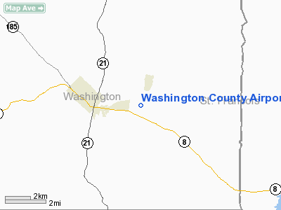
Washington County Airport |
Location & QuickFacts
| FAA Information Effective: | 2008-09-25 |
| Airport Identifier: | 8WC |
| Airport Status: | Operational |
| Longitude/Latitude: | 090-43-53.3600W/37-55-45.1250N
-90.731489/37.929201 (Estimated) |
| Elevation: | 959 ft / 292.30 m (Surveyed) |
| Land: | 120 acres |
| From nearest city: | 3 nautical miles E of Potosi, MO |
| Location: | Washington County, MO |
| Magnetic Variation: | 00E (2005) |
Owner & Manager
| Ownership: | Publicly owned |
| Owner: | Washington County
RON STEVENS, AIRPORT BOARD PRESIDENT. |
| Address: | Box 398
Potosi, MO 63664 |
| Phone number: | 573-438-4901 |
| Manager: | Patrick Campbell |
| Address: | 10351 Airport Road
Mineral Point, MO 63660 |
| Phone number: | 573-438-3582 |
Airport Operations and Facilities
| Airport Use: | Open to public |
| Wind indicator: | Yes |
| Segmented Circle: | Yes |
| Control Tower: | No |
| Lighting Schedule: | DUSK-DAWN
ACTVT MIRL RY 02/20 - CTAF. |
| Beacon Color: | Clear-Green (lighted land airport) |
| Landing fee charge: | No |
| Sectional chart: | St Louis |
| Region: | ACE - Central |
| Boundary ARTCC: | ZKC - Kansas City |
| Tie-in FSS: | STL - Saint Louis |
| FSS on Airport: | No |
| FSS Toll Free: | 1-800-WX-BRIEF |
| NOTAMs Facility: | STL (NOTAM-d service avaliable) |
| Federal Agreements: | Y1 |
Airport Communications
| CTAF: | 123.000 |
| Unicom: | 123.000 |
Airport Services
| Fuel available: | 100LLA
FOR FUEL AFTER HRS CALL NR POSTED BY OUTSIDE PHONE. |
| Bottled Oxygen: | NONE |
| Bulk Oxygen: | NONE |
Runway Information
Runway 02/20
| Dimension: | 4000 x 60 ft / 1219.2 x 18.3 m |
| Surface: | ASPH, Good Condition |
| Weight Limit: | Single wheel: 11000 lbs.
PAVEMENT RATED FOR ACFT UNDER 12,500 LBS. |
| Edge Lights: | Medium |
| |
Runway 02 |
Runway 20 |
| Longitude: | 090-44-01.4100W | 090-43-45.3100W |
| Latitude: | 37-55-26.4100N | 37-56-03.8400N |
| Elevation: | 959.00 ft | 946.00 ft |
| Alignment: | 19 | 127 |
| Traffic Pattern: | Right | Left |
| Markings: | Non-precision instrument, Poor Condition
MARKINGS FADED. | Non-precision instrument, Poor Condition
MARKINGS FADED. |
| Obstruction: | 61 ft trees, 834.0 ft from runway, 335 ft right of centerline, 10:1 slope to clear | 15 ft trees, 585.0 ft from runway, 119 ft right of centerline, 25:1 slope to clear |
|
Radio Navigation Aids
| ID |
Type |
Name |
Ch |
Freq |
Var |
Dist |
| PRI | NDB | Perrine | | 367.00 | 02E | 17.4 nm |
| FES | NDB | Festus | | 269.00 | 01E | 22.8 nm |
| UUV | NDB | Sullivan | | 356.00 | 02E | 27.5 nm |
| UBX | NDB | Cuba | | 380.00 | 01E | 34.0 nm |
| VIH | VOR/DME | Vichy | 124X | 117.70 | 06E | 48.1 nm |
| FAM | VORTAC | Farmington | 104X | 115.70 | 01E | 28.2 nm |
| FTZ | VORTAC | Foristell | 045X | 110.80 | 05E | 47.4 nm |
| SUS | VOT | Spirit Of St Louis | | 112.20 | | 44.2 nm |
Remarks
- WILDLIFE ON & INVOF ARPT.
- USE RIGHT TFC FOR RY 02; DO NOT OVERFLY PRISON AREA.
- FBO AND FUEL LOCATED AT SOUTH APRON.
Images and information placed above are from
http://www.airport-data.com/airport/8WC/
We thank them for the data!
| General Info
tr>
| Country |
United States
|
| State |
MISSOURI
|
| FAA ID |
8WC
|
| Latitude |
37-55-43.179N
|
| Longitude |
090-43-54.466W
|
| Elevation |
955 feet
|
| Near City |
POTOSI
|
We don't guarantee the information is fresh and accurate. The data may
be wrong or outdated.
For more up-to-date information please refer to other sources.
|
|


