|
|
| Warsaw Municipal Airport |
| IATA: none – ICAO: KRAW – FAA LID: RAW |
| Summary |
| Airport type |
Public |
| Owner |
City of Warsaw |
| Serves |
Warsaw, Missouri |
| Elevation AMSL |
936 ft / 285 m |
| Coordinates |
38°20′49″N 093°20′44″W / 38.34694°N 93.34556°W / 38.34694; -93.34556 |
| Runways |
| Direction |
Length |
Surface |
| ft |
m |
| 18/36 |
3,300 |
1,006 |
Concrete |
| Statistics (2006) |
| Aircraft operations |
3,330 |
| Source: Federal Aviation Administration |
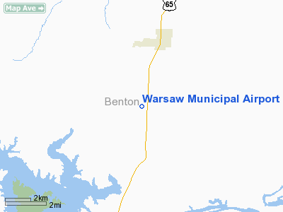
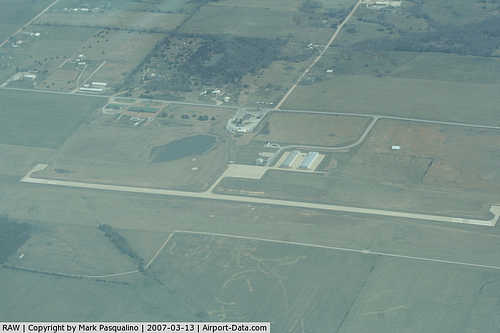
Warsaw Municipal Airport (ICAO: KRAW, FAA LID: RAW) is a city-owned, public-use airport located six miles (10 km) north of the central business district of Warsaw, a city in Benton County, Missouri, United States.
Although most U.S. airports use the same three-letter location identifier for the FAA and IATA, Warsaw Municipal Airport is assigned RAW by the FAA but has no designation from the IATA (which assigned RAW to Arawa, Papua New Guinea).
Facilities and aircraft
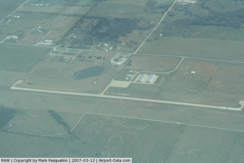
Warsaw Municipal Airport covers an area of 168 acres (68 ha) and has one runway designated 18/36 with a 3,300 x 60 ft (1,006 x 18 m) concrete surface. For the 12-month period ending February 28, 2006, the airport had 3,330 aircraft operations, an average of 9 per day: 96% general aviation, 3% military and 1% air taxi.
The above content comes from Wikipedia and is published under free licenses – click here to read more.
|
 |
(Click on the photo to enlarge) |
|
 |
(Click on the photo to enlarge) |
|
 |
(Click on the photo to enlarge) |
Location & QuickFacts
| FAA Information Effective: | 2008-09-25 |
| Airport Identifier: | RAW |
| Airport Status: | Operational |
| Longitude/Latitude: | 093-20-43.5000W/38-20-48.8000N
-93.345417/38.346889 (Estimated) |
| Elevation: | 936 ft / 285.29 m (Estimated) |
| Land: | 168 acres |
| From nearest city: | 6 nautical miles N of Warsaw, MO |
| Location: | Benton County, MO |
| Magnetic Variation: | 03E (1995) |
Owner & Manager
| Ownership: | Publicly owned |
| Owner: | City Of Warsaw |
| Address: | 181 Harrison Box 68
Warsaw, MO 65355 |
| Phone number: | 660-438-5522 |
| Manager: | Betty Brumbaugh |
| Address: | 181 Harrison Box 68
Warsaw, MO 65355 |
| Phone number: | 660-438-5522 |
Airport Operations and Facilities
| Airport Use: | Open to public |
| Wind indicator: | Yes |
| Segmented Circle: | Yes |
| Control Tower: | No |
| Lighting Schedule: | DUSK-DAWN
ACTVT MIRL RY 18/36 - CTAF. |
| Beacon Color: | Clear-Green (lighted land airport) |
| Sectional chart: | Kansas City |
| Region: | ACE - Central |
| Boundary ARTCC: | ZKC - Kansas City |
| Tie-in FSS: | COU - Columbia |
| FSS on Airport: | No |
| FSS Toll Free: | 1-800-WX-BRIEF |
| NOTAMs Facility: | COU (NOTAM-d service avaliable) |
| Federal Agreements: | NGY |
Airport Communications
Airport Services
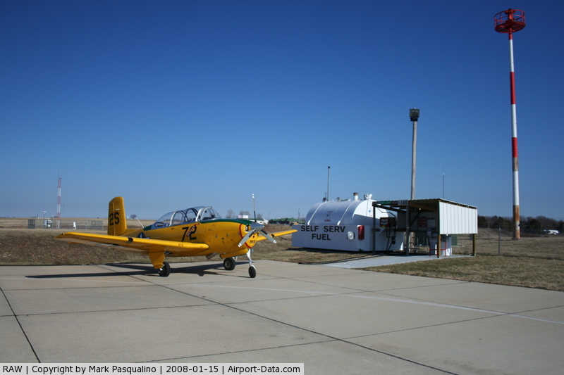
| Fuel available: | 100LL
FUEL AVBL 24 HR SELF SERVE. |
Runway Information
Runway 18/36
| Dimension: | 3300 x 60 ft / 1005.8 x 18.3 m |
| Surface: | CONC, Good Condition |
| Weight Limit: | Dual wheel: 12500 lbs. |
| Edge Lights: | Medium |
| |
Runway 18 |
Runway 36 |
| Longitude: | 093-20-42.3300W | 093-20-44.6100W |
| Latitude: | 38-21-05.0600N | 38-20-32.4800N |
| Traffic Pattern: | Left | Left |
| Markings: | Non-precision instrument, Fair Condition | Non-precision instrument, Fair Condition |
|
Radio Navigation Aids
| ID |
Type |
Name |
Ch |
Freq |
Var |
Dist |
| GLY | NDB | Golden Valley | | 388.00 | 04E | 16.0 nm |
| HCK | NDB | Hawks | | 296.00 | 04E | 20.0 nm |
| DMO | NDB | Sedalia | | 281.00 | 03E | 22.9 nm |
| AIZ | NDB | Kaiser | | 377.00 | 05E | 40.3 nm |
| PUR | NDB | Marshall | | 371.00 | 03E | 42.4 nm |
| VER | NDB | Viertel | | 347.00 | 02E | 47.7 nm |
| SZL | TACAN | Whiteman | 035X | | 04E | 25.3 nm |
| SHY | VOR/DME | Sunshine | 021X | 108.40 | 05E | 39.6 nm |
Remarks
- WILDLIFE ON & INVOF ARPT.
- PVMT EDGE DROP-OFFS ALONG THE NORTH EDGE OF THE TWY SERVING THE APRON EXCEED SIX INCHES IN VARIOUS LOCATIONS.
- PER TELCON WITH GLEN HELM ACE-625.
Images and information placed above are from
http://www.airport-data.com/airport/RAW/
We thank them for the data!
| General Info
|
| Country |
United States
|
| State |
MISSOURI
|
| FAA ID |
RAW |
| Latitude |
38-20-48.800N
|
| Longitude |
093-20-43.530W
|
| Elevation |
936 feet
|
| Near City |
WARSAW
|
We don't guarantee the information is fresh and accurate. The data may
be wrong or outdated.
For more up-to-date information please refer to other sources.
|
|