 |
|
Location & QuickFacts
| FAA Information Effective: | 2008-09-25 |
| Airport Identifier: | 45MO |
| Airport Status: | Operational |
| Longitude/Latitude: | 090-38-20.4430W/38-50-50.1840N
-90.639012/38.847273 (Estimated) |
| Elevation: | 424 ft / 129.24 m (Estimated) |
| Land: | 0 acres |
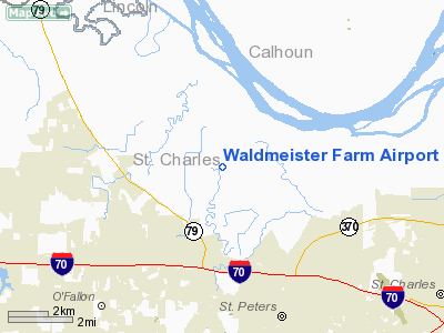
| From nearest city: | 3 nautical miles SE of St Peters, MO |
| Location: | St Charles County, MO |
| Magnetic Variation: | 02E (1985) |
Owner & Manager
| Ownership: | Privately owned |
| Owner: | August A. Busch Iii |
| Address: | Waldmeister Farm Po Box 935
St Peters, MO 63376 |
| Phone number: | 573-278-3521 |
| Manager: | August A. Busch Iii |
| Address: | Waldeister Farm Po Box 936
St Peters, MO 63376 |
| Phone number: | 314-278-3521 |
Airport Operations and Facilities
| Airport Use: | Private |
| Wind indicator: | Yes |
| Segmented Circle: | No |
| Control Tower: | No |
| Landing fee charge: | No |
| Sectional chart: | St Louis |
| Region: | ACE - Central |
| Boundary ARTCC: | ZKC - Kansas City |
| Tie-in FSS: | STL - Saint Louis |
| FSS on Airport: | No |
| FSS Toll Free: | 1-800-WX-BRIEF |
Airport Communications
Runway Information
Runway 18/36
| Dimension: | 2100 x 20 ft / 640.1 x 6.1 m |
| Surface: | TURF, |
| |
Runway 18 |
Runway 36 |
| Traffic Pattern: | Right | Left |
|
Helipad H1
| Dimension: | 50 x 50 ft / 15.2 x 15.2 m |
| Surface: | TURF, |
| |
Runway H1 |
Runway |
| Traffic Pattern: | Left | Left |
|
Radio Navigation Aids
| ID |
Type |
Name |
Ch |
Freq |
Var |
Dist |
| LM | NDB | Oblio | | 338.00 | 00E | 8.2 nm |
| CVM | NDB | Civic Memorial | | 263.00 | 02E | 27.4 nm |
| FES | NDB | Festus | | 269.00 | 01E | 40.9 nm |
| UUV | NDB | Sullivan | | 356.00 | 02E | 44.3 nm |
| BL | NDB | Belleville | | 362.00 | 02E | 47.4 nm |
| PPQ | NDB | Pittsfield | | 344.00 | 02E | 48.1 nm |
| LTD | NDB | Litchfield | | 371.00 | 01E | 48.9 nm |
| SKE | TACAN | Scott | 059X | | 02E | 41.2 nm |
| CSX | VOR/DME | Cardinal | 111Y | 116.45 | 00E | 14.2 nm |
| STL | VORTAC | St Louis | 121X | 117.40 | 01E | 7.4 nm |
| FTZ | VORTAC | Foristell | 045X | 110.80 | 05E | 18.1 nm |
| TOY | VORTAC | Troy | 107X | 116.00 | 04E | 34.4 nm |
| SUS | VOT | Spirit Of St Louis | | 112.20 | | 11.1 nm |
| STL | VOT | St Louis Lambert | | 111.00 | | 14.3 nm |
Remarks
- (E111-2) HEL ASP: PRVDD APCH/DEP PATHS TO THE LNDG AREA ARE MAINTD FOR A MIN 8:1 GLIDE SLOPE AND TRSNL SFC BE MAINTD FOR A 2:1 SLOPE.
- PRVDD THE OWNER/OPERATOR ENSURE ALL USERS OF THE ARPT FLY TFC PATTERNS WEST OF ARPT; I.E. RGT TFC TO RWY 18 & LEFT TFC TO RWY 36; THAT THE APCH TO EACH RWY IS MAINTD FOR A MIN 20:1 GLIDE SLOPE AND THE TRANSITIONAL SFC BE MAINTD FOR A 7:1 SLOPE.
Images and information placed above are from
http://www.airport-data.com/airport/45MO/
We thank them for the data!
| General Info
|
| Country |
United States
|
| State |
MISSOURI
|
| FAA ID |
45MO
|
| Latitude |
38-50-50.184N
|
| Longitude |
090-38-20.443W
|
| Elevation |
424 feet
|
| Near City |
ST PETERS
|
We don't guarantee the information is fresh and accurate. The data may
be wrong or outdated.
For more up-to-date information please refer to other sources.
|
|


