 |
|
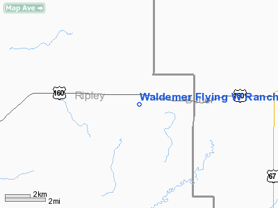
Waldemer Flying W Ranch Airport |
Location & QuickFacts
| FAA Information Effective: | 2008-09-25 |
| Airport Identifier: | MO58 |
| Airport Status: | Operational |
| Longitude/Latitude: | 090-38-25.4210W/36-39-30.2040N
-90.640395/36.658390 (Estimated) |
| Elevation: | 460 ft / 140.21 m (Estimated) |
| Land: | 0 acres |
| From nearest city: | 1 nautical miles SW of Fairdealing, MO |
| Location: | Ripley County, MO |
| Magnetic Variation: | 02E (1985) |
Owner & Manager
| Ownership: | Privately owned |
| Owner: | David Z. Waldemer |
| Address: | Rt 1, Box 60
Fairdealing, MO 63939 |
| Phone number: | 314-857-2686 |
| Manager: | David Z. Waldemer |
| Address: | Rt 1, Box 60
Fairdealing, MO 63939 |
| Phone number: | 573-857-2686 |
Airport Operations and Facilities
| Airport Use: | Private |
| Wind indicator: | Yes |
| Segmented Circle: | No |
| Control Tower: | No |
| Landing fee charge: | No |
| Sectional chart: | St Louis |
| Region: | ACE - Central |
| Boundary ARTCC: | ZME - Memphis |
| Tie-in FSS: | COU - Columbia |
| FSS on Airport: | No |
| FSS Toll Free: | 1-800-WX-BRIEF |
Airport Services
| Airframe Repair: | MAJOR |
| Power Plant Repair: | MAJOR |
Runway Information
Runway N/S
| Dimension: | 2370 x 100 ft / 722.4 x 30.5 m |
| Surface: | TURF, |
| |
Runway N |
Runway S |
| Traffic Pattern: | Left | Left |
| Obstruction: | 60 ft trees, 1000.0 ft from runway | |
|
Radio Navigation Aids
| ID |
Type |
Name |
Ch |
Freq |
Var |
Dist |
| FD | NDB | Earli | | 278.00 | 03E | 15.1 nm |
| TNZ | NDB | Lawrence County | | 227.00 | 01E | 30.5 nm |
| DXE | NDB | Dexter | | 423.00 | 00E | 34.6 nm |
| PGR | NDB | Paragould | | 383.00 | 01E | 36.3 nm |
| TKX | NDB | Kennett | | 358.00 | 00E | 38.9 nm |
| JBR | VOR/DME | Jonesboro | 023X | 108.60 | 02E | 47.2 nm |
| MAW | VORTAC | Malden | 049X | 111.20 | 03E | 35.7 nm |
| ARG | VORTAC | Walnut Ridge | 092X | 114.50 | 04E | 36.3 nm |
Remarks
- 200' TOWER 2600' NW OF N END OF RUNWAY.
- CONDITIONAL - PROVIDED THE APPROACH TO EACH RWY IS MAINTAINED FOR A MINIMUM 20:1 GLIDE SLOPE AND THE TRANSITIONAL SURFACE BE MAINTAINED FOR A 7:1 SLOPE.
Images and information placed above are from
http://www.airport-data.com/airport/MO58/
We thank them for the data!
| General Info
|
| Country |
United States
|
| State |
MISSOURI
|
| FAA ID |
MO58
|
| Latitude |
36-39-30.204N
|
| Longitude |
090-38-25.421W
|
| Elevation |
460 feet
|
| Near City |
FAIRDEALING
|
We don't guarantee the information is fresh and accurate. The data may
be wrong or outdated.
For more up-to-date information please refer to other sources.
|
|


