 |
|
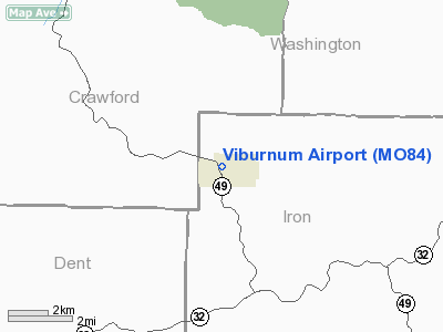
Location & QuickFacts
| FAA Information Effective: | 2008-09-25 |
| Airport Identifier: | MO84 |
| Airport Status: | Operational |
| Longitude/Latitude: | 091-08-00.4820W/37-43-00.1660N
-91.133467/37.716713 (Estimated) |
| Elevation: | 1272 ft / 387.71 m (Estimated) |
| Land: | 18 acres |
| From nearest city: | 0 nautical miles NE of Viburnum, MO |
| Location: | Iron County, MO |
| Magnetic Variation: | 03E (1985) |
Owner & Manager
| Ownership: | Publicly owned |
| Owner: | City Of Viburnum |
| Address: | Box 596
Viburnum, MO 65566 |
| Phone number: | 573-244-5520 |
| Manager: | Pamela J. Wagner, Mayor |
| Address: | Box 596
Viburnum, MO 65566 |
| Phone number: | 573-244-3231 |
Airport Operations and Facilities
| Airport Use: | Private |
| Wind indicator: | Yes |
| Segmented Circle: | No |
| Control Tower: | No |
| Lighting Schedule: | RDO-CTL
ACTVT LIRL RY 09/27 - 122.8. |
| Landing fee charge: | No |
| Sectional chart: | Kansas City |
| Region: | ACE - Central |
| Boundary ARTCC: | ZKC - Kansas City |
| Tie-in FSS: | COU - Columbia |
| FSS on Airport: | No |
| FSS Toll Free: | 1-800-WX-BRIEF |
Airport Services
| Airframe Repair: | NONE |
| Power Plant Repair: | NONE |
Runway Information
Runway 09/27
| Dimension: | 3195 x 47 ft / 973.8 x 14.3 m |
| Surface: | ASPH, Fair Condition |
| Edge Lights: | Non-standard lighting system
NSTD LIRL; 5 GREEN THLD LGTS AT EACH THLD; RY EDGE LGTS SPACING INCORRECT. |
| |
Runway 09 |
Runway 27 |
| Traffic Pattern: | Left | Left |
| Markings: | , | Nonstandard, Fair Condition
NSTD NRS; NRS SMALL. |
| Obstruction: | 80 ft trees, 350.0 ft from runway, 75 ft left of centerline, 1:1 slope to clear
+1-61 FT BRUSH; TREES; HIGH GND & ROAD 0-200 FT FM RY END L & R. | 23 ft trees, 300.0 ft from runway, 120 ft left of centerline, 4:1 slope to clear
+1-25 FT TREES & ROAD 0-200 FT FM RY END 100-125 FT L. |
|
Radio Navigation Aids
| ID |
Type |
Name |
Ch |
Freq |
Var |
Dist |
| UBX | NDB | Cuba | | 380.00 | 01E | 25.2 nm |
| UUV | NDB | Sullivan | | 356.00 | 02E | 31.2 nm |
| PRI | NDB | Perrine | | 367.00 | 02E | 33.6 nm |
| FES | NDB | Festus | | 269.00 | 01E | 45.6 nm |
| BHN | NDB | Buckhorn | | 391.00 | 03E | 46.2 nm |
| TBN | VOR | Forney | | 110.00 | 03E | 47.8 nm |
| VIH | VOR/DME | Vichy | 124X | 117.70 | 06E | 37.8 nm |
| MAP | VORTAC | Maples | 081X | 113.40 | 06E | 32.1 nm |
| FAM | VORTAC | Farmington | 104X | 115.70 | 01E | 42.9 nm |
Remarks
- RY 09 HIGH GND; BLDGS & TREES ON APCH; NO SAFETY AREA.
- RY 27 100' STEEP SLOPE 200' FM RY END.
- PROVDD CLEAR APCH TO EACH RWY MAINTAINED FOR A MIN 20:1 GLIDE SLOPE; MAINTAIN A TRSNL SURFACE FOR A 7:1 SLOPE; AND PROVIDE 20:1 APCH RATIO.
Images and information placed above are from
http://www.airport-data.com/airport/MO84/
We thank them for the data!
| General Info
|
| Country |
United States
|
| State |
MISSOURI
|
| FAA ID |
MO84
|
| Latitude |
37-43-00.166N
|
| Longitude |
091-08-00.482W
|
| Elevation |
1272 feet
|
| Near City |
VIBURNUM
|
We don't guarantee the information is fresh and accurate. The data may
be wrong or outdated.
For more up-to-date information please refer to other sources.
|
|


