 |
|
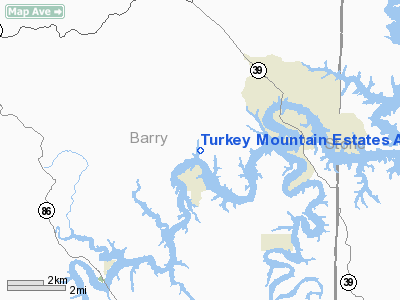
Turkey Mountain Estates Airport |
Location & QuickFacts
| FAA Information Effective: | 2008-09-25 |
| Airport Identifier: | MO00 |
| Airport Status: | Operational |
| Longitude/Latitude: | 093-40-00.6930W/36-35-30.2390N
-93.666859/36.591733 (Estimated) |
| Elevation: | 1000 ft / 304.80 m (Estimated) |
| Land: | 8 acres |
| From nearest city: | 3 nautical miles SW of Shell Knob, MO |
| Location: | Barry County, MO |
| Magnetic Variation: | 04E (1985) |
Owner & Manager
| Ownership: | Privately owned |
| Owner: | Don & Mary Aven |
| Address: | Hcr 64, Box 2101
Shell Knob, MO 65747 |
| Phone number: | 417-858-2073 |
| Manager: | Judy Reynolds (a Co-owner) |
| Address: | Hcr 64, Box 2110
Shell Knob, MO 65747 |
| Phone number: | 417-858-6345 |
Airport Operations and Facilities
| Airport Use: | Private |
| Wind indicator: | Yes |
| Segmented Circle: | No |
| Control Tower: | No |
| Landing fee charge: | No |
| Sectional chart: | Kansas City |
| Region: | ACE - Central |
| Boundary ARTCC: | ZME - Memphis |
| Tie-in FSS: | COU - Columbia |
| FSS on Airport: | No |
| FSS Toll Free: | 1-800-WX-BRIEF |
Airport Services
| Airframe Repair: | NONE |
| Power Plant Repair: | NONE |
Runway Information
Runway 18/36
| Dimension: | 3950 x 80 ft / 1204.0 x 24.4 m |
| Surface: | TURF, Good Condition |
| |
Runway 18 |
Runway 36 |
| Traffic Pattern: | Left | Left |
| Obstruction: | 43 ft trees, 120 ft right of centerline | 12 ft trees, 170.0 ft from runway, 45 ft left of centerline, 14:1 slope to clear |
|
Radio Navigation Aids
| ID |
Type |
Name |
Ch |
Freq |
Var |
Dist |
| PLK | NDB | Point Lookout/dcmsnd | | 204.00 | 03E | 21.2 nm |
| ILJ | NDB | Willard | | 254.00 | 03E | 43.9 nm |
| SLG | NDB | Siloam Springs | | 284.00 | 04E | 46.5 nm |
| HRO | VOR/DME | Harrison | 072X | 112.50 | 04E | 27.4 nm |
| EOS | VOR/DME | Neosho | 120X | 117.30 | 07E | 40.0 nm |
| DAK | VOR/DME | Drake | 025X | 108.80 | 07E | 41.8 nm |
| RZC | VORTAC | Razorback | 111X | 116.40 | 04E | 30.2 nm |
| DGD | VORTAC | Dogwood | 031X | 109.40 | 06E | 46.0 nm |
| SGF | VORTAC | Springfield | 116X | 116.90 | 04E | 48.6 nm |
Remarks
- TREES, FCS, HGRS, BLDGS, GND, ROAD, SIGNS, GOLF COURSE, BRUSH, WIND INDICATOR & PLINES LCTD IN PRIM SFC.
- EDDY CURRENTS NEAR SOUTH END OF RY.
Images and information placed above are from
http://www.airport-data.com/airport/MO00/
We thank them for the data!
| General Info
|
| Country |
United States
|
| State |
MISSOURI
|
| FAA ID |
MO00
|
| Latitude |
36-35-30.239N
|
| Longitude |
093-40-00.693W
|
| Elevation |
1000 feet
|
| Near City |
SHELL KNOB
|
We don't guarantee the information is fresh and accurate. The data may
be wrong or outdated.
For more up-to-date information please refer to other sources.
|
|


