 |
|
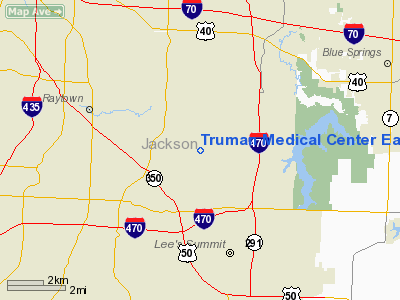
Truman Medical Center East Heliport |
Location & QuickFacts
| FAA Information Effective: | 2008-09-25 |
| Airport Identifier: | 7MO0 |
| Airport Status: | Operational |
| Longitude/Latitude: | 094-23-40.8230W/38-58-30.0240N
-94.394673/38.975007 (Estimated) |
| Elevation: | 983 ft / 299.62 m (Estimated) |
| Land: | 0 acres |
| From nearest city: | 7 nautical miles S of Kansas City, MO |
| Location: | Jackson County, MO |
| Magnetic Variation: | 05E (1990) |
Owner & Manager
| Ownership: | Privately owned |
| Owner: | Truman Medical Center East |
| Address: | 7900 Lee's Summit Road
Kansas City, MO 64139 |
| Phone number: | 816-373-4415 |
| Manager: | John Pruitt |
| Address: | 7900 Lee's Summit Road
Kansas City, MO 64139 |
| Phone number: | 816-373-4415
EXT 1292. |
Airport Operations and Facilities
| Airport Use: | Private
MEDICAL USE. |
| Wind indicator: | Yes |
| Segmented Circle: | No |
| Control Tower: | No |
| Lighting Schedule: | DUSK-DAWN |
| Beacon Color: | Clear-Green-Yellow (heliport) |
| Sectional chart: | Kansas City |
| Region: | ACE - Central |
| Boundary ARTCC: | ZKC - Kansas City |
| Tie-in FSS: | COU - Columbia |
| FSS Toll Free: | 1-800-WX-BRIEF |
Runway Information
Helipad H1
| Dimension: | 35 x 35 ft / 10.7 x 10.7 m |
| Surface: | CONC, |
| |
Runway H1 |
Runway |
| Traffic Pattern: | Left | Left |
|
Radio Navigation Aids
| ID |
Type |
Name |
Ch |
Freq |
Var |
Dist |
| LXT | NDB | Lesumit | | 263.00 | 04E | 1.4 nm |
| GKB | NDB | Norge | | 517.00 | 05E | 13.2 nm |
| GQ | NDB | Norge | | 517.00 | 05E | 13.2 nm |
| DO | NDB | Dotte | | 359.00 | 05E | 22.2 nm |
| GPH | NDB | Mosby | | 284.00 | 03E | 22.7 nm |
| HCK | NDB | Hawks | | 296.00 | 04E | 43.8 nm |
| EZZ | NDB | Cameron | | 394.00 | 03E | 45.7 nm |
| GLY | NDB | Golden Valley | | 388.00 | 04E | 49.8 nm |
| SZL | TACAN | Whiteman | 035X | | 04E | 42.0 nm |
| RIS | VOR/DME | Riverside | 051X | 111.40 | 05E | 12.9 nm |
| OJC | VOR/DME | Johnson County | 077X | 113.00 | 06E | 17.9 nm |
| BQS | VOR/DME | Braymer | 049X | 111.20 | 03E | 46.2 nm |
| ANX | VORTAC | Napoleon | 087X | 114.00 | 07E | 14.4 nm |
| MCI | VORTAC | Kansas City | 079Y | 113.25 | 05E | 24.5 nm |
| BUM | VORTAC | Butler | 106X | 115.90 | 07E | 42.5 nm |
| MKC | VOT | Kansas City Downtown | | 108.60 | | 13.0 nm |
Remarks
- OWNER DESIRES ARPT NOT BE CHARTED.
- PRVDD AREA IS GRADED; APCH/DEP RTES FM THE E; WITH M WIRES TO S; REMOVAL OF LARGE TREE AT THE S END; WIND INDICATOR PLACED ON TOP OF BLDG; HOSP PROVIDE SECURITY; & LEE'S SUMMIT MO IS TO PROVIDE FIRE PROTECTION. APCH/DEP IS AN 8:1 GLIDE SLOPE & 2:1 TRANSITIONAL SLOPE.
Images and information placed above are from
http://www.airport-data.com/airport/7MO0/
We thank them for the data!
| General Info
|
| Country |
United States
|
| State |
MISSOURI
|
| FAA ID |
7MO0
|
| Latitude |
38-58-30.024N
|
| Longitude |
094-23-40.823W
|
| Elevation |
983 feet
|
| Near City |
KANSAS CITY
|
We don't guarantee the information is fresh and accurate. The data may
be wrong or outdated.
For more up-to-date information please refer to other sources.
|
|


