 |
|
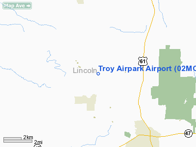
Location & QuickFacts
| FAA Information Effective: | 2008-09-25 |
| Airport Identifier: | 02MO |
| Airport Status: | Operational |
| Longitude/Latitude: | 091-02-00.5090W/39-03-00.1670N
-91.033475/39.050046 (Estimated) |
| Elevation: | 650 ft / 198.12 m (Estimated) |
| Land: | 115 acres |
| From nearest city: | 5 nautical miles NW of Troy, MO |
| Location: | Lincoln County, MO |
| Magnetic Variation: | 02E (1985) |
Owner & Manager
| Ownership: | Privately owned |
| Owner: | Frank D. Baldwin |
| Address: | Rte 3 Box 214
Troy, MO 63379 |
| Phone number: | 573-528-4886 |
| Manager: | Frank D. Baldwin |
| Address: | Rte 3 Box 214
Troy, MO 63379 |
| Phone number: | 573-528-4886 |
Airport Operations and Facilities
| Airport Use: | Private |
| Wind indicator: | Yes |
| Segmented Circle: | No |
| Control Tower: | No |
| Landing fee charge: | No |
| Sectional chart: | Kansas City |
| Region: | ACE - Central |
| Boundary ARTCC: | ZKC - Kansas City |
| Tie-in FSS: | STL - Saint Louis |
| FSS on Airport: | No |
| FSS Toll Free: | 1-800-WX-BRIEF |
Runway Information
Runway 08/26
| Dimension: | 2200 x 50 ft / 670.6 x 15.2 m |
| Surface: | TURF, Good Condition |
| |
Runway 08 |
Runway 26 |
| Traffic Pattern: | Left | Left |
| Obstruction: | 25 ft trees, 200.0 ft from runway | |
|
Radio Navigation Aids
| ID |
Type |
Name |
Ch |
Freq |
Var |
Dist |
| LM | NDB | Oblio | | 338.00 | 00E | 30.1 nm |
| PPQ | NDB | Pittsfield | | 344.00 | 02E | 37.3 nm |
| HAE | NDB | Hannibal | | 411.00 | 03E | 45.0 nm |
| CVM | NDB | Civic Memorial | | 263.00 | 02E | 46.6 nm |
| FTT | NDB | Guthrie | | 317.00 | 03E | 47.1 nm |
| UUV | NDB | Sullivan | | 356.00 | 02E | 49.3 nm |
| CSX | VOR/DME | Cardinal | 111Y | 116.45 | 00E | 36.2 nm |
| FTZ | VORTAC | Foristell | 045X | 110.80 | 05E | 21.6 nm |
| STL | VORTAC | St Louis | 121X | 117.40 | 01E | 28.2 nm |
| UIN | VORTAC | Quincy | 083X | 113.60 | 05E | 49.3 nm |
| SUS | VOT | Spirit Of St Louis | | 112.20 | | 29.4 nm |
| STL | VOT | St Louis Lambert | | 111.00 | | 36.3 nm |
Images and information placed above are from
http://www.airport-data.com/airport/02MO/
We thank them for the data!
| General Info
|
| Country |
United States
|
| State |
MISSOURI
|
| FAA ID |
02MO
|
| Latitude |
39-03-00.167N
|
| Longitude |
091-02-00.509W
|
| Elevation |
650 feet
|
| Near City |
TROY
|
We don't guarantee the information is fresh and accurate. The data may
be wrong or outdated.
For more up-to-date information please refer to other sources.
|
|


