 |
|
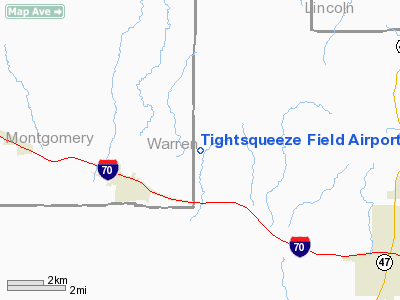
Tightsqueeze Field Airport |
Location & QuickFacts
| FAA Information Effective: | 2008-09-25 |
| Airport Identifier: | 55MO |
| Airport Status: | Operational |
| Longitude/Latitude: | 091-15-36.5550W/38-52-20.1580N
-91.260154/38.872266 (Estimated) |
| Elevation: | 820 ft / 249.94 m (Estimated) |
| Land: | 0 acres |
| From nearest city: | 3 nautical miles NE of Jonesburg, MO |
| Location: | Warren County, MO |
| Magnetic Variation: | 03E (1985) |
Owner & Manager
| Ownership: | Privately owned |
| Owner: | M. Hendershot & D. Tate |
| Address: | Rr 200-1
Jonesburg, MO 63351 |
| Manager: | Don E Tate |
| Address: | Rr 1 Box 200c
Jonesburg, MO 63351 |
| Phone number: | 573-488-5218 |
Airport Operations and Facilities
| Airport Use: | Private |
| Wind indicator: | Yes |
| Segmented Circle: | No |
| Control Tower: | No |
| Landing fee charge: | No |
| Sectional chart: | Kansas City |
| Region: | ACE - Central |
| Boundary ARTCC: | ZKC - Kansas City |
| Tie-in FSS: | STL - Saint Louis |
| FSS on Airport: | No |
| FSS Toll Free: | 1-800-WX-BRIEF |
Runway Information
Runway 18/36
| Dimension: | 2000 x 80 ft / 609.6 x 24.4 m |
| Surface: | TURF, |
| |
Runway 18 |
Runway 36 |
| Traffic Pattern: | Left | Left |
| Obstruction: | | 50 ft trees, 350.0 ft from runway |
|
Radio Navigation Aids
| ID |
Type |
Name |
Ch |
Freq |
Var |
Dist |
| FTT | NDB | Guthrie | | 317.00 | 03E | 34.9 nm |
| LM | NDB | Oblio | | 338.00 | 00E | 37.0 nm |
| UUV | NDB | Sullivan | | 356.00 | 02E | 38.5 nm |
| JE | NDB | Algoa | | 397.00 | 03E | 42.8 nm |
| ONH | NDB | Noah | | 515.00 | 03E | 48.3 nm |
| UBX | NDB | Cuba | | 380.00 | 01E | 49.1 nm |
| CSX | VOR/DME | Cardinal | 111Y | 116.45 | 00E | 42.7 nm |
| COU | VOR/DME | Columbia | 039X | 110.20 | 03E | 45.0 nm |
| VIH | VOR/DME | Vichy | 124X | 117.70 | 06E | 48.0 nm |
| FTZ | VORTAC | Foristell | 045X | 110.80 | 05E | 17.2 nm |
| STL | VORTAC | St Louis | 121X | 117.40 | 01E | 36.4 nm |
| HLV | VORTAC | Hallsville | 089X | 114.20 | 06E | 43.1 nm |
| SUS | VOT | Spirit Of St Louis | | 112.20 | | 31.2 nm |
| STL | VOT | St Louis Lambert | | 111.00 | | 42.7 nm |
| JEF | VOT | Jefferson City | | 112.00 | | 45.0 nm |
Remarks
- PROVIDED THE APPROACH TO EACH RWY IS MAINTAINED FOR A MINIMUM 20:1 GLIDE SLOPE AND THAT THE TRANSITIONAL SURFACE BE MAINTAINED FOR A 7:1 SLOPE.
Images and information placed above are from
http://www.airport-data.com/airport/55MO/
We thank them for the data!
| General Info
|
| Country |
United States
|
| State |
MISSOURI
|
| FAA ID |
55MO
|
| Latitude |
38-52-20.158N
|
| Longitude |
091-15-36.555W
|
| Elevation |
820 feet
|
| Near City |
JONESBURG
|
We don't guarantee the information is fresh and accurate. The data may
be wrong or outdated.
For more up-to-date information please refer to other sources.
|
|


