 |
|
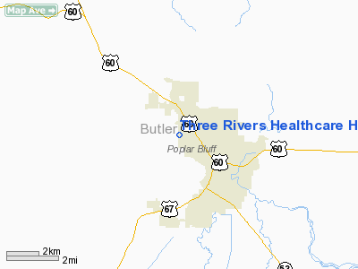
Three Rivers Healthcare Hospital Heliport |
Location & QuickFacts
| FAA Information Effective: | 2008-09-25 |
| Airport Identifier: | MU29 |
| Airport Status: | Operational |
| Longitude/Latitude: | 090-25-54.8100W/36-46-26.3800N
-90.431892/36.773994 (Estimated) |
| Elevation: | 350 ft / 106.68 m (Estimated) |
| Land: | 0 acres |
| From nearest city: | 0 nautical miles N of Poplar Bluff, MO |
| Location: | Butler County, MO |
| Magnetic Variation: | 02E (1985) |
Owner & Manager
| Ownership: | Privately owned |
| Owner: | Tenet |
| Address: |
|
| Manager: | Three Rivers Healthcare |
| Address: | 2620 North Westwood Blvd
Poplar Bluff, MO 63901 |
| Phone number: | 573-785-7721 |
Airport Operations and Facilities
| Airport Use: | Private
MEDICAL. |
| Wind indicator: | Yes |
| Segmented Circle: | Yes |
| Control Tower: | No |
| Landing fee charge: | No |
| Sectional chart: | St Louis |
| Region: | ACE - Central |
| Boundary ARTCC: | ZME - Memphis |
| Tie-in FSS: | STL - Saint Louis |
| FSS on Airport: | No |
| FSS Toll Free: | 1-800-WX-BRIEF |
Runway Information
Helipad H1
| Dimension: | 40 x 40 ft / 12.2 x 12.2 m |
| Surface: | CONC, |
| |
Runway H1 |
Runway |
| Traffic Pattern: | Left | Left |
|
Radio Navigation Aids
| ID |
Type |
Name |
Ch |
Freq |
Var |
Dist |
| FD | NDB | Earli | | 278.00 | 03E | 8.0 nm |
| DXE | NDB | Dexter | | 423.00 | 00E | 23.7 nm |
| TKX | NDB | Kennett | | 358.00 | 00E | 37.9 nm |
| TNZ | NDB | Lawrence County | | 227.00 | 01E | 41.6 nm |
| PGR | NDB | Paragould | | 383.00 | 01E | 42.9 nm |
| CGI | VOR/DME | Cape Girardeau | 076X | 112.90 | 01E | 49.5 nm |
| MAW | VORTAC | Malden | 049X | 111.20 | 03E | 28.3 nm |
| ARG | VORTAC | Walnut Ridge | 092X | 114.50 | 04E | 47.2 nm |
Remarks
- OWNER DOES NOT DESIRE CHARTING.
- PROVIDED THAT APPROACH/DEPARTURE PATHS TO THE LANDING AREA ARE MAINTAINED FOR A MINIMUM 8:1 GLIDE SLOPE AND THAT THE TRANSITIONAL SURFACE BE MAINTAINED FOR A MINIMUM 2:1 SLOPE.
Images and information placed above are from
http://www.airport-data.com/airport/MU29/
We thank them for the data!
| General Info
|
| Country |
United States
|
| State |
MISSOURI
|
| FAA ID |
MU29
|
| Latitude |
36-46-26.380N
|
| Longitude |
090-25-54.810W
|
| Elevation |
350 feet
|
| Near City |
POPLAR BLUFF
|
We don't guarantee the information is fresh and accurate. The data may
be wrong or outdated.
For more up-to-date information please refer to other sources.
|
|


