 |
|
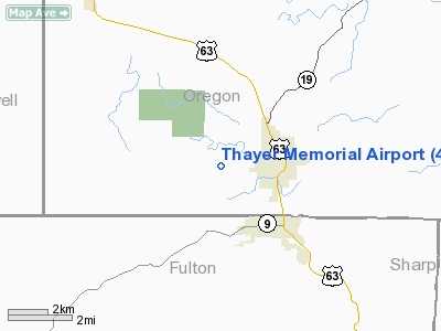
Location & QuickFacts
| FAA Information Effective: | 2008-09-25 |
| Airport Identifier: | 42M |
| Airport Status: | Operational |
| Longitude/Latitude: | 091-34-19.2000W/36-31-20.2000N
-91.572000/36.522278 (Estimated) |
| Elevation: | 790 ft / 240.79 m (Estimated) |
| Land: | 80 acres |
| From nearest city: | 2 nautical miles W of Thayer, MO |
| Location: | Oregon County, MO |
| Magnetic Variation: | 03E (1985) |
Owner & Manager
| Ownership: | Publicly owned |
| Owner: | City Of Thayer |
| Address: | 124 N 2nd Box 76
Thayer, MO 65791 |
| Phone number: | 417-264-3921 |
| Manager: | Bill Martin |
| Address: | Rt 2 Box 2135
Thayer, MO 65791 |
| Phone number: | 417-264-7844 |
Airport Operations and Facilities
| Airport Use: | Open to public |
| Wind indicator: | Yes |
| Segmented Circle: | No |
| Control Tower: | No |
| Lighting Schedule: | DUSK-DAWN
FOR LIRL RY 09/27 KEY 122.9 5 TIMES. |
| Beacon Color: | Clear-Green (lighted land airport)
ROTG BCN OTS INDEFLY. |
| Landing fee charge: | No |
| Sectional chart: | Kansas City |
| Region: | ACE - Central |
| Boundary ARTCC: | ZME - Memphis |
| Tie-in FSS: | COU - Columbia |
| FSS on Airport: | No |
| FSS Toll Free: | 1-800-WX-BRIEF |
| NOTAMs Facility: | COU (NOTAM-d service avaliable) |
Airport Communications
Airport Services
Runway Information
Runway 09/27
| Dimension: | 4200 x 49 ft / 1280.2 x 14.9 m
WIDTH VARIANCE 49-50 FT. |
| Surface: | ASPH, Good Condition |
| Edge Lights: | Non-standard lighting system
RWY 09/27 NSTD LIRL; RY EDGE & THLD LGTS PLACED 15 FT OFF EDGES OF PAVEMENT. RY 27 DSPLCD THLD LGTS NSTD LOC 10' W OF DSPLCD THLD BAR; FIRST 160 FT OF DSPLCD THLD UNLGTD AT NIGHT. |
| |
Runway 09 |
Runway 27 |
| Longitude: | 091-34-44.7600W | 091-33-53.5500W |
| Latitude: | 36-31-22.2400N | 36-31-18.1800N |
| Traffic Pattern: | Left | Right |
| Markings: | Basic, Good Condition | Basic, Good Condition |
| Displaced threshold: | 0.00 ft | 155.00 ft |
| Obstruction: | 55 ft trees, 200.0 ft from runway, 125 ft right of centerline
RWY 09 +1-15 FT BRUSH 0-10 FT FM RY END 75 FT L, +1-3 FT GND 50-95 FT FM RY END 40-125 FT R. | 31 ft trees, 245.0 ft from runway, 85 ft right of centerline, 1:1 slope to clear
RWY 27 APCH SLOPE 12:1 TO DSPLCD THR; +30 FT TREES 510 FT 110 FT L; 17:1 BASED ON DSPLCD THR; +22 FT TREES 360 FT 125 FT R; 16:1 BASED ON DSPLCD THR.
RWY 27 +1 FT FC 20 FT FM RY END L/R; 1-21 FT FC & BRUSH 65-80 FT FM RY END L/R. |
|
Radio Navigation Aids
| ID |
Type |
Name |
Ch |
Freq |
Var |
Dist |
| AJX | NDB | Ash Flat | | 344.00 | 03E | 20.6 nm |
| UNO | NDB | Pomona | | 335.00 | 02E | 26.6 nm |
| MNF | NDB | Mountain View | | 365.00 | 03E | 29.1 nm |
| TNZ | NDB | Lawrence County | | 227.00 | 01E | 36.7 nm |
| VLX | NDB | Wilcox | | 348.00 | 02E | 46.8 nm |
| HUW | VOR/DME | Hutton | 053X | 111.60 | 02E | 26.3 nm |
| FLP | VOR/DME | Flippin | 075X | 112.80 | 03E | 44.9 nm |
| ARG | VORTAC | Walnut Ridge | 092X | 114.50 | 04E | 38.9 nm |
Remarks
- WILD ANIMALS ON RY AT EARLY & LATE HRS.
- NTSD RY SAFETY AREAS BYD EACH RY END & ALONG RY EDGES; RY 09 END INCORRECT TERRAIN GRADIENTS & BRUSH; RY 27 END BRUSH, TREES, FENCE & POSTS. TALL BRUSH ALONG PAVEMENT EDGES.
Images and information placed above are from
http://www.airport-data.com/airport/42M/
We thank them for the data!
| General Info
|
| Country |
United States
|
| State |
MISSOURI
|
| FAA ID |
42M
|
| Latitude |
36-31-00.224N
|
| Longitude |
091-34-00.510W
|
| Elevation |
790 feet
|
| Near City |
THAYER
|
We don't guarantee the information is fresh and accurate. The data may
be wrong or outdated.
For more up-to-date information please refer to other sources.
|
|


