 |
|
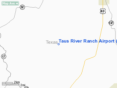
Location & QuickFacts
| FAA Information Effective: | 2008-09-25 |
| Airport Identifier: | MU86 |
| Airport Status: | Operational |
| Longitude/Latitude: | 091-57-27.5600W/37-25-12.1640N
-91.957656/37.420046 (Estimated) |
| Elevation: | 956 ft / 291.39 m (Estimated) |
| Land: | 97 acres |
| From nearest city: | 6 nautical miles N of Houston, MO |
| Location: | Texas County, MO |
| Magnetic Variation: | 03E (1990) |
Owner & Manager
| Ownership: | Privately owned |
| Owner: | James & Mildred Tausworthe |
| Address: | Po Box 253
Houston, MO 65483 |
| Phone number: | 314-674-2107 |
| Manager: | James & Mildred Tausworthe |
| Address: | Po Box 253
Houston, MO 65483 |
| Phone number: | 573-674-2107 |
Airport Operations and Facilities
| Airport Use: | Private |
| Wind indicator: | Yes |
| Segmented Circle: | No |
| Control Tower: | No |
| Sectional chart: | Kansas City |
| Region: | ACE - Central |
| Boundary ARTCC: | ZKC - Kansas City |
| Tie-in FSS: | COU - Columbia |
| FSS on Airport: | No |
| FSS Toll Free: | 1-800-WX-BRIEF |
Runway Information
Runway 17/35
| Dimension: | 1600 x 100 ft / 487.7 x 30.5 m |
| Surface: | TURF, |
| |
Runway 17 |
Runway 35 |
| Traffic Pattern: | Left | Left |
|
Radio Navigation Aids
| ID |
Type |
Name |
Ch |
Freq |
Var |
Dist |
| BHN | NDB | Buckhorn | | 391.00 | 03E | 18.1 nm |
| MNF | NDB | Mountain View | | 365.00 | 03E | 28.2 nm |
| UNO | NDB | Pomona | | 335.00 | 02E | 32.7 nm |
| IEB | NDB | Lebanon | | 414.00 | 03E | 34.6 nm |
| AOV | NDB | Bilmart | | 341.00 | 02E | 43.8 nm |
| UBX | NDB | Cuba | | 380.00 | 01E | 46.3 nm |
| AIZ | NDB | Kaiser | | 377.00 | 05E | 49.5 nm |
| TBN | VOR | Forney | | 110.00 | 03E | 21.2 nm |
| HUW | VOR/DME | Hutton | 053X | 111.60 | 02E | 33.1 nm |
| VIH | VOR/DME | Vichy | 124X | 117.70 | 06E | 45.7 nm |
| SHY | VOR/DME | Sunshine | 021X | 108.40 | 05E | 48.3 nm |
| MAP | VORTAC | Maples | 081X | 113.40 | 06E | 13.1 nm |
Remarks
- PROVIDED APCHS ARE MAINTAINED FOR A 20:1 SLOPE & TRANSITIONAL SURFACES FOR A 7:1 SLOPE.
Images and information placed above are from
http://www.airport-data.com/airport/MU86/
We thank them for the data!
| General Info
|
| Country |
United States
|
| State |
MISSOURI
|
| FAA ID |
MU86
|
| Latitude |
37-25-12.164N
|
| Longitude |
091-57-27.560W
|
| Elevation |
956 feet
|
| Near City |
HOUSTON
|
We don't guarantee the information is fresh and accurate. The data may
be wrong or outdated.
For more up-to-date information please refer to other sources.
|
|


