 |
|
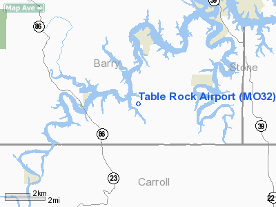
Location & QuickFacts
| FAA Information Effective: | 2008-09-25 |
| Airport Identifier: | MO32 |
| Airport Status: | Operational |
| Longitude/Latitude: | 093-40-36.6920W/36-31-43.2450N
-93.676859/36.528679 (Estimated) |
| Elevation: | 1053 ft / 320.95 m (Surveyed) |
| Land: | 0 acres |
| From nearest city: | 1 nautical miles W of Golden, MO |
| Location: | Barry County, MO |
| Magnetic Variation: | 04E (1985) |
Owner & Manager
| Ownership: | Privately owned |
| Owner: | Al Thorton |
| Address: | Hrc-1 Box 396
Lampe, MO 65681 |
| Phone number: | 417-862-1981 |
| Manager: | Al Thornton |
| Address: |
417-862-1981 |
| Phone number: | 417-271-3403 |
Airport Operations and Facilities
| Airport Use: | Private |
| Wind indicator: | Yes |
| Segmented Circle: | No |
| Control Tower: | No |
| Landing fee charge: | No |
| Sectional chart: | Kansas City |
| Region: | ACE - Central |
| Boundary ARTCC: | ZME - Memphis |
| Tie-in FSS: | COU - Columbia |
| FSS on Airport: | No |
| FSS Toll Free: | 1-800-WX-BRIEF |
Airport Services
| Fuel available: | 100LL |
| Airframe Repair: | MAJOR |
| Power Plant Repair: | MAJOR |
| Bottled Oxygen: | NONE |
| Bulk Oxygen: | NONE |
Runway Information
Runway 09/27
| Dimension: | 2325 x 100 ft / 708.7 x 30.5 m |
| Surface: | CONC, |
| |
Runway 09 |
Runway 27 |
| Traffic Pattern: | Right | Right |
| Runway End Identifier: | No | No |
| Centerline Lights: | No | No |
| Touchdown Lights: | No | No |
| Obstruction: | 10 ft road | 12 ft road, 0.0 ft from runway |
|
Radio Navigation Aids
| ID |
Type |
Name |
Ch |
Freq |
Var |
Dist |
| PLK | NDB | Point Lookout/dcmsnd | | 204.00 | 03E | 22.4 nm |
| SLG | NDB | Siloam Springs | | 284.00 | 04E | 44.3 nm |
| ILJ | NDB | Willard | | 254.00 | 03E | 47.7 nm |
| HRO | VOR/DME | Harrison | 072X | 112.50 | 04E | 25.7 nm |
| DAK | VOR/DME | Drake | 025X | 108.80 | 07E | 38.6 nm |
| EOS | VOR/DME | Neosho | 120X | 117.30 | 07E | 41.2 nm |
| RZC | VORTAC | Razorback | 111X | 116.40 | 04E | 27.4 nm |
| DGD | VORTAC | Dogwood | 031X | 109.40 | 06E | 48.7 nm |
Remarks
- GRAVEL ROAD & HGRS LOCATED IN PRIMARY SURFACE AREA.
- ESTAB PRIOR TO 1959.
Images and information placed above are from
http://www.airport-data.com/airport/MO32/
We thank them for the data!
| General Info
|
| Country |
United States
|
| State |
MISSOURI
|
| FAA ID |
MO32
|
| Latitude |
36-31-43.245N
|
| Longitude |
093-40-36.692W
|
| Elevation |
1053 feet
|
| Near City |
GOLDEN
|
We don't guarantee the information is fresh and accurate. The data may
be wrong or outdated.
For more up-to-date information please refer to other sources.
|
|


