 |
|
Location & QuickFacts
| FAA Information Effective: | 2008-09-25 |
| Airport Identifier: | 26MO |
| Airport Status: | Operational |
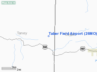
| Longitude/Latitude: | 092-47-04.6100W/36-36-48.2200N
-92.784614/36.613394 (Estimated) |
| Elevation: | 985 ft / 300.23 m (Estimated) |
| Land: | 9 acres |
| From nearest city: | 6 nautical miles NW of Theodosia, MO |
| Location: | Taney County, MO |
| Magnetic Variation: | 02E (2000) |
Owner & Manager
| Ownership: | Privately owned |
| Owner: | Kendell Taber |
| Address: | Hcr 74 Box 822
Theodosia, MO 65761 |
| Phone number: | 417-785-4477 |
| Manager: | Kendall Taber |
| Address: | Hcr 74 Box 822
Theodosia, MO 65761 |
| Phone number: | 417-785-4477 |
Airport Operations and Facilities
| Airport Use: | Private |
| Wind indicator: | Yes |
| Segmented Circle: | No |
| Control Tower: | No |
| Sectional chart: | Kansas City |
| Region: | ACE - Central |
| Boundary ARTCC: | ZME - Memphis |
| Tie-in FSS: | COU - Columbia |
| FSS Toll Free: | 1-800-WX-BRIEF |
Runway Information
Runway 14/32
| Dimension: | 1500 x 90 ft / 457.2 x 27.4 m |
| Surface: | TURF, |
| |
Runway 14 |
Runway 32 |
| Traffic Pattern: | Left | Left |
| Obstruction: | 30 ft trees, 150.0 ft from runway | |
|
Radio Navigation Aids
| ID |
Type |
Name |
Ch |
Freq |
Var |
Dist |
| PLK | NDB | Point Lookout/dcmsnd | | 204.00 | 03E | 21.5 nm |
| AOV | NDB | Bilmart | | 341.00 | 02E | 22.0 nm |
| UNO | NDB | Pomona | | 335.00 | 02E | 45.4 nm |
| FLP | VOR/DME | Flippin | 075X | 112.80 | 03E | 24.6 nm |
| HRO | VOR/DME | Harrison | 072X | 112.50 | 04E | 27.3 nm |
| HUW | VOR/DME | Hutton | 053X | 111.60 | 02E | 45.3 nm |
| DGD | VORTAC | Dogwood | 031X | 109.40 | 06E | 25.0 nm |
Remarks
- PRVDD A CLEAR APCH TO EA RY FOR A 20:1 GLIDE SLOPE & A CLEAR TRANSITIONAL SFC FOR A 7:1 SLOPE.
Images and information placed above are from
http://www.airport-data.com/airport/26MO/
We thank them for the data!
| General Info
|
| Country |
United States
|
| State |
MISSOURI
|
| FAA ID |
26MO
|
| Latitude |
36-36-48.220N
|
| Longitude |
092-47-04.610W
|
| Elevation |
985 feet
|
| Near City |
THEODOSIA
|
We don't guarantee the information is fresh and accurate. The data may
be wrong or outdated.
For more up-to-date information please refer to other sources.
|
|


