 |
|
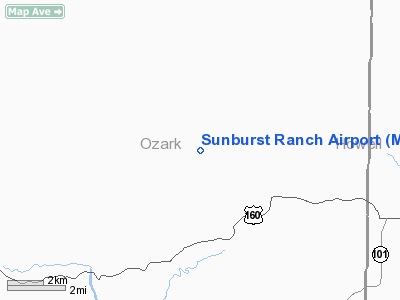
Location & QuickFacts
| FAA Information Effective: | 2008-09-25 |
| Airport Identifier: | MU48 |
| Airport Status: | Operational |
| Longitude/Latitude: | 092-13-13.5670W/36-38-54.2210N
-92.220435/36.648395 (Estimated) |
| Elevation: | 820 ft / 249.94 m (Estimated) |
| Land: | 368 acres |
| From nearest city: | 10 nautical miles NE of Gainesville, MO |
| Location: | Ozark County, MO |
| Magnetic Variation: | 04E (1985) |
Owner & Manager
| Ownership: | Privately owned |
| Owner: | Albert S. Eckilson |
| Address: | Route B Box 25
Caulfield, MO 65626 |
| Manager: | Larry Lindemann |
| Address: | Star Rt
Caulfield, MO 65626 |
| Phone number: | 417-284-3443 |
Airport Operations and Facilities
| Airport Use: | Private |
| Wind indicator: | Yes |
| Segmented Circle: | No |
| Control Tower: | No |
| Landing fee charge: | No |
| Sectional chart: | Kansas City |
| Region: | ACE - Central |
| Boundary ARTCC: | ZME - Memphis |
| Tie-in FSS: | COU - Columbia |
| FSS on Airport: | No |
| FSS Toll Free: | 1-800-WX-BRIEF |
Airport Services
Runway Information
Runway 09/27
| Dimension: | 3800 x 150 ft / 1158.2 x 45.7 m |
| Surface: | TURF, Good Condition |
| |
Runway 09 |
Runway 27 |
| Traffic Pattern: | Left | Left |
| Displaced threshold: | 0.00 ft | 800.00 ft |
| Obstruction: | | 50 ft trees, 50.0 ft from runway, 20:1 slope to clear |
|
Radio Navigation Aids
| ID |
Type |
Name |
Ch |
Freq |
Var |
Dist |
| UNO | NDB | Pomona | | 335.00 | 02E | 20.7 nm |
| AOV | NDB | Bilmart | | 341.00 | 02E | 29.3 nm |
| MNF | NDB | Mountain View | | 365.00 | 03E | 32.1 nm |
| AJX | NDB | Ash Flat | | 344.00 | 03E | 40.9 nm |
| VLX | NDB | Wilcox | | 348.00 | 02E | 47.3 nm |
| PLK | NDB | Point Lookout/dcmsnd | | 204.00 | 03E | 48.7 nm |
| HUW | VOR/DME | Hutton | 053X | 111.60 | 02E | 20.4 nm |
| FLP | VOR/DME | Flippin | 075X | 112.80 | 03E | 23.9 nm |
| DGD | VORTAC | Dogwood | 031X | 109.40 | 06E | 38.8 nm |
Remarks
- PRVDD THE TREES IN THE APCH TO RWY 27 ARE REMOVED OR THE RWY DSPLCD A SUFFICIENT DISTANCE SO THAT THE TREES NO LONGER PRESENT A POSSIBLE UNSAFE COND.
Images and information placed above are from
http://www.airport-data.com/airport/MU48/
We thank them for the data!
| General Info
|
| Country |
United States
|
| State |
MISSOURI
|
| FAA ID |
MU48
|
| Latitude |
36-38-54.221N
|
| Longitude |
092-13-13.567W
|
| Elevation |
820 feet
|
| Near City |
GAINESVILLE
|
We don't guarantee the information is fresh and accurate. The data may
be wrong or outdated.
For more up-to-date information please refer to other sources.
|
|


