 |
|
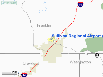
Sullivan Regional Airport |
Location & QuickFacts
| FAA Information Effective: | 2008-09-25 |
| Airport Identifier: | UUV |
| Airport Status: | Operational |
| Longitude/Latitude: | 091-09-51.4000W/38-14-00.5000N
-91.164278/38.233472 (Estimated) |
| Elevation: | 933 ft / 284.38 m (Surveyed) |
| Land: | 332 acres |
| From nearest city: | 1 nautical miles N of Sullivan, MO |
| Location: | Franklin County, MO |
| Magnetic Variation: | 02E (1995) |
Owner & Manager
| Ownership: | Publicly owned |
| Owner: | City Of Sullivan |
| Address: | 210 W. Washington St
Sullivan, MO 63080 |
| Phone number: | 573-468-4612 |
| Manager: | Larry Cuneio |
| Address: | 345 N. Church
Sullivan, MO 63080 |
| Phone number: | 573-468-2631 |
Airport Operations and Facilities
| Airport Use: | Open to public |
| Wind indicator: | Yes |
| Segmented Circle: | Yes |
| Control Tower: | No |
| Lighting Schedule: | DUSK-DAWN
MIRL RY 06/24 PRESET ON LOW INTST; TO INCR INTST ACTVT - CTAF. PAPI ON 24 HRS. |
| Beacon Color: | Clear-Green (lighted land airport) |
| Sectional chart: | Kansas City |
| Region: | ACE - Central |
| Boundary ARTCC: | ZKC - Kansas City |
| Tie-in FSS: | STL - Saint Louis |
| FSS on Airport: | No |
| FSS Toll Free: | 1-800-WX-BRIEF |
| NOTAMs Facility: | STL (NOTAM-d service avaliable) |
| Federal Agreements: | NGY |
Airport Communications
| CTAF: | 122.700 |
| Unicom: | 122.700 |
Airport Services
| Fuel available: | 100LLA |
| Airframe Repair: | MAJOR |
| Power Plant Repair: | MAJOR |
Runway Information
Runway 06/24
| Dimension: | 4500 x 75 ft / 1371.6 x 22.9 m |
| Surface: | CONC, Good Condition |
| Weight Limit: | Single wheel: 12500 lbs. |
| Edge Lights: | Medium |
| |
Runway 06 |
Runway 24 |
| Longitude: | 091-10-15.9007W | 091-09-26.9504W |
| Latitude: | 38-13-49.4856N | 38-14-11.5737N |
| Elevation: | 933.00 ft | 924.00 ft |
| Alignment: | 60 | 127 |
| Traffic Pattern: | Left | Right |
| Markings: | Non-precision instrument, Good Condition | Non-precision instrument, Good Condition |
| Crossing Height: | 28.00 ft | 24.00 ft |
| VASI: | 2-light PAPI on left side | 2-light PAPI on left side |
| Visual Glide Angle: | 4.00° | 3.00° |
| Obstruction: | 53 ft tree, 943.0 ft from runway, 288 ft right of centerline, 14:1 slope to clear | 26 ft tree, 527.0 ft from runway, 246 ft right of centerline, 12:1 slope to clear |
|
Radio Navigation Aids
| ID |
Type |
Name |
Ch |
Freq |
Var |
Dist |
| UUV | NDB | Sullivan | | 356.00 | 02E | 0.1 nm |
| UBX | NDB | Cuba | | 380.00 | 01E | 16.0 nm |
| FES | NDB | Festus | | 269.00 | 01E | 36.7 nm |
| PRI | NDB | Perrine | | 367.00 | 02E | 44.8 nm |
| JE | NDB | Algoa | | 397.00 | 03E | 46.8 nm |
| LM | NDB | Oblio | | 338.00 | 00E | 47.0 nm |
| VIH | VOR/DME | Vichy | 124X | 117.70 | 06E | 26.1 nm |
| CSX | VOR/DME | Cardinal | 111Y | 116.45 | 00E | 49.0 nm |
| FTZ | VORTAC | Foristell | 045X | 110.80 | 05E | 29.2 nm |
| MAP | VORTAC | Maples | 081X | 113.40 | 06E | 48.7 nm |
| STL | VORTAC | St Louis | 121X | 117.40 | 01E | 49.5 nm |
| SUS | VOT | Spirit Of St Louis | | 112.20 | | 35.3 nm |
| STL | VOT | St Louis Lambert | | 111.00 | | 48.8 nm |
Remarks
- PAJA & ULTRALIGHTS ON & INVOF ARPT.
- DEER ON & INVOF ARPT.
- PRVDD EXISTING SULLIVAN MEMORIAL ARPT IS CLSD UPON ACTIVATION OF SULLIVAN REGIONAL ARPT.
Images and information placed above are from
http://www.airport-data.com/airport/UUV/
We thank them for the data!
| General Info
|
| Country |
United States
|
| State |
MISSOURI
|
| FAA ID |
UUV
|
| Latitude |
38-14-00.350N
|
| Longitude |
091-09-51.600W
|
| Elevation |
933 feet
|
| Near City |
SULLIVAN
|
We don't guarantee the information is fresh and accurate. The data may
be wrong or outdated.
For more up-to-date information please refer to other sources.
|
|


