 |
|
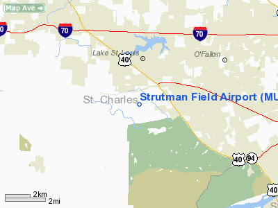
Location & QuickFacts
| FAA Information Effective: | 2008-09-25 |
| Airport Identifier: | MU42 |
| Airport Status: | Operational |
| Longitude/Latitude: | 090-47-13.4660W/38-45-10.1880N
-90.787074/38.752830 (Estimated) |
| Elevation: | 620 ft / 188.98 m (Estimated) |
| Land: | 20 acres |
| From nearest city: | 4 nautical miles SE of Wentzville, MO |
| Location: | St Charles County, MO |
| Magnetic Variation: | 02E (1985) |
Owner & Manager
| Ownership: | Privately owned |
| Owner: | John R Strutman |
| Address: | 2449 Sommers Road
Ofallon, MO 63366 |
| Phone number: | 573-625-2160 |
| Manager: | John R Strutman |
| Address: | 2449 Sommers Road
O' Fallon, MO 63366 |
| Phone number: | 573-625-2160 |
Airport Operations and Facilities
| Airport Use: | Private |
| Wind indicator: | Yes |
| Segmented Circle: | Yes |
| Control Tower: | No |
| Sectional chart: | Kansas City |
| Region: | ACE - Central |
| Boundary ARTCC: | ZKC - Kansas City |
| Tie-in FSS: | STL - Saint Louis |
| FSS Toll Free: | 1-800-WX-BRIEF |
Runway Information
Runway 09/27
| Dimension: | 1900 x 50 ft / 579.1 x 15.2 m |
| Surface: | TURF, |
| |
Runway 09 |
Runway 27 |
| Traffic Pattern: | Left | Left |
| Obstruction: | 25 ft pline, 50.0 ft from runway | 3 ft fence |
|
Radio Navigation Aids
| ID |
Type |
Name |
Ch |
Freq |
Var |
Dist |
| LM | NDB | Oblio | | 338.00 | 00E | 14.9 nm |
| CVM | NDB | Civic Memorial | | 263.00 | 02E | 35.2 nm |
| UUV | NDB | Sullivan | | 356.00 | 02E | 35.8 nm |
| FES | NDB | Festus | | 269.00 | 01E | 38.4 nm |
| SKE | TACAN | Scott | 059X | | 02E | 45.6 nm |
| CSX | VOR/DME | Cardinal | 111Y | 116.45 | 00E | 20.0 nm |
| FTZ | VORTAC | Foristell | 045X | 110.80 | 05E | 9.3 nm |
| STL | VORTAC | St Louis | 121X | 117.40 | 01E | 15.7 nm |
| TOY | VORTAC | Troy | 107X | 116.00 | 04E | 40.7 nm |
| SUS | VOT | Spirit Of St Louis | | 112.20 | | 8.3 nm |
| STL | VOT | St Louis Lambert | | 111.00 | | 19.9 nm |
Remarks
- PROVIDED APCHS ARE MAINT FOR A 20:1 GLIDE SLOPE AND TRSNL SFCS FOR A 7:1 SLOPE; AVOID PHELAN'S FIELD TFC PAT EAST OF STRUTMAN FIELD.
Images and information placed above are from
http://www.airport-data.com/airport/MU42/
We thank them for the data!
| General Info
|
| Country |
United States
|
| State |
MISSOURI
|
| FAA ID |
MU42
|
| Latitude |
38-45-10.188N
|
| Longitude |
090-47-13.466W
|
| Elevation |
620 feet
|
| Near City |
WENTZVILLE
|
We don't guarantee the information is fresh and accurate. The data may
be wrong or outdated.
For more up-to-date information please refer to other sources.
|
|


