 |
|
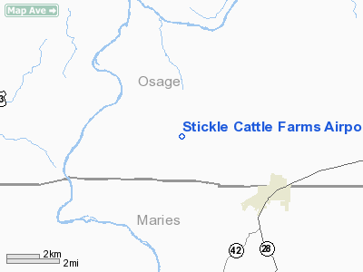
Stickle Cattle Farms Airport |
Location & QuickFacts
| FAA Information Effective: | 2008-09-25 |
| Airport Identifier: | MO78 |
| Airport Status: | Operational |
| Longitude/Latitude: | 091-47-00.6000W/38-19-00.1600N
-91.783500/38.316711 (Estimated) |
| Elevation: | 700 ft / 213.36 m (Estimated) |
| Land: | 0 acres |
| From nearest city: | 3 nautical miles NW of Belle, MO |
| Location: | Osage County, MO |
| Magnetic Variation: | 03E (1985) |
Owner & Manager
| Ownership: | Privately owned |
| Owner: | A. W. Stickle |
| Address: | 2236 Croydon Walk
Frontenac, MO 63131 |
| Phone number: | 314-432-8095 |
| Address: |
|
Airport Operations and Facilities
| Airport Use: | Private |
| Wind indicator: | No |
| Segmented Circle: | No |
| Control Tower: | No |
| Landing fee charge: | No |
| Sectional chart: | Kansas City |
| Region: | ACE - Central |
| Boundary ARTCC: | ZKC - Kansas City |
| Tie-in FSS: | COU - Columbia |
| FSS on Airport: | No |
| FSS Toll Free: | 1-800-WX-BRIEF |
Airport Services
| Airframe Repair: | NONE |
| Power Plant Repair: | NONE |
Runway Information
Runway E/W
| Dimension: | 3000 x 80 ft / 914.4 x 24.4 m |
| Surface: | TURF, |
| |
Runway E |
Runway W |
| Traffic Pattern: | Left | Left |
|
Radio Navigation Aids
| ID |
Type |
Name |
Ch |
Freq |
Var |
Dist |
| JE | NDB | Algoa | | 397.00 | 03E | 19.4 nm |
| UBX | NDB | Cuba | | 380.00 | 01E | 22.6 nm |
| ONH | NDB | Noah | | 515.00 | 03E | 29.0 nm |
| UUV | NDB | Sullivan | | 356.00 | 02E | 29.6 nm |
| FTT | NDB | Guthrie | | 317.00 | 03E | 33.3 nm |
| AIZ | NDB | Kaiser | | 377.00 | 05E | 38.7 nm |
| BHN | NDB | Buckhorn | | 391.00 | 03E | 40.2 nm |
| TBN | VOR | Forney | | 110.00 | 03E | 38.4 nm |
| VIH | VOR/DME | Vichy | 124X | 117.70 | 06E | 10.4 nm |
| COU | VOR/DME | Columbia | 039X | 110.20 | 03E | 36.1 nm |
| SHY | VOR/DME | Sunshine | 021X | 108.40 | 05E | 42.1 nm |
| MAP | VORTAC | Maples | 081X | 113.40 | 06E | 43.6 nm |
| FTZ | VORTAC | Foristell | 045X | 110.80 | 05E | 44.4 nm |
| JEF | VOT | Jefferson City | | 112.00 | | 23.7 nm |
Images and information placed above are from
http://www.airport-data.com/airport/MO78/
We thank them for the data!
| General Info
|
| Country |
United States
|
| State |
MISSOURI
|
| FAA ID |
MO78
|
| Latitude |
38-19-00.160N
|
| Longitude |
091-47-00.600W
|
| Elevation |
700 feet
|
| Near City |
BELLE
|
We don't guarantee the information is fresh and accurate. The data may
be wrong or outdated.
For more up-to-date information please refer to other sources.
|
|


