 |
|
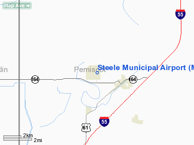
Location & QuickFacts
| FAA Information Effective: | 2008-09-25 |
| Airport Identifier: | M12 |
| Airport Status: | Operational |
| Longitude/Latitude: | 089-51-34.1000W/36-05-44.2000N
-89.859472/36.095611 (Estimated) |
| Elevation: | 258 ft / 78.64 m (Surveyed) |
| Land: | 620 acres |
| From nearest city: | 2 nautical miles NW of Steele, MO |
| Location: | Pemiscot County, MO |
| Magnetic Variation: | 02E (1985) |
Owner & Manager
| Ownership: | Publicly owned |
| Owner: | City Of Steele |
| Address: | 115 S Walnut St
Steele, MO 63877 |
| Phone number: | 573-695-3690 |
| Manager: | Mike Lee |
| Address: | 1051 Administration Drive
Steele, MO 63877 |
| Phone number: | 573-695-3842 |
Airport Operations and Facilities
| Airport Use: | Open to public |
| Wind indicator: | Yes |
| Segmented Circle: | Yes
NSTD SEG CIRCLE - NO SEGMENTATION; SMALL CIRCLE. |
| Control Tower: | No |
| Lighting Schedule: | DUSK-DAWN
ACTVT MIRL RY 18/36 - CTAF. |
| Beacon Color: | Clear-Green (lighted land airport) |
| Landing fee charge: | No |
| Sectional chart: | St Louis |
| Region: | ACE - Central |
| Boundary ARTCC: | ZME - Memphis |
| Tie-in FSS: | STL - Saint Louis |
| FSS on Airport: | No |
| FSS Toll Free: | 1-800-WX-BRIEF |
| NOTAMs Facility: | STL (NOTAM-d service avaliable) |
| Federal Agreements: | R |
Airport Communications
| CTAF: | 122.800 |
| Unicom: | 122.800 |
Airport Services
Runway Information
Runway 18/36
| Dimension: | 3985 x 60 ft / 1214.6 x 18.3 m |
| Surface: | ASPH, Good Condition |
| Edge Lights: | Medium |
| |
Runway 18 |
Runway 36 |
| Longitude: | 089-51-34.1100W | 089-51-34.0800W |
| Latitude: | 36-06-03.9100N | 36-05-24.5100N |
| Traffic Pattern: | Left | Left |
| Markings: | Basic, Good Condition | Basic, Good Condition |
| Obstruction: | 15 ft road, 675.0 ft from runway, 31:1 slope to clear | 15 ft road, 315.0 ft from runway, 7:1 slope to clear |
|
Radio Navigation Aids
| ID |
Type |
Name |
Ch |
Freq |
Var |
Dist |
| IUI | NDB | Hicks | | 350.00 | 01E | 9.6 nm |
| TKX | NDB | Kennett | | 358.00 | 00E | 11.8 nm |
| MXA | NDB | Manila | | 282.00 | 01E | 19.0 nm |
| DNT | NDB | Nally Dunston | | 343.00 | 01W | 22.9 nm |
| BPW | NDB | Osceola | | 239.00 | 02E | 25.3 nm |
| PGR | NDB | Paragould | | 383.00 | 01E | 31.7 nm |
| COO | NDB | Covington | | 326.00 | 02E | 33.2 nm |
| FD | NDB | Earli | | 278.00 | 03E | 41.3 nm |
| DXE | NDB | Dexter | | 423.00 | 00E | 41.8 nm |
| UC | NDB | Obion | | 212.00 | 00E | 43.7 nm |
| MIG | NDB | Millington | | 232.00 | 04E | 49.2 nm |
| TGC | NDB | Gibson | | 378.00 | 01E | 50.0 nm |
| GOJ | VOR | Gosnell | | 111.80 | 01E | 9.6 nm |
| JBR | VOR/DME | Jonesboro | 023X | 108.60 | 02E | 37.9 nm |
| DYR | VORTAC | Dyersburg | 115X | 116.80 | 03E | 26.7 nm |
| MAW | VORTAC | Malden | 049X | 111.20 | 03E | 27.7 nm |
Remarks
- CROP DUSTING ACFT ON & INVOF ARPT.
- PARALLEL TWY CLSD.
- ALL TWYS CLSD EXCEPT MAIN TWY TO RAMP.
- ESTABD PRIOR OCT 1959.
Images and information placed above are from
http://www.airport-data.com/airport/M12/
We thank them for the data!
| General Info
|
| Country |
United States
|
| State |
MISSOURI
|
| FAA ID |
M12
|
| Latitude |
36-05-45.251N
|
| Longitude |
089-51-48.308W
|
| Elevation |
259 feet
|
| Near City |
STEELE
|
We don't guarantee the information is fresh and accurate. The data may
be wrong or outdated.
For more up-to-date information please refer to other sources.
|
|


