 |
|
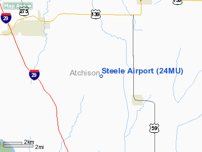
Location & QuickFacts
| FAA Information Effective: | 2008-09-25 |
| Airport Identifier: | 24MU |
| Airport Status: | Operational |
| Longitude/Latitude: | 095-26-18.9330W/40-21-45.9960N
-95.438592/40.362777 (Estimated) |
| Elevation: | 1077 ft / 328.27 m (Surveyed) |
| Land: | 0 acres |
| From nearest city: | 3 nautical miles NW of Fairfax, MO |
| Location: | Atchison County, MO |
| Magnetic Variation: | 05E (1985) |
Owner & Manager
| Ownership: | Privately owned |
| Address: |
|
| Manager: | James E. Steele |
| Address: | Route 2
Fairfax, MO 64446 |
| Phone number: | 816-686-2657 |
Airport Operations and Facilities
| Airport Use: | Private |
| Wind indicator: | No |
| Segmented Circle: | No |
| Control Tower: | No |
| Landing fee charge: | No |
| Sectional chart: | Omaha |
| Region: | ACE - Central |
| Boundary ARTCC: | ZMP - Minneapolis |
| Tie-in FSS: | COU - Columbia |
| FSS on Airport: | No |
| FSS Toll Free: | 1-800-WX-BRIEF |
Airport Services
| Airframe Repair: | NONE |
| Power Plant Repair: | NONE |
Runway Information
Runway NW/SE
| Dimension: | 1500 x 50 ft / 457.2 x 15.2 m |
| Surface: | TURF, |
| |
Runway NW |
Runway SE |
| Traffic Pattern: | Left | Left |
|
Radio Navigation Aids
| ID |
Type |
Name |
Ch |
Freq |
Var |
Dist |
| AYB | NDB | Auburn | | 430.00 | 05E | 17.3 nm |
| FNB | NDB | Brenner | | 404.00 | 05E | 18.5 nm |
| SDA | NDB | Shenandoah | | 411.00 | 05E | 23.4 nm |
| EVU | NDB | Emville | | 317.00 | 05E | 24.0 nm |
| AFK | NDB | Nebraska City | | 347.00 | 05E | 24.2 nm |
| ICL | NDB | Clarinda | | 353.00 | 04E | 28.8 nm |
| AZN | NDB | Amazon | | 233.00 | 06E | 37.7 nm |
| RDK | NDB | Red Oak | | 230.00 | 04E | 40.2 nm |
| PMV | NDB | Plattsmouth | | 329.00 | 06E | 41.1 nm |
| CRZ | NDB | Corning | | 278.00 | 04E | 49.2 nm |
| OFF | TACAN | Offutt | 054X | | 05E | 50.0 nm |
| RBA | VOR/DME | Robinson | 019X | 108.20 | 04E | 30.8 nm |
| STJ | VORTAC | St Joseph | 102X | 115.50 | 08E | 33.8 nm |
| PWE | VORTAC | Pawnee City | 071X | 112.40 | 05E | 36.5 nm |
Remarks
- WIRES NORTH
- PRVDD APCH TO EACH RWY IS MAINTD FOR A MIN 20:1 GLIDE SLOPE AND TRANSITIONAL SFC MAINTD FOR A 7:1 SLOPE.
Images and information placed above are from
http://www.airport-data.com/airport/24MU/
We thank them for the data!
| General Info
|
| Country |
United States
|
| State |
MISSOURI
|
| FAA ID |
24MU
|
| Latitude |
40-21-45.996N
|
| Longitude |
095-26-18.933W
|
| Elevation |
1077 feet
|
| Near City |
FAIRFAX
|
We don't guarantee the information is fresh and accurate. The data may
be wrong or outdated.
For more up-to-date information please refer to other sources.
|
|


