 |
|
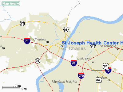
St Joseph Health Center Heliport (MO44) |
Location & QuickFacts
| FAA Information Effective: | 2008-09-25 |
| Airport Identifier: | MO44 |
| Airport Status: | Operational |
| Longitude/Latitude: | 090-29-00.4270W/38-47-00.1830N
-90.483452/38.783384 (Estimated) |
| Elevation: | 530 ft / 161.54 m (Estimated) |
| Land: | 0 acres |
| From nearest city: | 1 nautical miles N of St Charles, MO |
| Location: | St Charles County, MO |
| Magnetic Variation: | 02E (1985) |
Owner & Manager
| Ownership: | Privately owned |
| Owner: | St Joseph Health Center |
| Address: | 300 First Capitol Drive
St Charles, MO 63301 |
| Phone number: | 573-947-5076 |
| Manager: | Kevin F. Kast |
| Address: | 300 First Capitol Driveq
St Charles, MO 63301 |
| Phone number: | 573-947-5076 |
Airport Operations and Facilities
| Airport Use: | Private
MEDICAL. |
| Wind indicator: | Yes |
| Segmented Circle: | No |
| Control Tower: | No |
| Lighting Schedule: | PHONE REQ
FOR FLOOD LGTS CALL 314-947-5076. |
| Sectional chart: | St Louis |
| Region: | ACE - Central |
| Boundary ARTCC: | ZKC - Kansas City |
| Tie-in FSS: | STL - Saint Louis |
| FSS Toll Free: | 1-800-WX-BRIEF |
Runway Information
Helipad H1
| Dimension: | 40 x 40 ft / 12.2 x 12.2 m |
| Surface: | ASPH, |
| |
Runway H1 |
Runway |
| Traffic Pattern: | Left | Left |
|
Radio Navigation Aids
| ID |
Type |
Name |
Ch |
Freq |
Var |
Dist |
| LM | NDB | Oblio | | 338.00 | 00E | 1.1 nm |
| CVM | NDB | Civic Memorial | | 263.00 | 02E | 21.0 nm |
| FES | NDB | Festus | | 269.00 | 01E | 35.6 nm |
| BL | NDB | Belleville | | 362.00 | 02E | 39.1 nm |
| LTD | NDB | Litchfield | | 371.00 | 01E | 44.2 nm |
| UUV | NDB | Sullivan | | 356.00 | 02E | 45.9 nm |
| SKE | TACAN | Scott | 059X | | 02E | 32.9 nm |
| CSX | VOR/DME | Cardinal | 111Y | 116.45 | 00E | 6.0 nm |
| STL | VORTAC | St Louis | 121X | 117.40 | 01E | 4.6 nm |
| FTZ | VORTAC | Foristell | 045X | 110.80 | 05E | 23.5 nm |
| TOY | VORTAC | Troy | 107X | 116.00 | 04E | 26.6 nm |
| STL | VOT | St Louis Lambert | | 111.00 | | 6.1 nm |
| SUS | VOT | Spirit Of St Louis | | 112.20 | | 10.7 nm |
Remarks
- PRVDD THAT ONLY THE WEST AND NORTHWEST INGRESS/EGRESS ROUTES UTILIZED.
Images and information placed above are from
http://www.airport-data.com/airport/MO44/
We thank them for the data!
| General Info
|
| Country |
United States
|
| State |
MISSOURI
|
| FAA ID |
MO44
|
| Latitude |
38-47-00.183N
|
| Longitude |
090-29-00.427W
|
| Elevation |
530 feet
|
| Near City |
ST CHARLES
|
We don't guarantee the information is fresh and accurate. The data may
be wrong or outdated.
For more up-to-date information please refer to other sources.
|
|


