 |
|
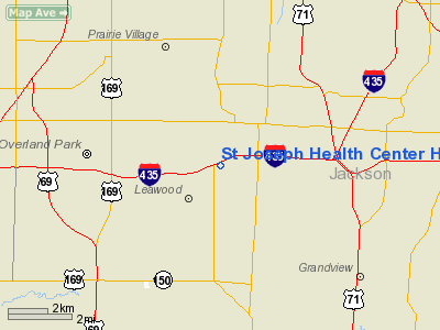
St Joseph Health Center Heliport (MO21) |
Location & QuickFacts
| FAA Information Effective: | 2008-09-25 |
| Airport Identifier: | MO21 |
| Airport Status: | Operational |
| Longitude/Latitude: | 094-36-15.8420W/38-56-10.0230N
-94.604401/38.936117 (Estimated) |
| Elevation: | 900 ft / 274.32 m (Estimated) |
| Land: | 0 acres |
| From nearest city: | 0 nautical miles N of Kansas City, MO |
| Location: | Jackson County, MO |
| Magnetic Variation: | 05E (1985) |
Owner & Manager
| Ownership: | Privately owned |
| Owner: | St Joseph Health Center |
| Address: | 1000 Carondelet Dr
Kansas City, MO 64114 |
| Phone number: | 816-942-4400 |
| Manager: | Cynthia Wickstrom |
| Address: | St Joseph Health Center
1000 Carondelet Dr |
| Phone number: | 816-943-2688 |
Airport Operations and Facilities
| Airport Use: | Private
MEDICAL. |
| Wind indicator: | Yes |
| Segmented Circle: | No |
| Control Tower: | No |
| Lighting Schedule: | DUSK-DAWN |
| Sectional chart: | Kansas City |
| Region: | ACE - Central |
| Boundary ARTCC: | ZKC - Kansas City |
| Tie-in FSS: | COU - Columbia |
| FSS Toll Free: | 1-800-WX-BRIEF |
Airport Communications
Runway Information
Helipad H1
| Dimension: | 45 x 45 ft / 13.7 x 13.7 m |
| Surface: | ASPH, |
| |
Runway H1 |
Runway |
| Traffic Pattern: | Left | Left |
|
Radio Navigation Aids
| ID |
Type |
Name |
Ch |
Freq |
Var |
Dist |
| GQ | NDB | Norge | | 517.00 | 05E | 7.9 nm |
| GKB | NDB | Norge | | 517.00 | 05E | 7.9 nm |
| LXT | NDB | Lesumit | | 263.00 | 04E | 11.0 nm |
| DO | NDB | Dotte | | 359.00 | 05E | 18.4 nm |
| GPH | NDB | Mosby | | 284.00 | 03E | 28.3 nm |
| FOE | TACAN | Forbes | 053X | | 05E | 49.4 nm |
| OJC | VOR/DME | Johnson County | 077X | 113.00 | 06E | 8.4 nm |
| RIS | VOR/DME | Riverside | 051X | 111.40 | 05E | 11.1 nm |
| MCI | VORTAC | Kansas City | 079Y | 113.25 | 05E | 21.9 nm |
| ANX | VORTAC | Napoleon | 087X | 114.00 | 07E | 24.2 nm |
| BUM | VORTAC | Butler | 106X | 115.90 | 07E | 40.3 nm |
| TOP | VORTAC | Topeka | 125X | 117.80 | 05E | 45.7 nm |
| MKC | VOT | Kansas City Downtown | | 108.60 | | 11.2 nm |
| FOE | VOT | Forbes | | 111.00 | | 49.7 nm |
Remarks
- SEE AIRSPACE LTR DATED 3/3/98.
- SEE AIRSPACE LTR DATED 3/3/98.
Images and information placed above are from
http://www.airport-data.com/airport/MO21/
We thank them for the data!
We don't guarantee the information is fresh and accurate. The data may
be wrong or outdated.
For more up-to-date information please refer to other sources.
|
|


