 |
|
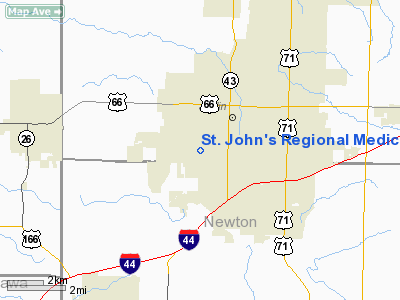
St. John's Regional Medical Center Heliport |
Location & QuickFacts
| FAA Information Effective: | 2008-09-25 |
| Airport Identifier: | 5MO7 |
| Airport Status: | Operational |
| Longitude/Latitude: | 094-31-52.8000W/37-03-41.4000N
-94.531333/37.061500 (Estimated) |
| Elevation: | 1020 ft / 310.90 m (Estimated) |
| Land: | 0 acres |
| From nearest city: | 0 nautical miles N of Joplin, MO |
| Location: | Jasper County, MO |
| Magnetic Variation: | 05E (1990) |
Owner & Manager
| Ownership: | Privately owned |
| Owner: | St. John's Regional Medical |
| Address: | 2727 Mcclelland Blvd.
Joplin, MO 64804 |
| Phone number: | 417-625-2888 |
| Manager: | Cyprian C. Skip Barthle |
| Address: | 1807 Connecticut
Joplin, MO 64804 |
| Phone number: | 417-624-4108 |
Airport Operations and Facilities
| Airport Use: | Private
MEDICAL USE. |
| Wind indicator: | Yes |
| Segmented Circle: | No |
| Control Tower: | No |
| Lighting Schedule: | PHONE REQ
FOR PERIMETER LGTS CALL 417-624-4148. |
| Sectional chart: | Kansas City |
| Region: | ACE - Central |
| Boundary ARTCC: | ZKC - Kansas City |
| Tie-in FSS: | COU - Columbia |
| FSS Toll Free: | 1-800-WX-BRIEF |
Runway Information
Helipad H1
| Dimension: | 60 x 60 ft / 18.3 x 18.3 m |
| Surface: | CONC, |
| |
Runway H1 |
Runway |
| Traffic Pattern: | Left | Left |
|
Radio Navigation Aids
| ID |
Type |
Name |
Ch |
Freq |
Var |
Dist |
| PTS | NDB | Pittsburg | | 365.00 | 05E | 24.7 nm |
| LLU | NDB | Spring River | | 356.00 | 05E | 27.7 nm |
| FSK | NDB | Fort Scott | | 379.00 | 05E | 45.6 nm |
| EAD | NDB | Nevada | | 209.00 | 06E | 49.2 nm |
| PPF | NDB | Parsons | | 258.00 | 06E | 49.7 nm |
| CFV | NDB | Coffeyville | | 212.00 | 05E | 49.9 nm |
| EOS | VOR/DME | Neosho | 120X | 117.30 | 07E | 13.9 nm |
| OSW | VORTAC | Oswego | 123X | 117.60 | 08E | 32.7 nm |
Remarks
- OWNER DESIRES HELIPORT NOT BE CHARTED.
- PRVDD APCH/DEP FOR A 8:1 GLIDE SLOPE; 2:1 TRANSITIONAL SLOPE; MKD & LGTD PLINES TO THE W; PARALLELING THE N-S ST. & PLINES TO THE N PARALLELING THE E-W STS; & SECURITY IS PRVDD BY THE HOSP.
Images and information placed above are from
http://www.airport-data.com/airport/5MO7/
We thank them for the data!
| General Info
|
| Country |
United States
|
| State |
MISSOURI
|
| FAA ID |
5MO7
|
| Latitude |
37-03-41.400N
|
| Longitude |
094-31-52.800W
|
| Elevation |
1020 feet
|
| Near City |
JOPLIN
|
We don't guarantee the information is fresh and accurate. The data may
be wrong or outdated.
For more up-to-date information please refer to other sources.
|
|


