 |
|
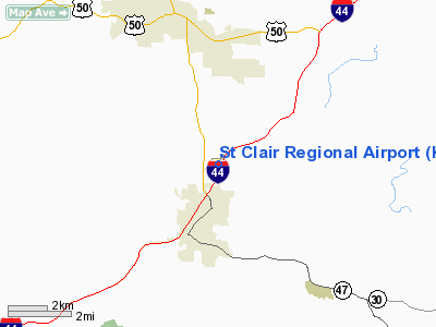
St Clair Regional Airport |
Location & QuickFacts
| FAA Information Effective: | 2008-09-25 |
| Airport Identifier: | K39 |
| Airport Status: | Operational |
| Longitude/Latitude: | 090-58-20.5000W/38-22-32.2000N
-90.972361/38.375611 (Estimated) |
| Elevation: | 656 ft / 199.95 m (Surveyed) |
| Land: | 66 acres |
| From nearest city: | 2 nautical miles N of St Clair, MO |
| Location: | Franklin County, MO |
| Magnetic Variation: | 02E (1985) |
Owner & Manager
| Ownership: | Publicly owned |
| Owner: | City Of St Clair |
| Address: | No 1 Paul Parks Drive
St Clair, MO 63077 |
| Phone number: | 636-629-0333 |
| Manager: | City Of St Clair |
| Address: | No 1 Paul Parks Drive
St Clair, MO 63077
ARPT ADDRESS 200 B AIRPORT RD. |
| Phone number: | 636-629-0333
ARPT PHONE 636-629-5353. |
Airport Operations and Facilities
| Airport Use: | Open to public |
| Wind indicator: | Yes |
| Segmented Circle: | No |
| Control Tower: | No |
| Lighting Schedule: | DUSK-DAWN |
| Beacon Color: | Clear-Green (lighted land airport) |
| Landing fee charge: | No |
| Sectional chart: | St Louis |
| Region: | ACE - Central |
| Boundary ARTCC: | ZKC - Kansas City |
| Tie-in FSS: | STL - Saint Louis |
| FSS on Airport: | No |
| FSS Toll Free: | 1-800-WX-BRIEF |
| NOTAMs Facility: | STL (NOTAM-d service avaliable) |
| Federal Agreements: | NGY |
Airport Communications
| CTAF: | 122.800 |
| Unicom: | 122.800 |
Airport Services
| Bottled Oxygen: | NONE |
| Bulk Oxygen: | NONE |
Runway Information
Runway 02/20
| Dimension: | 3198 x 60 ft / 974.8 x 18.3 m |
| Surface: | ASPH, Good Condition |
| Weight Limit: | Single wheel: 4000 lbs. |
| Edge Lights: | Low |
| |
Runway 02 |
Runway 20 |
| Longitude: | 090-58-27.4500W | 090-58-13.6000W |
| Latitude: | 38-22-17.3900N | 38-22-47.0700N |
| Traffic Pattern: | Left | Left |
| Markings: | Non-precision instrument, Good Condition | Non-precision instrument, Good Condition |
| Runway End Identifier: | Yes
REIL OTS INDEFLY. | |
| Obstruction: | 40 ft trees, 670.0 ft from runway, 180 ft left of centerline, 11:1 slope to clear | 18 ft tree, 226.0 ft from runway, 65 ft left of centerline, 1:1 slope to clear
RWY 20 +1-17 FT BRUSH, TREES, & WEEDS, 0-200 FT FM RY END, 60-125 FT L. |
|
Radio Navigation Aids
| ID |
Type |
Name |
Ch |
Freq |
Var |
Dist |
| UUV | NDB | Sullivan | | 356.00 | 02E | 12.4 nm |
| UBX | NDB | Cuba | | 380.00 | 01E | 28.5 nm |
| FES | NDB | Festus | | 269.00 | 01E | 29.6 nm |
| LM | NDB | Oblio | | 338.00 | 00E | 34.6 nm |
| PRI | NDB | Perrine | | 367.00 | 02E | 44.8 nm |
| CSX | VOR/DME | Cardinal | 111Y | 116.45 | 00E | 36.6 nm |
| VIH | VOR/DME | Vichy | 124X | 117.70 | 06E | 37.1 nm |
| FTZ | VORTAC | Foristell | 045X | 110.80 | 05E | 19.2 nm |
| STL | VORTAC | St Louis | 121X | 117.40 | 01E | 37.1 nm |
| SUS | VOT | Spirit Of St Louis | | 112.20 | | 22.9 nm |
| STL | VOT | St Louis Lambert | | 111.00 | | 36.4 nm |
Remarks
- ULTRALIGHTS ON & INVOF ARPT.
- HELICOPTER OPS ON & INVOF ARPT.
Images and information placed above are from
http://www.airport-data.com/airport/K39/
We thank them for the data!
| General Info
|
| Country |
United States
|
| State |
MISSOURI
|
| FAA ID |
K39
|
| Latitude |
38-22-33.396N
|
| Longitude |
090-58-14.662W
|
| Elevation |
656 feet
|
| Near City |
ST CLAIR
|
We don't guarantee the information is fresh and accurate. The data may
be wrong or outdated.
For more up-to-date information please refer to other sources.
|
|


