|
|
Springfield-branson National Airport |
Coordinates: 37°14′44″N 093°23′19″W / 37.24556°N 93.38861°W / 37.24556; -93.38861
| Springfield-Branson National Airport |
 |
| IATA: SGF – ICAO: KSGF – FAA LID: SGF |
| Summary |
| Airport type |
Public |
| Owner |
City of Springfield |
| Serves |
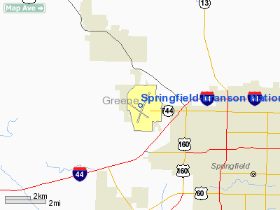
Springfield / Branson, Missouri |
| Elevation AMSL |
1,268 ft / 386 m |
| Website |
Springfield-Branson National Airport |
| Runways |
| Direction |
Length |
Surface |
| ft |
m |
| 14/32 |
8,000 |
2,438 |
Asphalt/Concrete |
| 2/20 |
7,000 |
2,134 |
Concrete |
| Statistics (2006) |
| Aircraft operations |
78,468 |
| Based aircraft |
190 |
| Sources: FAA, airport website |
FAA Diagram Springfield-Branson National Airport (IATA: SGF, ICAO: KSGF, FAA LID: SGF), formerly Springfield-Greene County Airport, Springfield Municipal Airport and Springfield-Branson Regional Airport, is a public airport located five miles (8 km) northwest of the central business district of Springfield, a city in Greene County, Missouri, United States. The airport has non-stop service to ten U.S. cities.
History
The airport opened under the name of Springfield-Greene County Airport on July 2, 1945 following bond issues of $350,000 in 1942 and $150,000 in 1945 to build the airport. It replaced the Springfield Park and Airport on East Division Street (which now operates as Downtown Airport (Missouri)). Springfield Park was the former McCluer Flying Field which opened in 1925 and purchased by the city in 1928 and which had commercial service by American Airlines and Transcontinental and Western. The airlines discontinued service during the Great Depression.
The airport was shortly renamed Springfield Municipal Airport after the city and county disagreed on funding.
In 1946 American Airlines began first commercial service to the new airport.
In October 1964 a new terminal opened (paid for by a 1960 $600,000 bond issue).
In 1992 the airport was renamed Springfield-Branson Regional Airport capitalizing on the sudden rise of the Branson, Missouri tourist industry (the airport is northwest of Springfield and Branson is more than 50 miles (80 km) southeast of the airport). In the same year the community of Lakeview, Missouri renamed itself Branson West, Missouri. The name changes prompted some locals to joke Springfield should change its name to "Branson North." Branson has no formal say in the running of the airport.
In May 2006 ground was broken for a new terminal and it was announced the airport would be renamed Springfield-Branson National Airport. The new Midfield Terminal opened on May 6, 2009.
Competing Branson airports
The Branson Airport opened in the spring of 2009 to compete with the municipally-owned Springfield airport. Branson Airport, LLC, is reportedly the first privately-owned airport in the US having regularly-scheduled commercial airline service. The $155 million project was funded by $117 of municipal bonds and private investors. It is located a few miles southeast of Hollister, Missouri. As of the fall of 2009, the Branson Airport has just 3 destinations and 2 airlines. Of the 3 destinations, both Atlanta and Dallas/Fort Worth are served by each airport, while Minneapolis/Saint Paul is exclusive to Branson Airport, until seasonal service to Minneapolis begins out of the Springfield Airport once again.
Meanwhile, Branson West hopes to open a $15 million airport with a 5,000-foot (1,500 m) runway on the west side of the community to open in the fall of 2008 on 930 acres (3.8 km) donated by Conco Companies of Springfield (200 acres), Kay Renfro (450 acres) and Martin Eastwood (200 acres). The City had initially proposed building the airport on the east side near Silver Dollar City but the plan was dropped due to protests.. The new airport currently has no plans for commercial traffic.
Incidents
- At 10:36pm March 20, 1955 American Airlines Flight 711 crashed more than a mile north of the airport. 11 of 32 passengers died along with the stewardess and copilot. The federal investigation blamed pilot error misjudging the altitude. It is the only commercial crash at the airport.
Facilities and aircraft
Springfield-Branson National Airport covers an area of 2,750 acres (1,113 ha) which contains two runways: 14/32 with an asphalt/concrete surface measuring 8,000 x 150 ft (2,438 x 46 m) and 2/20 with a 7,000 x 150 ft (2,134 x 46 m) concrete pavement.
For the 12-month period ending December 31, 2006, the airport had 78,468 aircraft operations, an average of 214 per day: 50% general aviation, 35% air taxi, 8% military and 6% scheduled commercial. There are 190 aircraft based at this airport: 71% single-engine, 20% multi-engine, 7% jet, 1% helicopter and 1% military.
Airlines and destinations
| Airlines |
Destinations |
| Allegiant Air |
Las Vegas, Los Angeles, Orlando, Phoenix/Mesa, St. Petersburg/Clearwater |
| American Eagle |
Chicago-O'Hare, Dallas/Fort Worth |
| Delta Connection operated by Atlantic Southeast Airlines |
Atlanta |
| Delta Connection operated by Mesaba Airlines |
Minneapolis/St. Paul [seasonal] |
| Delta Connection operated by Pinnacle Airlines |
Detroit [seasonal], Memphis |
| United Express operated by SkyWest Airlines |
Chicago-O'Hare, Denver |
| United Express operated by Trans States Airlines |
Chicago-O'Hare, Denver |
The above content comes from Wikipedia and is published under free licenses – click here to read more.
|
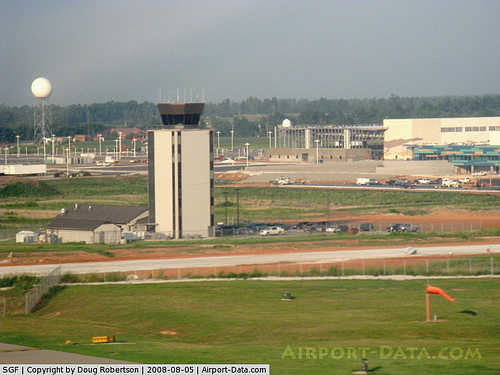 |
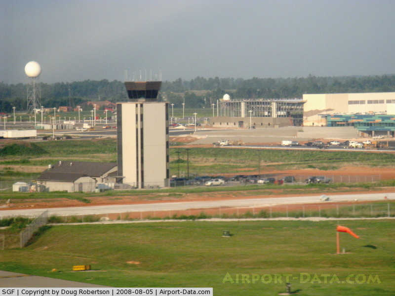
(Click on the photo to enlarge) |
|
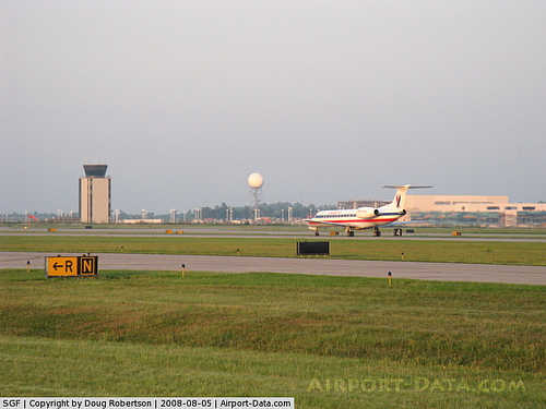 |
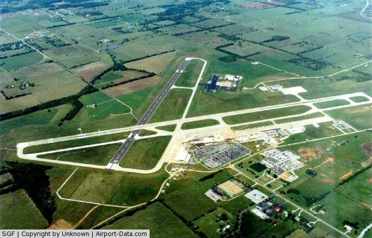
(Click on the photo to enlarge) |
|
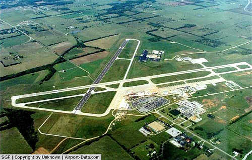 |
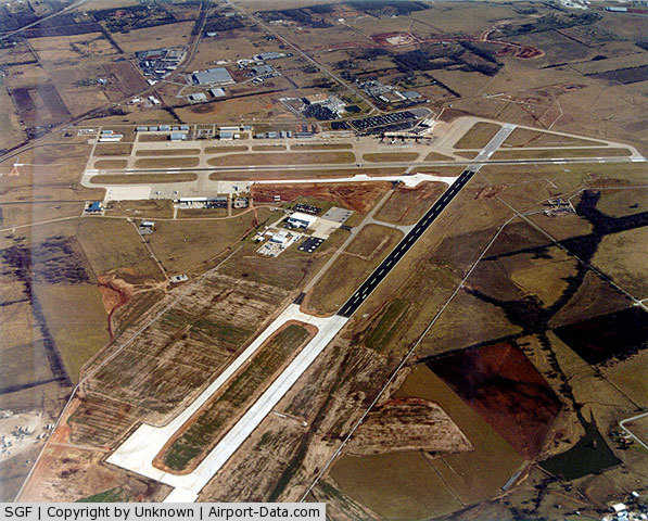
(Click on the photo to enlarge) |
|
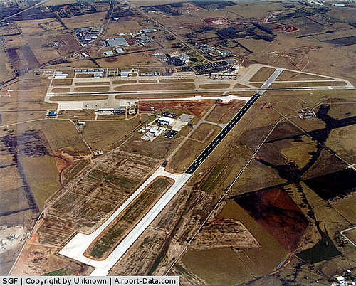 |
(Click on the photo to enlarge) |
Location & QuickFacts
| FAA Information Effective: | 2008-09-25 |
| Airport Identifier: | SGF |
| Airport Status: | Operational |
| Longitude/Latitude: | 093-23-19.1000W/37-14-44.4000N
-93.388639/37.245667 (Estimated) |
| Elevation: | 1268 ft / 386.49 m (Surveyed) |
| Land: | 2750 acres |
| From nearest city: | 5 nautical miles NW of Springfield, MO |
| Location: | Greene County, MO |
| Magnetic Variation: | 03E (2000) |
Owner & Manager
| Ownership: | Publicly owned |
| Owner: | City Of Springfield |
| Address: | 5000 W Kearney Suite 15
Springfield, MO 65803 |
| Phone number: | 417-869-1990 |
| Manager: | Mr. Gary Cyr, A.a.e.
DIRECTOR OF AVIATION. |
| Address: | 5000 W Kearney
Springfield, MO 65803 |
| Phone number: | 417-869-0300 |
Airport Operations and Facilities
| Airport Use: | Open to public |
| Wind indicator: | Yes |
| Segmented Circle: | No |
| Control Tower: | Yes |
| Lighting Schedule: | DUSK-DAWN |
| Beacon Color: | Clear-Green (lighted land airport) |
| Landing fee charge: | No |
| Sectional chart: | Kansas City |
| Region: | ACE - Central |
| Boundary ARTCC: | ZKC - Kansas City |
| Tie-in FSS: | COU - Columbia |
| FSS on Airport: | No |
| FSS Toll Free: | 1-800-WX-BRIEF |
| NOTAMs Facility: | SGF (NOTAM-d service avaliable) |
| Certification type/date: | I B S 05/1973
PPR 24 HRS FOR UNSKED ACR OPNS WITH MORE THAN 30 PSGR SEATS CALL SGF 417-869-1990. ARFF INDEX B PRVDD 0500-0000; AVBL ON REQUEST 0000-0500. ARFF INDEX C AVBL ON REQUEST. |
| Federal Agreements: | NGY3 |
Airport Communications
Airport Services
| Fuel available: | 100LLA
SELF SERVICE FUELING STATION AVAILABLE |
| Airframe Repair: | MAJOR |
| Power Plant Repair: | MAJOR |
| Bottled Oxygen: | NONE |
| Bulk Oxygen: | HIGH/LOW |
Runway Information
Runway 02/20
| Dimension: | 7003 x 150 ft / 2134.5 x 45.7 m |
| Surface: | CONC,
RY 14/32 IS 5,400 FT ASPH (PFC) & 2,600 FT CONC (GROOVED). |
| Surface Treatment: | Saw-cut or plastic Grooved |
| Weight Limit: | Single wheel: 135000 lbs.
Dual wheel: 170000 lbs.
Dual tandem wheel: 300000 lbs. |
| Edge Lights: | High |
| |
Runway 02 |
Runway 20 |
| Longitude: | 093-23-21.2249W | 093-22-49.0721W |
| Latitude: | 37-14-08.3447N | 37-15-12.6254N |
| Elevation: | 1264.00 ft | 1262.00 ft |
| Alignment: | 22 | 127 |
| ILS Type: | ILS
| |
| Traffic Pattern: | Left | Left |
| Markings: | Precision instrument, Good Condition | Precision instrument, Good Condition |
| Crossing Height: | 54.00 ft | 47.00 ft |
| VASI: | 4-box on left side | 4-light PAPI on left side |
| Visual Glide Angle: | 3.00° | 3.00° |
| RVR Equipment: | touchdown | |
| Approach lights: | MALSR | MALS |
| Decleard distances: | Take off run available 7003.00 ft
Take off distance available 7003.00 ft
Actual stop distance available 7003.00 ft
Landing distance available 7003.00 ft
| Take off run available 7003.00 ft
Take off distance available 7003.00 ft
Actual stop distance available 7003.00 ft
Landing distance available 7003.00 ft
|
|
Runway 14/32
| Dimension: | 8000 x 150 ft / 2438.4 x 45.7 m |
| Surface: | ASPH-CONC, Good Condition
RY 14/32 IS 5,400 FT ASPH (PFC) & 2,600 FT CONC (GROOVED). |
| Surface Treatment: | Saw-cut or plastic Grooved |
| Weight Limit: | Single wheel: 135000 lbs.
Dual wheel: 170000 lbs.
Dual tandem wheel: 300000 lbs. |
| Edge Lights: | High |
| |
Runway 14 |
Runway 32 |
| Longitude: | 093-24-01.8359W | 093-23-00.6404W |
| Latitude: | 37-15-18.8600N | 37-14-16.7201N |
| Elevation: | 1260.00 ft | 1268.00 ft |
| Alignment: | 127 | 127 |
| ILS Type: | ILS/DME
| |
| Traffic Pattern: | Left | Left |
| Markings: | Precision instrument, Good Condition | Non-precision instrument, Good Condition |
| Crossing Height: | 56.00 ft | 35.00 ft |
| VASI: | 4-light PAPI on right side | 4-light PAPI on left side |
| Visual Glide Angle: | 3.00° | 3.00° |
| Approach lights: | MALSR | |
| Runway End Identifier: | Yes | Yes |
| Decleard distances: | Take off run available 8000.00 ft
Take off distance available 8000.00 ft
Actual stop distance available 8000.00 ft
Landing distance available 8000.00 ft
| Take off run available 8000.00 ft
Take off distance available 8000.00 ft
Actual stop distance available 8000.00 ft
Landing distance available 8000.00 ft
|
|
Radio Navigation Aids
| ID |
Type |
Name |
Ch |
Freq |
Var |
Dist |
| ILJ | NDB | Willard | | 254.00 | 03E | 4.1 nm |
| AOV | NDB | Bilmart | | 341.00 | 02E | 37.9 nm |
| PLK | NDB | Point Lookout/dcmsnd | | 204.00 | 03E | 37.9 nm |
| IEB | NDB | Lebanon | | 414.00 | 03E | 40.0 nm |
| LLU | NDB | Spring River | | 356.00 | 05E | 46.4 nm |
| SGF | VORTAC | Springfield | 116X | 116.90 | 04E | 7.1 nm |
| DGD | VORTAC | Dogwood | 031X | 109.40 | 06E | 27.9 nm |
Remarks
- USE CAUTION FOR POWERED PARACHUTE ACTVTY INVOF DOWNTOWN ARPT (7 MI ENE OF SGF) AT OR BLO 1,000 FT.
- BIRDS & WILDLIFE ON & INVOF ARPT.
- PILOTS MUST ASK FOR & RECEIVE CLEARANCE FM ATC GND CTL TO PUSHBACK "INTO" TWY 'N' WHEN PARKED ON TERMINAL GATES 4, 7, & 8.
Images and information placed above are from
http://www.airport-data.com/airport/SGF/
We thank them for the data!
| General Info
|
| Country |
United States
|
| State |
MISSOURI
|
| FAA ID |
SGF
|
| Latitude |
37-14-39.574N
|
| Longitude |
093-23-12.689W
|
| Elevation |
1267 feet
|
| Near City |
SPRINGFIELD
|
We don't guarantee the information is fresh and accurate. The data may
be wrong or outdated.
For more up-to-date information please refer to other sources.
|
|