 |
|
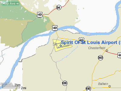
Spirit Of St Louis Airport |
| Spirit of St. Louis Airport |
| IATA: SUS – ICAO: KSUS – FAA LID: SUS |
| Summary |
| Airport type |
Public |
| Owner |
St. Louis County |
| Location |
St. Louis, Missouri |
| Elevation AMSL |
463 ft / 141 m |
| Coordinates |
38°39′44″N 090°39′07″W / 38.66222°N 90.65194°W / 38.66222; -90.65194 |
| Runways |
| Direction |
Length |
Surface |
| ft |
m |
| 8L/26R |
5,000 |
1,524 |
Asphalt |
| 8R/26L |
7,485 |
2,281 |
Concrete |
| Statistics (2006) |
| Aircraft operations |
144,897 |
| Based aircraft |
424 |
| Source: Federal Aviation Administration |
Spirit of St. Louis Airport (IATA: SUS, ICAO: KSUS, FAA LID: SUS) is a public airport located 17 miles (27 km) west of the central business district of St. Louis, in St. Louis County, Missouri, United States. It is owned by St. Louis County.
Facilities and aircraft
Spirit of St. Louis Airport covers an area of 1,500 acres (526 ha) which contains two parallel runways: 8L/26R measuring 5,000 x 75 ft (1,524 x 23 m) and 8R/26L measuring 7,485 x 150 ft (46 m), an all weather, ILS equipped runway. (2,281 x 46 m).
For the 12-month period ending December 31, 2006, the airport had 144,897 aircraft operations, an average of 396 per day: 91% general aviation, 8% air taxi, 1% military and <1% scheduled commercial. There are 424 aircraft based at this airport: 55% single engine, 9% multi-engine, 30% jet aircraft and 5% helicopters.
The airport also hosted the St. Louis County Fair and Air show, where the fair is located on the airport itself, as well as petting zoos, food stands and static displays. The airport was shut down when the air show part is going on. It was hosted every Labor Day weekend Friday-Monday. Due to airport expansion, the St. Louis County Fair and Air Show will not be held at the Spirit of St. Louis Airport after 2007, and the air show will no longer be held due to other location issues.
In 2007, the airport finished a multi-million dollar expansion project to add a parallel taxiway to the north of 26R/8L. This added land is currently available to lease with taxiway access.
The above content comes from Wikipedia and is published under free licenses – click here to read more.
Location & QuickFacts
| FAA Information Effective: | 2008-09-25 |
| Airport Identifier: | SUS |
| Airport Status: | Operational |
| Longitude/Latitude: | 090-39-07.3570W/38-39-43.6270N
-90.652044/38.662119 (Estimated) |
| Elevation: | 463 ft / 141.12 m (Surveyed) |
| Land: | 1300 acres |
| From nearest city: | 17 nautical miles W of St Louis, MO |
| Location: | St Louis County, MO |
| Magnetic Variation: | 02E (1990) |
Owner & Manager
| Ownership: | Publicly owned |
| Owner: | St Louis County |
| Address: | 18270 Edison Ave Nr 100
Chesterfield, MO 63005-3704 |
| Phone number: | 636-532-2222 |
| Manager: | Mr. John D. Bales |
| Address: | 18270 Edison Ave, Nr 100
Chesterfield, MO 63005-3704 |
| Phone number: | 636-532-2222 |
Airport Operations and Facilities
| Airport Use: | Open to public |
| Wind indicator: | Yes |
| Segmented Circle: | No |
| Control Tower: | Yes |
| Lighting Schedule: | DUSK-DAWN
HIRL RY 08R/26L PRESET ON MED INTST 0000-0600; MIRL RY 08L/26R PRESET ON LOW INTST 0000-0600. MALSR RYS 08R & 26L PRESET ON MED INTST 0600-0000 TO INCR INTST AFT 0000 - CTAF. |
| Beacon Color: | Clear-Green (lighted land airport) |
| Landing fee charge: | No |
| Sectional chart: | St Louis |
| Region: | ACE - Central |
| Boundary ARTCC: | ZKC - Kansas City |
| Tie-in FSS: | STL - Saint Louis |
| FSS on Airport: | No |
| FSS Toll Free: | 1-800-WX-BRIEF |
| NOTAMs Facility: | SUS (NOTAM-d service avaliable) |
| Certification type/date: | IV A U 10/199
PPR 24 HRS FOR ACR OPNS WITH MORE THAN 30 PSGR SEATS; CALL AMGR 636-532-1858. |
| Federal Agreements: | NGY |
Airport Communications
| CTAF: | 124.750 |
| Unicom: | 122.950 |
Airport Services
| Fuel available: | 100LLA |
| Airframe Repair: | MAJOR |
| Power Plant Repair: | MAJOR |
| Bottled Oxygen: | LOW |
| Bulk Oxygen: | LOW |
Runway Information
Runway 08L/26R
| Dimension: | 5000 x 75 ft / 1524.0 x 22.9 m |
| Surface: | ASPH, Good Condition |
| Surface Treatment: | Rubberized Friction Seal Coat |
| Weight Limit: | Dual tandem wheel: 45500 lbs. |
| Edge Lights: | Medium |
| |
Runway 08L |
Runway 26R |
| Longitude: | 090-40-05.8253W | 090-39-04.1427W |
| Latitude: | 38-39-50.9041N | 38-40-01.1103N |
| Elevation: | 463.00 ft | 463.00 ft |
| Alignment: | 78 | 127 |
| Traffic Pattern: | Left | Right |
| Markings: | Basic, Good Condition | Basic, Good Condition |
| Crossing Height: | 41.00 ft | 47.00 ft |
| VASI: | 4-light PAPI on left side | 4-box on left side |
| Visual Glide Angle: | 3.00° | 3.50° |
| Obstruction: | , 50:1 slope to clear | 31 ft pole, 1200.0 ft from runway, 150 ft right of centerline, 32:1 slope to clear |
| Decleard distances: | Take off run available 5000.00 ft
Take off distance available 5000.00 ft
Actual stop distance available 5000.00 ft
Landing distance available 5000.00 ft
| Take off run available 5000.00 ft
Take off distance available 5000.00 ft
Actual stop distance available 5000.00 ft
Landing distance available 5000.00 ft
|
|
Runway 08R/26L
| Dimension: | 7485 x 150 ft / 2281.4 x 45.7 m |
| Surface: | CONC, |
| Surface Treatment: | Saw-cut or plastic Grooved |
| Weight Limit: | Single wheel: 33000 lbs.
Dual wheel: 100000 lbs. |
| Edge Lights: | High |
| |
Runway 08R |
Runway 26L |
| Longitude: | 090-39-35.0891W | 090-38-02.7592W |
| Latitude: | 38-39-27.7047N | 38-39-42.9918N |
| Elevation: | 461.00 ft | 462.00 ft |
| Alignment: | 78 | 127 |
| ILS Type: | ILS
| ILS
|
| Traffic Pattern: | Right | Left |
| Markings: | Precision instrument, Good Condition | Precision instrument, Good Condition |
| Crossing Height: | 56.00 ft | 40.00 ft |
| Displaced threshold: | 0.00 ft | 481.00 ft |
| VASI: | 4-box on right side | 4-box on left side |
| Visual Glide Angle: | 3.00° | 3.00° |
| RVR Equipment: | touchdown | |
| Approach lights: | MALSR | MALSR |
| Runway End Identifier: | | No |
| Centerline Lights: | Yes | Yes |
| Decleard distances: | Take off run available 7485.00 ft
Take off distance available 7485.00 ft
Actual stop distance available 7245.00 ft
Landing distance available 7245.00 ft
| Take off run available 7485.00 ft
Take off distance available 7485.00 ft
Actual stop distance available 7485.00 ft
Landing distance available 7004.00 ft
|
|
Radio Navigation Aids
| ID |
Type |
Name |
Ch |
Freq |
Var |
Dist |
| LM | NDB | Oblio | | 338.00 | 00E | 11.8 nm |
| FES | NDB | Festus | | 269.00 | 01E | 30.7 nm |
| CVM | NDB | Civic Memorial | | 263.00 | 02E | 31.2 nm |
| UUV | NDB | Sullivan | | 356.00 | 02E | 35.2 nm |
| BL | NDB | Belleville | | 362.00 | 02E | 43.7 nm |
| SKE | TACAN | Scott | 059X | | 02E | 38.2 nm |
| CSX | VOR/DME | Cardinal | 111Y | 116.45 | 00E | 14.7 nm |
| STL | VORTAC | St Louis | 121X | 117.40 | 01E | 14.3 nm |
| FTZ | VORTAC | Foristell | 045X | 110.80 | 05E | 15.1 nm |
| TOY | VORTAC | Troy | 107X | 116.00 | 04E | 34.7 nm |
| STL | VOT | St Louis Lambert | | 111.00 | | 14.5 nm |
Remarks
- NUMEROUS & INTENSE HELICOPTER OPNS ON ARPT.
- TWY 'C' INTXN CLSD INDEFLY AT RY 08L/26R NORTH OF TWY 'E'.
- REMOTE ARPT ADZY SVC 124.75 AVBL 0500-1100 DLY.
- ARPT CLSD TO ACFT OVER 100,000 LBS; EXCEPT ACFT 100,000-150,000 LBS FOR PPR 24 HRS CALL AMGR 636-532-1858.
- BE ALERT; NOISE SENSITIVE AREAS TO THE SOUTH OF ARPT.
- NO ENGINE RUNS AFTER 2200 WITHOUT ARPT APPROVAL.
- LOCAL CALL TO AFSS 636-536-2980
- NOISE ABATEMENT PROCEDURE: FOR DEP STAGE II ACFT USE RY 08L/26R 2200-0700 EXCP PPR 636-532-2222 MON-FRI 0800-1700, OTR TIMES CALL 314-568-0581/0583, 636-536-2877, OR 636-441-9231.
- NOISE ABATEMENT PROCEDURES: FOR DEP STAGE III ACFT USE 08L/26R 2300-0600.
- HI-POWER RUN-UPS GO AS DIRECTED BY ATC, 0001-0600 USE ECHO RUN UP PAD.
- TWY 'B' BETWEEN SE & NW ENTRANCE TO WEST RAMP, TWY 'B' NW TWY 'A' FM THE DSTC OF 200 FT TO 700 FT & TWY 'Z' NOT VISIBLE BY TWR.
Images and information placed above are from
http://www.airport-data.com/airport/SUS/
We thank them for the data!
| General Info
|
| Country |
United States
|
| State |
MISSOURI
|
| FAA ID |
SUS
|
| Latitude |
38-39-42.733N
|
| Longitude |
090-39-04.428W
|
| Elevation |
463 feet
|
| Near City |
ST LOUIS
|
We don't guarantee the information is fresh and accurate. The data may
be wrong or outdated.
For more up-to-date information please refer to other sources.
|
|


