 |
|
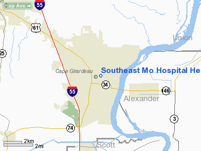
Southeast Mo Hospital Heliport |
Location & QuickFacts
| FAA Information Effective: | 2008-09-25 |
| Airport Identifier: | MU10 |
| Airport Status: | Operational |
| Longitude/Latitude: | 089-32-26.3320W/37-18-38.1820N
-89.540648/37.310606 (Estimated) |
| Elevation: | 450 ft / 137.16 m (Estimated) |
| Land: | 0 acres |
| From nearest city: | 1 nautical miles W of Cape Girardeau, MO |
| Location: | Cape Girardeau County, MO |
| Magnetic Variation: | 02E (1985) |
Owner & Manager
| Ownership: | Privately owned |
| Owner: | Southeast Hospital |
| Address: | 1701 Lacey
Cape Girardeau, MO 63701 |
| Phone number: | 314-334-4822 |
| Address: |
|
| Phone number: | 314-651-5855 |
Airport Operations and Facilities
| Airport Use: | Private
MEDICAL. |
| Wind indicator: | Yes |
| Segmented Circle: | No |
| Control Tower: | No |
| Lighting Schedule: | DUSK-DAWN |
| Beacon Color: | Clear-Green-Yellow (heliport) |
| Landing fee charge: | No |
| Sectional chart: | St Louis |
| Region: | ACE - Central |
| Boundary ARTCC: | ZME - Memphis |
| Tie-in FSS: | STL - Saint Louis |
| FSS on Airport: | No |
| FSS Toll Free: | 1-800-WX-BRIEF |
Runway Information
Helipad H1
| Dimension: | 171 x 63 ft / 52.1 x 19.2 m |
| Surface: | CONC,
ROOFTOP. |
| |
Runway H1 |
Runway |
| Traffic Pattern: | Left | Left |
|
Radio Navigation Aids
| ID |
Type |
Name |
Ch |
Freq |
Var |
Dist |
| CIR | NDB | Cairo | | 397.00 | 00E | 21.3 nm |
| CHQ | NDB | Charleston | | 208.00 | 01E | 29.3 nm |
| DXE | NDB | Dexter | | 423.00 | 00E | 36.8 nm |
| PJY | NDB | Pinckneyville | | 215.00 | 00E | 40.8 nm |
| BDD | NDB | Bellgrade | | 254.00 | 00E | 42.8 nm |
| CGI | VOR/DME | Cape Girardeau | 076X | 112.90 | 01E | 5.2 nm |
| MWA | VOR/DME | Marion | 041X | 110.40 | 04E | 36.7 nm |
| CNG | VORTAC | Cunningham | 078X | 113.10 | 03E | 38.3 nm |
| FAM | VORTAC | Farmington | 104X | 115.70 | 01E | 39.6 nm |
| MAW | VORTAC | Malden | 049X | 111.20 | 03E | 48.8 nm |
Remarks
- PRVDD APCH/DEP PATHS TO LNDG/TKOF AREA ARE MAINTD FOR A MIN 8:1 GLIDE SLOPE & TRSNL SFC BE MAINTD FOR MIN 2:1 SLOPE.
Images and information placed above are from
http://www.airport-data.com/airport/MU10/
We thank them for the data!
| General Info
|
| Country |
United States
|
| State |
MISSOURI
|
| FAA ID |
MU10
|
| Latitude |
37-18-38.182N
|
| Longitude |
089-32-26.332W
|
| Elevation |
450 feet
|
| Near City |
CAPE GIRARDEAU
|
We don't guarantee the information is fresh and accurate. The data may
be wrong or outdated.
For more up-to-date information please refer to other sources.
|
|


