 |
|
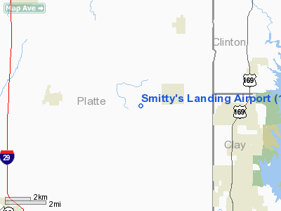
Location & QuickFacts
| FAA Information Effective: | 2008-09-25 |
| Airport Identifier: | 1MU2 |
| Airport Status: | Operational |
| Longitude/Latitude: | 094-40-02.0400W/39-26-50.6400N
-94.667233/39.447400 (Estimated) |
| Elevation: | 800 ft / 243.84 m (Estimated) |
| Land: | 5 acres |
| From nearest city: | 2 nautical miles SW of Ridgely, MO |
| Location: | Platte County, MO |
| Magnetic Variation: | 04E (1995) |
Owner & Manager
| Ownership: | Privately owned |
| Owner: | Mike & Jane Smith |
| Address: | 1401 Ne Bronze Dr.
Lee's Summit, MO 64086 |
| Phone number: | 816-525-9530 |
| Manager: | Mike & Jane Smith |
| Address: | 1401 Ne Bronze Dr.
Lee's Summit, MO 64086 |
| Phone number: | 816-525-9530 |
Airport Operations and Facilities
| Airport Use: | Private |
| Wind indicator: | Yes |
| Segmented Circle: | No |
| Control Tower: | No |
| Sectional chart: | Kansas City |
| Region: | ACE - Central |
| Boundary ARTCC: | ZKC - Kansas City |
| Tie-in FSS: | COU - Columbia |
| FSS on Airport: | No |
| FSS Toll Free: | 1-800-WX-BRIEF |
Runway Information
Runway 12/30
| Dimension: | 1400 x 60 ft / 426.7 x 18.3 m |
| Surface: | TURF, |
| |
Runway 12 |
Runway 30 |
| Traffic Pattern: | Left | Left |
| Obstruction: | | 4 ft fence, 5.0 ft from runway |
|
Radio Navigation Aids
| ID |
Type |
Name |
Ch |
Freq |
Var |
Dist |
| DO | NDB | Dotte | | 359.00 | 05E | 14.1 nm |
| GPH | NDB | Mosby | | 284.00 | 03E | 17.8 nm |
| GKB | NDB | Norge | | 517.00 | 05E | 23.2 nm |
| GQ | NDB | Norge | | 517.00 | 05E | 23.2 nm |
| EZZ | NDB | Cameron | | 394.00 | 03E | 24.9 nm |
| AZN | NDB | Amazon | | 233.00 | 06E | 28.5 nm |
| LXT | NDB | Lesumit | | 263.00 | 04E | 32.3 nm |
| RIS | VOR/DME | Riverside | 051X | 111.40 | 05E | 19.9 nm |
| OJC | VOR/DME | Johnson County | 077X | 113.00 | 06E | 36.6 nm |
| BQS | VOR/DME | Braymer | 049X | 111.20 | 03E | 38.3 nm |
| RBA | VOR/DME | Robinson | 019X | 108.20 | 04E | 42.6 nm |
| MCI | VORTAC | Kansas City | 079Y | 113.25 | 05E | 10.3 nm |
| ANX | VORTAC | Napoleon | 087X | 114.00 | 07E | 32.8 nm |
| STJ | VORTAC | St Joseph | 102X | 115.50 | 08E | 33.1 nm |
| TOP | VORTAC | Topeka | 125X | 117.80 | 05E | 45.1 nm |
| MKC | VOT | Kansas City Downtown | | 108.60 | | 19.8 nm |
Remarks
- PRVDD A CLEAR APCH TO EA RY END FOR A 20:1 GLIDE SLOPE; A CLEAR TRANSITIONAL SFC FOR A 7:1 SLOPE; DUE TO CLOSE PROXMTY OF MCI NO MORE THA 4 ACFT BASED AT ONE TIME; PILOTS MUST ADHERE TO CLASS 'B' AIRSPACE RULES.
Images and information placed above are from
http://www.airport-data.com/airport/1MU2/
We thank them for the data!
| General Info
|
| Country |
United States
|
| State |
MISSOURI
|
| FAA ID |
1MU2
|
| Latitude |
39-26-37.994N
|
| Longitude |
094-39-50.846W
|
| Elevation |
800 feet
|
| Near City |
RIDGELY
|
We don't guarantee the information is fresh and accurate. The data may
be wrong or outdated.
For more up-to-date information please refer to other sources.
|
|


