 |
|
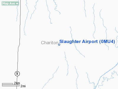
Location & QuickFacts
| FAA Information Effective: | 2008-09-25 |
| Airport Identifier: | 0MU4 |
| Airport Status: | Operational |
| Longitude/Latitude: | 092-52-00.6960W/39-36-58.0960N
-92.866860/39.616138 (Estimated) |
| Elevation: | 800 ft / 243.84 m (Estimated) |
| Land: | 10 acres |
| From nearest city: | 8 nautical miles SE of Marceline, MO |
| Location: | Chariton County, MO |
| Magnetic Variation: | 03E (1990) |
Owner & Manager
| Ownership: | Privately owned |
| Owner: | Ray E Slaughter |
| Address: | 309 East Lake St
Marceline, MO 64658 |
| Phone number: | 816-376-2340 |
| Manager: | Ray E Slaughter |
| Address: | 309 E Lake St
Marceline, MO 64658 |
| Phone number: | 816-376-2340 |
Airport Operations and Facilities
| Airport Use: | Private |
| Wind indicator: | Yes |
| Segmented Circle: | No |
| Control Tower: | No |
| Sectional chart: | Kansas City |
| Region: | ACE - Central |
| Boundary ARTCC: | ZKC - Kansas City |
| Tie-in FSS: | COU - Columbia |
| FSS on Airport: | No |
| FSS Toll Free: | 1-800-WX-BRIEF |
Runway Information
Runway 11/29
| Dimension: | 1700 x 60 ft / 518.2 x 18.3 m |
| Surface: | TURF, |
| |
Runway 11 |
Runway 29 |
| Traffic Pattern: | Left | Left |
| Obstruction: | 25 ft pline, 500.0 ft from runway | |
|
Radio Navigation Aids
| ID |
Type |
Name |
Ch |
Freq |
Var |
Dist |
| BZK | NDB | Brookfield | | 383.00 | 03E | 14.3 nm |
| CHT | NDB | Chillicothe | | 375.00 | 03E | 30.6 nm |
| PUR | NDB | Marshall | | 371.00 | 03E | 37.7 nm |
| VER | NDB | Viertel | | 347.00 | 02E | 41.0 nm |
| TRX | NDB | Trenton | | 400.00 | 03E | 43.6 nm |
| MCM | VOR/DME | Macon | 076X | 112.90 | 06E | 18.0 nm |
| BQS | VOR/DME | Braymer | 049X | 111.20 | 03E | 46.7 nm |
| IRK | VORTAC | Kirksville | 093X | 114.60 | 06E | 33.7 nm |
| HLV | VORTAC | Hallsville | 089X | 114.20 | 06E | 45.7 nm |
Remarks
- PRVDD APCHS HAVE 20:1 SLOPE & TRANSITIONAL SFC MAINTAINED AT A 7:1 SLOPE.
Images and information placed above are from
http://www.airport-data.com/airport/0MU4/
We thank them for the data!
| General Info
|
| Country |
United States
|
| State |
MISSOURI
|
| FAA ID |
0MU4
|
| Latitude |
39-36-58.096N
|
| Longitude |
092-52-00.696W
|
| Elevation |
800 feet
|
| Near City |
MARCELINE
|
We don't guarantee the information is fresh and accurate. The data may
be wrong or outdated.
For more up-to-date information please refer to other sources.
|
|


