 |
|
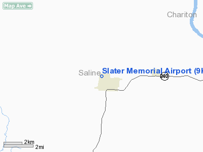
Location & QuickFacts
| FAA Information Effective: | 2008-09-25 |
| Airport Identifier: | 9K5 |
| Airport Status: | Operational |
| Longitude/Latitude: | 093-04-22.0000W/39-13-45.8000N
-93.072778/39.229389 (Estimated) |
| Elevation: | 860 ft / 262.13 m (Estimated) |
| Land: | 15 acres |
| From nearest city: | 1 nautical miles NW of Slater, MO |
| Location: | Saline County, MO |
| Magnetic Variation: | 04E (1985) |
Owner & Manager
| Ownership: | Publicly owned |
| Owner: | City Of Slater |
| Address: | 232 N. Main
Slater, MO 65349 |
| Phone number: | 660-529-2271 |
| Manager: | Russell Griffin
CITY ADMIN. |
| Address: | 232 N. Main
Slater, MO 65349 |
| Phone number: | 660-529-2271 |
Airport Operations and Facilities
| Airport Use: | Open to public |
| Wind indicator: | Yes |
| Segmented Circle: | No |
| Control Tower: | No |
| Lighting Schedule: | NONE |
| Landing fee charge: | No |
| Sectional chart: | Kansas City |
| Region: | ACE - Central |
| Boundary ARTCC: | ZKC - Kansas City |
| Tie-in FSS: | COU - Columbia |
| FSS on Airport: | No |
| FSS Toll Free: | 1-800-WX-BRIEF |
| NOTAMs Facility: | COU (NOTAM-d service avaliable) |
| Federal Agreements: | 1 |
Airport Communications
Airport Services
| Airframe Repair: | NONE |
| Power Plant Repair: | NONE |
| Bottled Oxygen: | NONE |
| Bulk Oxygen: | NONE |
Runway Information
Runway 04/22
| Dimension: | 2455 x 132 ft / 748.3 x 40.2 m |
| Surface: | TURF, Fair Condition |
| |
Runway 04 |
Runway 22 |
| Longitude: | 093-04-32.7700W | 093-04-11.2300W |
| Latitude: | 39-13-37.0100N | 39-13-54.5700N |
| Traffic Pattern: | Left | Left |
| Displaced threshold: | 0.00 ft | 300.00 ft
DSPLCD THLD 4 FT HIGHER THAN RY END. DSPLCD THLD NOT MKD. |
| Obstruction: | , 50:1 slope to clear | 13 ft road, 125 ft right of centerline
33:1 TO DSPLCD THLD. |
|
Radio Navigation Aids
| ID |
Type |
Name |
Ch |
Freq |
Var |
Dist |
| PUR | NDB | Marshall | | 371.00 | 03E | 12.6 nm |
| VER | NDB | Viertel | | 347.00 | 02E | 24.7 nm |
| DMO | NDB | Sedalia | | 281.00 | 03E | 31.9 nm |
| BZK | NDB | Brookfield | | 383.00 | 03E | 32.2 nm |
| CHT | NDB | Chillicothe | | 375.00 | 03E | 38.3 nm |
| HCK | NDB | Hawks | | 296.00 | 04E | 43.0 nm |
| SZL | TACAN | Whiteman | 035X | | 04E | 37.1 nm |
| MCM | VOR/DME | Macon | 076X | 112.90 | 06E | 37.5 nm |
| BQS | VOR/DME | Braymer | 049X | 111.20 | 03E | 44.4 nm |
| COU | VOR/DME | Columbia | 039X | 110.20 | 03E | 47.2 nm |
| HLV | VORTAC | Hallsville | 089X | 114.20 | 06E | 44.6 nm |
| ANX | VORTAC | Napoleon | 087X | 114.00 | 07E | 49.9 nm |
Remarks
- RY 04/22 SOFT DURG PROLONGED WET PERIODS.
- LARGE WATERFOWL ON & INVOF ARPT.
- RY 04/22 NO LINE OF SIGHT BTN RY ENDS.
- +1-10 FT CROPS ALONG RY EDGES FM SPRING TO FALL.
- PRVDD APCHS TO ARPT ARE MAINTD FOR A MIN 10:1 GS & TRSNL SFC MAINTD FOR 7:1 SLOPE.
Images and information placed above are from
http://www.airport-data.com/airport/9K5/
We thank them for the data!
| General Info
|
| Country |
United States
|
| State |
MISSOURI
|
| FAA ID |
9K5
|
| Latitude |
39-13-45.090N
|
| Longitude |
093-04-20.707W
|
| Elevation |
860 feet
|
| Near City |
SLATER
|
We don't guarantee the information is fresh and accurate. The data may
be wrong or outdated.
For more up-to-date information please refer to other sources.
|
|


