 |
|
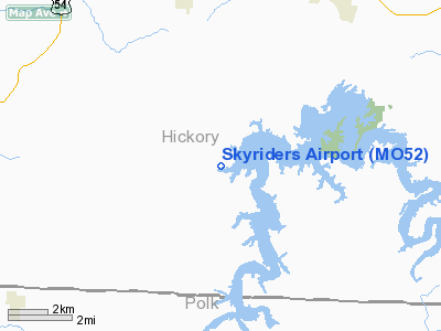
Location & QuickFacts
| FAA Information Effective: | 2008-09-25 |
| Airport Identifier: | MO52 |
| Airport Status: | Operational |
| Longitude/Latitude: | 093-23-00.7160W/37-52-00.1240N
-93.383532/37.866701 (Estimated) |
| Elevation: | 900 ft / 274.32 m (Estimated) |
| Land: | 20 acres |
| From nearest city: | 4 nautical miles SE of Wheatland, MO |
| Location: | Hickory County, MO |
| Magnetic Variation: | 04E (1985) |
Owner & Manager
| Ownership: | Privately owned |
| Owner: | John Kieffer |
| Address: | Rt 1, Box 274
Wheatland, MO 65779 |
| Phone number: | 417-282-6280 |
| Manager: | John Kieffer |
| Address: | Rt 1, Box 274
Wheatland, MO 65779 |
| Phone number: | 417-282-6280 |
Airport Operations and Facilities
| Airport Use: | Private |
| Wind indicator: | Yes |
| Segmented Circle: | No |
| Control Tower: | No |
| Landing fee charge: | No |
| Sectional chart: | Kansas City |
| Region: | ACE - Central |
| Boundary ARTCC: | ZKC - Kansas City |
| Tie-in FSS: | COU - Columbia |
| FSS on Airport: | No |
| FSS Toll Free: | 1-800-WX-BRIEF |
Airport Services
| Airframe Repair: | NONE |
| Power Plant Repair: | NONE |
| Bottled Oxygen: | NONE |
| Bulk Oxygen: | NONE |
Runway Information
Runway 16/34
| Dimension: | 2000 x 45 ft / 609.6 x 13.7 m |
| Surface: | TURF, Fair Condition |
| |
Runway 16 |
Runway 34 |
| Traffic Pattern: | Left | Left |
| Markings: | None, | None, |
| Runway End Identifier: | No | No |
| Centerline Lights: | No | No |
| Touchdown Lights: | No | No |
| Obstruction: | 15 ft trees | 40 ft trees |
|
Radio Navigation Aids
| ID |
Type |
Name |
Ch |
Freq |
Var |
Dist |
| GLY | NDB | Golden Valley | | 388.00 | 04E | 32.8 nm |
| ILJ | NDB | Willard | | 254.00 | 03E | 34.2 nm |
| IEB | NDB | Lebanon | | 414.00 | 03E | 38.8 nm |
| AIZ | NDB | Kaiser | | 377.00 | 05E | 41.7 nm |
| EAD | NDB | Nevada | | 209.00 | 06E | 43.6 nm |
| HCK | NDB | Hawks | | 296.00 | 04E | 46.7 nm |
| LLU | NDB | Spring River | | 356.00 | 05E | 49.6 nm |
| SHY | VOR/DME | Sunshine | 021X | 108.40 | 05E | 38.5 nm |
| SGF | VORTAC | Springfield | 116X | 116.90 | 04E | 30.8 nm |
Remarks
- TREES, HGR, BLDG & WEEDS & HIGH GND IN PRIM SFC; VIOLATIONS OF 7:1; TREES &KK HIGH GND BOTH SIDES & ENDS.
- RWY 16/34 SOFT AFTER HEAVY RAIN.
- HAZARDOUS OBSTRUCTIONS IN ALL APCHS.
Images and information placed above are from
http://www.airport-data.com/airport/MO52/
We thank them for the data!
| General Info
|
| Country |
United States
|
| State |
MISSOURI
|
| FAA ID |
MO52
|
| Latitude |
37-52-00.124N
|
| Longitude |
093-23-00.716W
|
| Elevation |
900 feet
|
| Near City |
WHEATLAND
|
We don't guarantee the information is fresh and accurate. The data may
be wrong or outdated.
For more up-to-date information please refer to other sources.
|
|


