 |
|
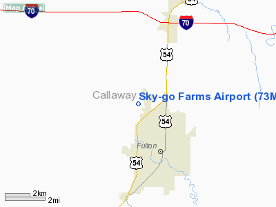
Location & QuickFacts
| FAA Information Effective: | 2008-09-25 |
| Airport Identifier: | 73MU |
| Airport Status: | Operational |
| Longitude/Latitude: | 091-58-08.7080W/38-53-08.0950N
-91.969086/38.885582 (Estimated) |
| Elevation: | 878 ft / 267.61 m (Estimated) |
| Land: | 0 acres |
| From nearest city: | 3 nautical miles NW of Fulton, MO |
| Location: | Callaway County, MO |
| Magnetic Variation: | 02E (1995) |
Owner & Manager
| Ownership: | Privately owned |
| Owner: | John Danuser |
| Address: | 4898 State Road Hh
Fulton, MO 65251-3730 |
| Phone number: | 314-642-2473 |
| Manager: | John Danuser |
| Address: | 4898 State Road Hh
Fulton, MO 65251-3730 |
| Phone number: | 573-642-2473 |
Airport Operations and Facilities
| Airport Use: | Private |
| Wind indicator: | Yes |
| Segmented Circle: | No |
| Control Tower: | No |
| Sectional chart: | Kansas City |
| Region: | ACE - Central |
| Boundary ARTCC: | ZKC - Kansas City |
| Tie-in FSS: | COU - Columbia |
| FSS on Airport: | No |
| FSS Toll Free: | 1-800-WX-BRIEF |
Runway Information
Runway 09/27
| Dimension: | 1800 x 60 ft / 548.6 x 18.3 m |
| Surface: | TURF, |
| |
Runway 09 |
Runway 27 |
| Traffic Pattern: | Left | Right |
|
Runway 18/36
| Dimension: | 1800 x 60 ft / 548.6 x 18.3 m |
| Surface: | TURF, |
| |
Runway 18 |
Runway 36 |
| Traffic Pattern: | Left | Right |
|
Radio Navigation Aids
| ID |
Type |
Name |
Ch |
Freq |
Var |
Dist |
| FTT | NDB | Guthrie | | 317.00 | 03E | 3.1 nm |
| ONH | NDB | Noah | | 515.00 | 03E | 19.7 nm |
| JE | NDB | Algoa | | 397.00 | 03E | 20.9 nm |
| VER | NDB | Viertel | | 347.00 | 02E | 33.7 nm |
| COU | VOR/DME | Columbia | 039X | 110.20 | 03E | 12.5 nm |
| VIH | VOR/DME | Vichy | 124X | 117.70 | 06E | 45.7 nm |
| HLV | VORTAC | Hallsville | 089X | 114.20 | 06E | 15.6 nm |
| FTZ | VORTAC | Foristell | 045X | 110.80 | 05E | 48.1 nm |
| JEF | VOT | Jefferson City | | 112.00 | | 19.7 nm |
Remarks
- PRVDD CLEAR APCH TO EACH RY FOR A 20:1 GLIDE SLOPE; CLEAR TRANSITIONAL SFC FOR A 7:1 SLOPE & ALL TFC PATTERNS REMAIN NORTH & EAST OF ARPT.
Images and information placed above are from
http://www.airport-data.com/airport/73MU/
We thank them for the data!
| General Info
|
| Country |
United States
|
| State |
MISSOURI
|
| FAA ID |
73MU
|
| Latitude |
38-53-08.095N
|
| Longitude |
091-58-08.708W
|
| Elevation |
878 feet
|
| Near City |
FULTON
|
We don't guarantee the information is fresh and accurate. The data may
be wrong or outdated.
For more up-to-date information please refer to other sources.
|
|


